


Should you wander east out of Whitechapel station keeping to the north side of Whitechapel Road, you’ll eventually pass the end of the market (if it’s on that day) and get to the pub called The Blind Beggar. I recognise that other blogs are available and one or more of these will go on at length into the history of the Blind Beggar and reach the dark story of the Kray Twins from the 1960s. This particular pub played a big role in their downfall. But you have the Wikipedia no doubt at hand on your device. Strangely, all I’m going to do is use it as a landmark.
It’s on the junction of Cambridge Heath Road.
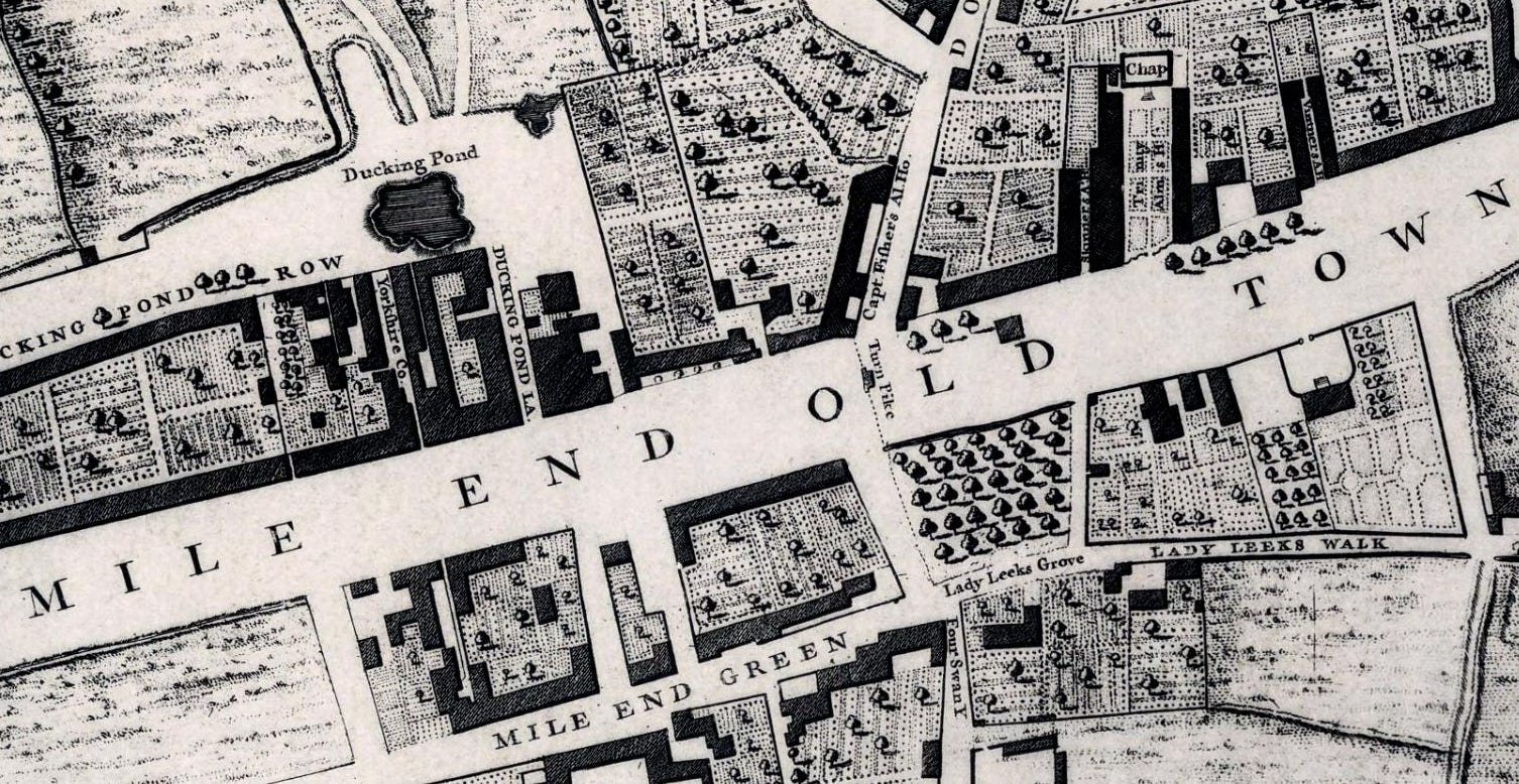
On the 1750s John Rocque map this junction was marked by a turnpike - Mile End Gate - crossing the main road. The Mile End Gate actual name ain’t on the Rocque map so don’t go looking for it.
Before proceeding in the eighteenth century, you’d get down from your seat, park Dobbin (your horse) with a nice nosebag and perhaps some water and go into the Blind Beggar for a quick tipple, pay the tollkeeper, get Dobbin ready and be on your way. Actually often you’d stay the night at the inn, only continuing the next day. Coming in from Essex was a tiring business and why not face the busy city traffic afresh the next morning?
Tollbooths nearly always had a pub/inn beside them for just this sort of trade. These are often still here - the Roebuck on Great Dover Street is another tollbooth pub as are the hostelries of Notting Hill Gate - but the tolls have gone away.
As usual the John Rocque map shows a quite eccentric version of eighteenth century London. The majestic-sounding Cambridge Heath Road was then called Dog Row - we can see the DO at the top of the map. We have a ducking pond somewhere behind the modern Whitechapel station. South of the main road east Lady Leek has made an impression on road namers - Lady Leek’s Grove and Lady Leek’s Walk.
Speaking of road names the ‘Mile End’ name is everywhere on the map of the 1750s - Mile End Old Town and Mile End Green.
That’s because the turnpike was the site of the original Mile End. The term Mile End was recorded as early as 1288 and the mile was related to the distance as measured from Aldgate.
These days Mile End is thought of as a lot further east - around the station of that name. In between Whitechapel station and Mile End station nowadays, the area is known as Stepney Green.
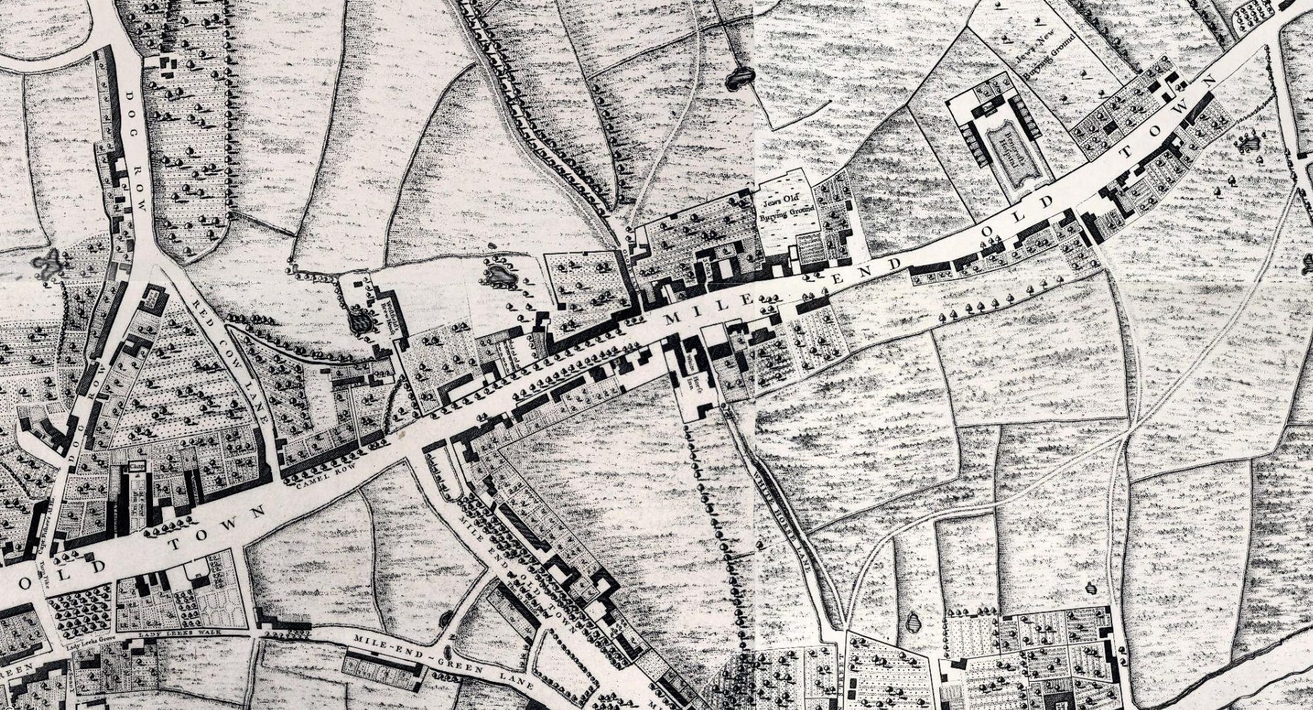
Zooming out and putting Mile End Gate itself in the bottom left of the map, we can see Mile End as it was - the area east of the turnpike and not west of the modern Mile End station.
Let’s travel slowly towards Essex and look at stuff on the Rocque map as we do.
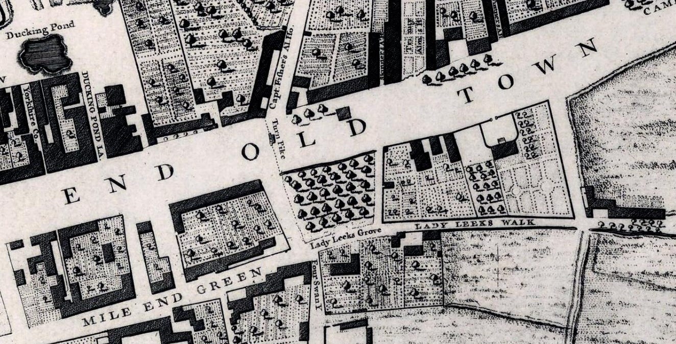
Above the D of MILE END OLD TOWN on the map, there’s a building.
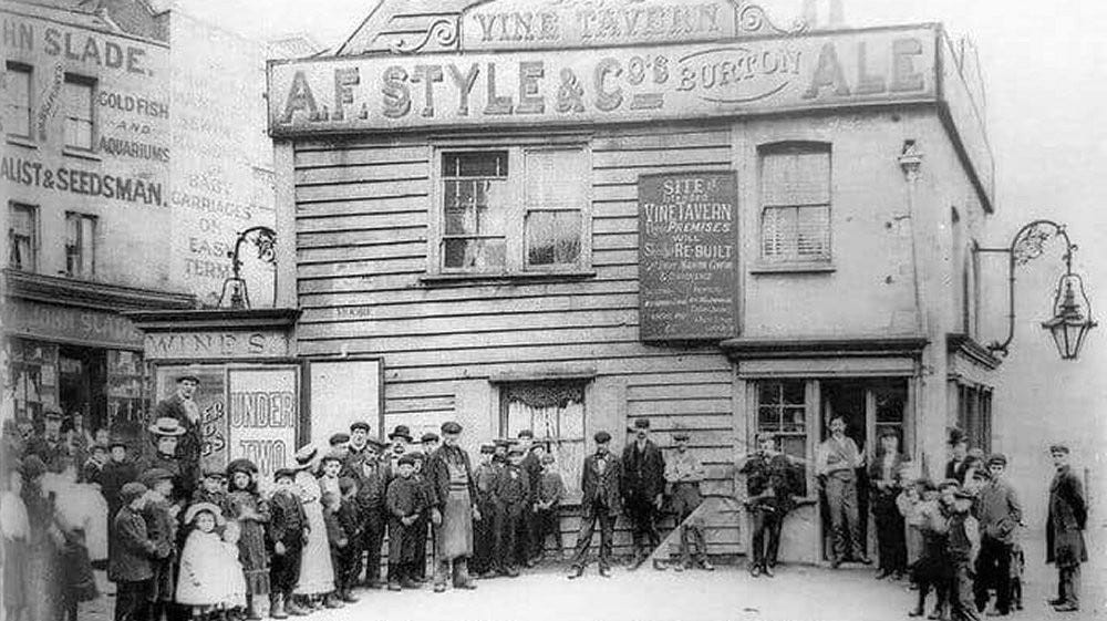
This was the Vine Tavern - here it was, photographed in 1870. The sign promises that it WILL be rebuilt. Let’s hope that it was to everybody’s satisfaction.
The Vine Tavern was situated on a site in the middle of Mile End Road, theoretically at number 31. There were references to the Vine Tavern by 1625. The pub was closed and demolished in 1903 as it was in the way of traffic. A bust of General William Booth, founder of the Salvation Army marks the former site of the pub.
On that same map between Lady Leek’s Walk and the main road, there’s a house with a courtyard in front (beneath the TO of Mile End Old Town).
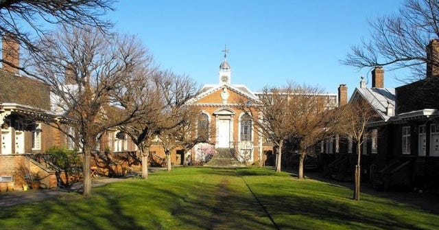
This was Captain James Cook’s house, now numbered 88 Mile End Road. Opposite his house were the Trinity Green Almshouses which are still there. These were built in 1695 and intended for “decay’d Masters & Commanders.”
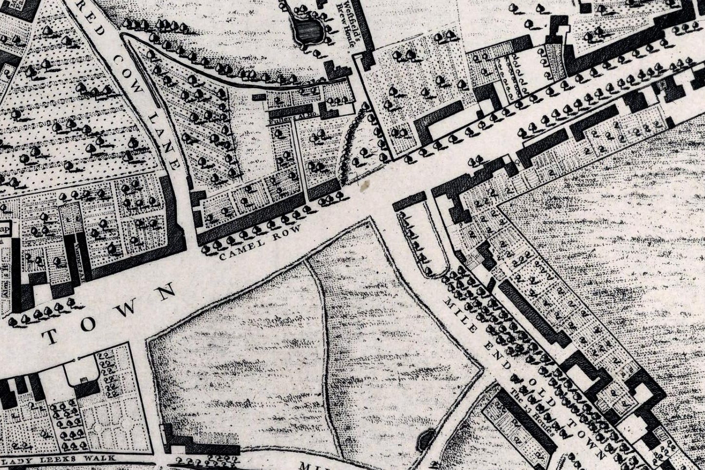
A couple of fields are opposite Camel Row before a turning into Mile End Green (with this road confusingly also called Mile End Old Town - now called ‘Stepney Green’). Down this lane are The 13 Houses. They sound lovely.
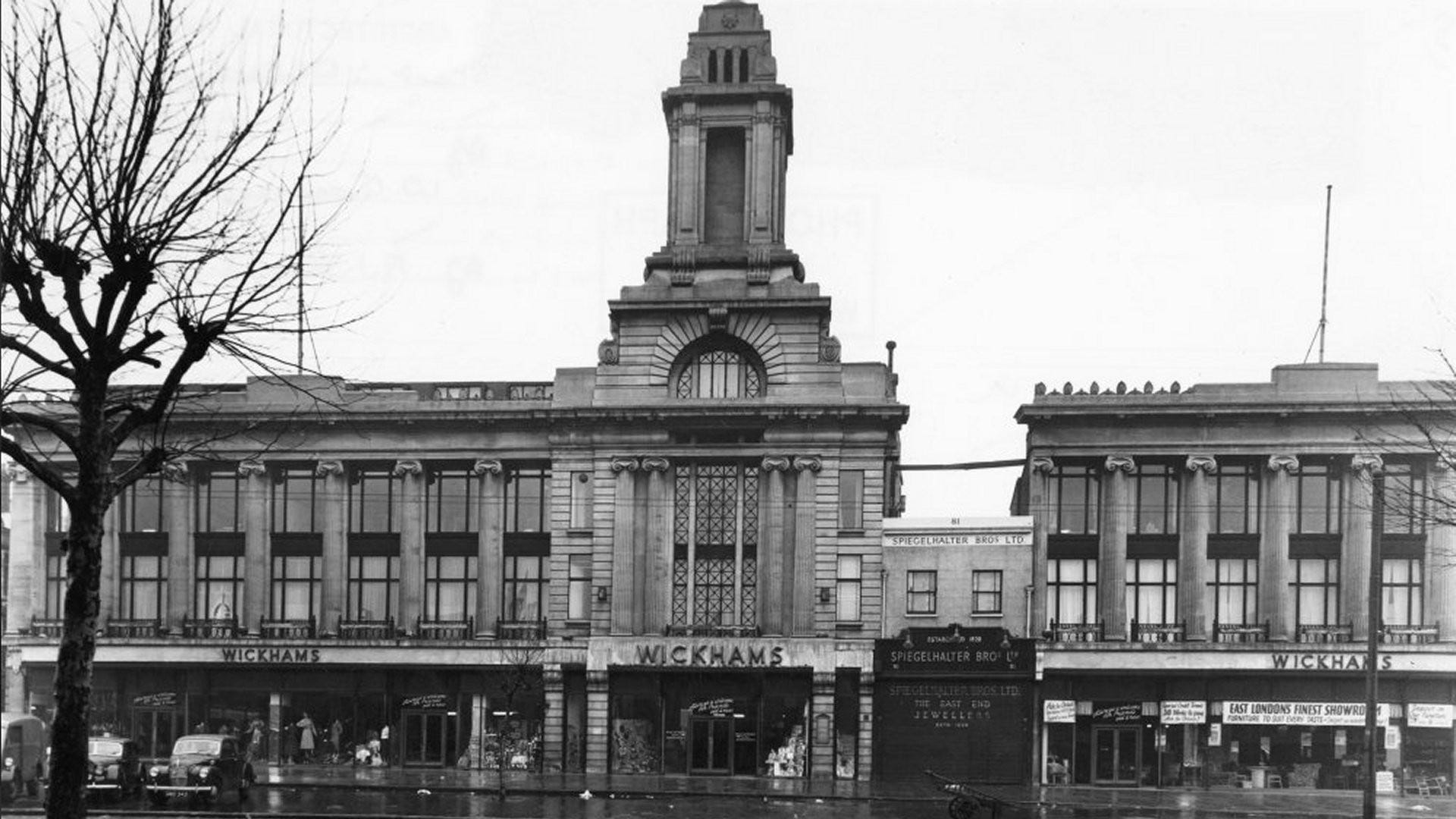
The Wickham family originally operated as drapers, conducting their business from 69, 71, and 73 Mile End Road - where Camel Row is on the Rocque map. The adjacent property at No. 75 was occupied by the Spiegelhalter family, who were clockmakers and jewellers. The family had moved on from the mirror-making trade that their surname implies. In approximately 1892, the Spiegelhalters agreed with the Wickhams to relocate from No. 75 to 81 Mile End Road, allowing the Wickhams to expand their shop into the newly-vacated space.
Over the course of 35 years, the Wickham family gradually acquired the entire block, except for the Spiegelhalters’ shop at No. 81. Their plan was to expand their store, and they attempted to purchase the Spiegelhalter property from the next generation. Negotiations for a mutually acceptable price failed, resulting in the Spiegelhalters’ shop becoming a holdout. The new Wickhams store was constructed around the Spiegelhalter shop. The contract for the stone façade had been awarded before it became clear that the Spiegelhalters were unwilling to sell. To accommodate this, the right wing of the building was shifted to the right by the width of the Spiegelhalters’ land. The buildings are all still there but assigned now to various owners.
The fields of Mile End Green were known as the Mile End Waste. This was the site where William Booth preached against the dangers of alcohol in the 19th century. His sermons there led to the founding of the Salvation Army, an organisation dedicated to helping the poor and destitute who gathered in the area.
The Mile End Waste had long been used for political and religious meetings and gatherings. After a brief meeting with the king the previous day, the Essex part of the Peasants’ Revolt met here just before they gathered to move onto London itself.

On the corner of Globe Lane (now Globe Road) Stepney Green station opened in 1902. As we travel east along Mile End Road, we pass the White Horse Inn which lent its name to White Horse Lane, which still exists.
North of Mile End Road is the Jews’ Old Burying Ground. This was established in 1657 and was the first Jewish cemetery in the whole of Britain after Oliver Cromwell allowed Jews back into the country. They had been expelled 267 years earlier by Edward I. The cemetery was put here since Mile End was completely rural then and away from urban London.
The 1657 burial place gave rise to what became Mile End Old Town. The area was largely Jewish by the time the suburb was officially recognised in 1690. That name fell out of fashion and the Jewish community later moved into Spitalfields leaving their cemeteries stranded amongst gentiles.
There’s still a very wonderful little turning called Mile End Place leading up to the southern wall of the Jews’ Old Burying Ground. Behind its archway, it’s an island of tranquillity in an otherwise bustling area. Mile End Place was built for Charrington Brewery workers. It was situated amongst three of the Jewish cemeteries and opposite a Jewish hospital. A kink built into Mile End Place means that Mile End Road cannot be seen from the cul-de-sac of cottages here, even today leaving a rural atmosphere

Our Rocque map extract continues past Bencroft’s Hospital (almshouses) and the Jews’ New Burying Ground. The People’s Palace would later be built on the site of the former, and Queen Mary University in time would surround the latter.
Francis Bancroft founded Bencroft’s Hospital but John Rocque the mapmaker was a bit cavalier with the spelling.
The People’s Palace was the 1887 site of the very first people’s palace which provided local people with a library, education and recreation.
Walter Besant, a Victorian novelist, visited the site in 1882 and described it in his All Sorts and Conditions of Men. The story is of a dream he had, in which a great “Palace of Delight has been erected, where the lower classes gather for instruction and amusement” The story inspired several philanthropists and charities to fund this fictional dream into reality.
It was designed by Edward Robson and it was heated by hot water and lit by gas. The octagonal library could hold 250 000 books. It employed women librarians at the suggestion of Sir Edmund Hay Currie who was the chair of the trustees. The first two women librarians were called Miss Black and Miss Low. There was an iron spiral staircase that allowed access to the galleries and books could be sent down on wires.
The building was destroyed by a fire in 1931, and a new People’s Palace was opened on the current site in 1937, immediately adjacent to the former. The People’s Palace was acquired by Queen Mary (QMUL) in 1954.
Queen Mary college took over the deconsecrated Jews’ New Burying Ground and its gravestones are scattered nowadays in an area of students eating their lunches. QMUL built its Mile End campus around the old cemetery.
East again we reach the Regent’s Canal. I can’t show this on the 1750s map as it wasn’t yet dug. So here’s the Open Street Map of the area - the People’s Palace is at the bottom left.
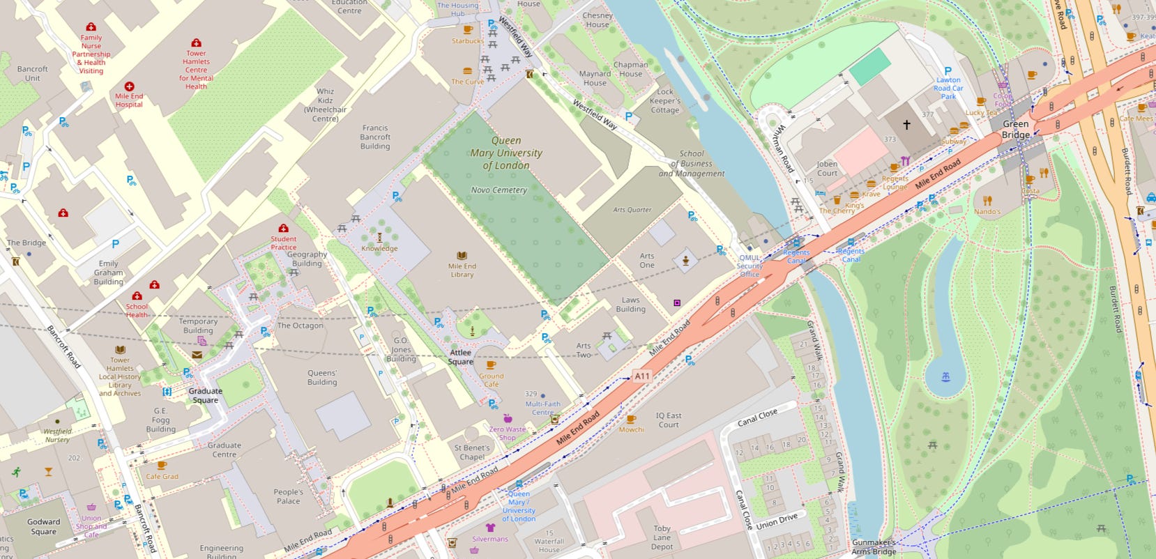
The Regent’s Canal Act was passed in 1812. Noted architect John Nash was a director of the company. In 1811 he had produced a masterplan for the Prince Regent, to redevelop a large area of central north London – as a result, the Regent’s Canal was included in the scheme.
This Camden to Limehouse section opened on 1 August 1820. It allowed goods from the Thames to reach the canal network from east of the City of London, negating the need to pass through the chaotic Pool of London.
Beyond the canal we have the 32 hectare Mile End Park which is bounded on the east side by the Mile End Road/Grove Road/Burdett Road junction.
60 000 ‘Men of Essex’ camped here and met Richard II on 14 June 1381, during the Peasants’ Revolt. We met those fellows earlier in this tale.
Mile End Park was created after the area was devastated by Second World War bombing. After the Blitz had done its work, the first V-2 rocket in the area hit the Grove Road railway bridge in 1944. The 1944 blast killed six people, injured 42, and entirely disrupted the local rail line. An English Heritage Blue Plaque is mounted on the bridge to mark the exact spot.
Post war planners decided to create a park instead of recreating housing and industry.
The difference that the park has made to the area is quite stark.
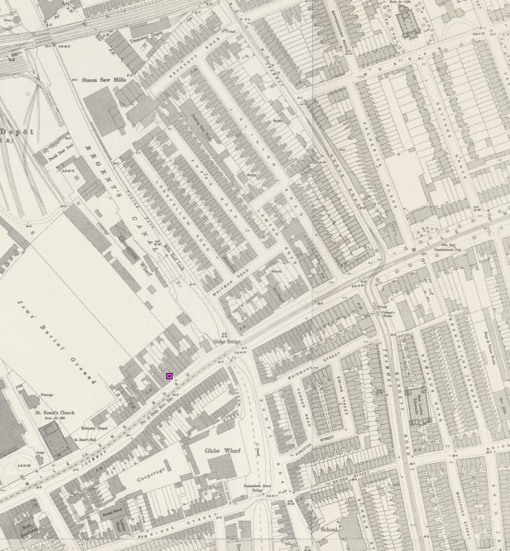
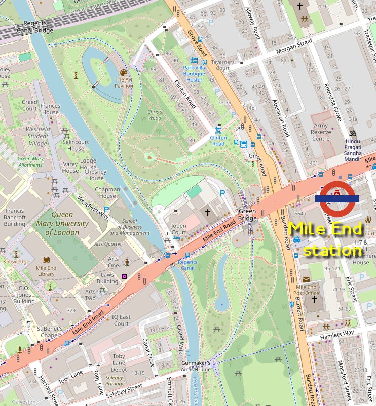
The Green Bridge - a pedestrian bridge over Mile End Road to the west of the main junction - opened in July 1999.
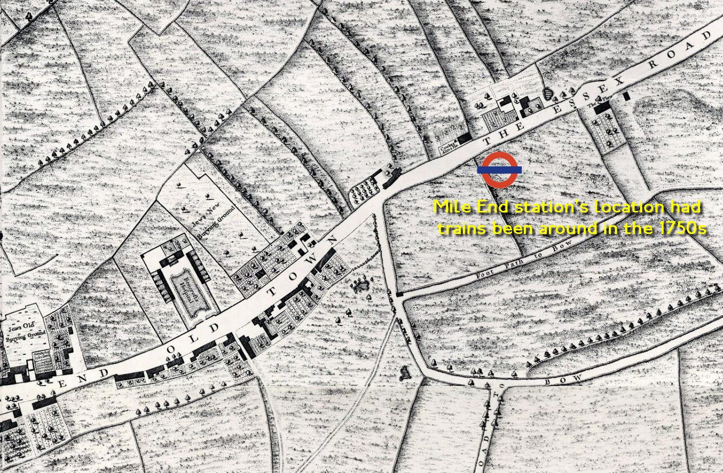
East of the junction we have the location of Mile End station. The station is really in the area beyond Grove Road which should be called Bow. Mile End — the modern area - extends only so far west of the canal before us modern folk start calling it Stepney.
Mile End station is a mile again from the original Mile End Turnpike. It should be Two Mile End really.
Love this! Amazing the changes I’ve seen since 1988, the whole area to the east of St Benet’s Chapel and the QMC Physics building is completely different. Nice to see Silvermans still there, but now on opposite side of Harford St, actually on Mile End Road. It used to be in an older building behind the Bancroft Arms, a pub I strangely never went in, even though it’s directly opposite the main building (People’s Palace and Queen’s Building). Maybe the beer was cheaper in the Union bar… anyhow, happy days!
Interesting piece. I think it's equally fair to say conceptions of where Stepney and Limehouse precisely are have shifted over time, also relating to the naming of stations.