


Euston - the HS2 London terminus
When plans for a Substack post go feral

Stuff happens.
For instance, I was bored at work one day about fifteen years ago and looking for a suitable London-themed URL for my collection of old London postcards, I found that theundergroundmap.com was free, and I bought it.
Once I had the website, it made sense to make it a ‘brand’ on social media, most notably on Facebook. I started to regularly publish my scans there of old London postcards.
Of course, with its Facebook name - The Underground Map - being a seeming London transport connection, even though I know it isn’t, the most oft-repeated comment type there is “Winchmore Hill is not on the Underground!”, said in indignation. I’m regularly defending why a page called The Underground Map is featuring old photos of Tulse Hill, Thamesmead and Teddington. But so be it.
My love of old photos is superseded by my interest in old London maps. Once I’d learned enough PHP (a website language) and MySQL (website database), I started to put my vast collection of old London maps online around 2011. I learned how to use MapCrucher to ‘georeference’ the maps. (The location of Swiss Cottage, The Oval, Mile End Road on an 1895 map all line up with the locations on a modern map)
www.theundergroundmap.com is just about a perfect name for a website featuring maps of London (if it wasn’t for the wasp-like annoyance of the regular “Wandsworth is not on the Underground!” comments on the parallel Facebook page).
I found out where a lot of my old postcards had been taken from and ‘geolocated’ them on the website thanks to my acquired PHP/MySQL programming skills. Many of the views were located on streets which no longer existed. Some old streets were bombed out during the Blitz and redeveloped. Other old streets changed their names because of duplicate names throughout London. But some 9000 old streets have gone from the map (I think that number is roughly right) and many more are still there but with new names.
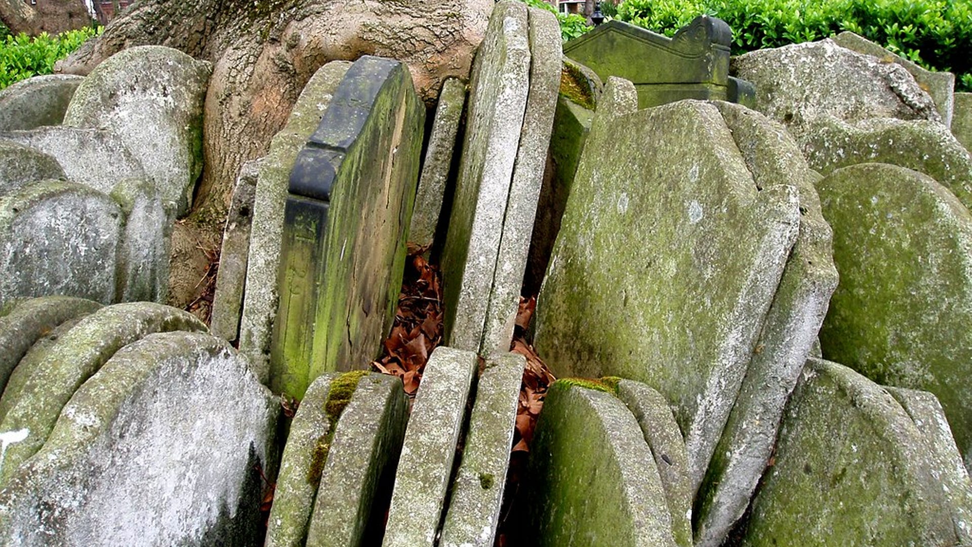
Intrigued where this particular Paradise Row or that particular King Street might have been on an old map, I googled genealogy websites to find out. And once I’d started that chestnut, I made sense that this would be a project. theundergroundmap.com would dedicate the rest of its website life to tell the stories of all the old streets (within the area bounded by the M25) which have disappeared and show where they were.
These old street geolocations got me curious as to what was there now. I started to go to random places during lunchbreaks and video these discoveries on my iPhone. I did nothing with the videos at the time.
I’d taken a walk in August 2021 from South Ealing to Northfields station as part of these expeditions (to film Weymouth Avenue if you must know).
One sunny March day in 2022 I treated myself with a walk from Chesham to Chalfont which was nothing to do with old streets but I was idly videoing it anyway. In a woodland just outside Chesham I had a thought…
South Ealing to Northfields is the shortest walk between London Underground stations - at least where the line is on the surface - that can be done. Chesham to Chalfont & Latimer is the longest. Why don’t I video walks between each Underground station and make it a YouTube ‘thing’? After all, I’d done the least and most effort in walking between four of them.
So since then I have started to upload my London Underground walks and given a new purpose to the Facebook page at least. The page is called The Underground Map and - well - I’m walking the Underground map.
Stuff happens.
I’d found a good name for a London history website, just by happenchance. It had ‘map’ in the title and then became a logical place to put old London maps. I got interested in old streets because of the old maps and took trips to find them. Then I started to visit them on trips between Underground stations. I videoed these trips and the name The Underground Map became ‘on point’.
Part of this ‘branding’ is also here on Substack - it’s also called theundergroundmap. I started this blog exactly one year and a day ago at time of writing - on 31 October 2023. I use Substack posts to feature my old map discoveries during my latest published walk between Underground stations.
Today was to be my published walk from Euston to Kings Cross St Pancras through Somers Town. It’s been a couple of weeks of illness in the family so I’d been putting off the writing until the last minute as usual. My mind has been on other things.
But I’d prepared the way earlier in the week by recreating a map of the Somers Town area before there was a thing called Somers Town. The 1750s map featured a rural area then called Figs Mead before the New Road (Euston Road) came along. And I was going to discuss it.
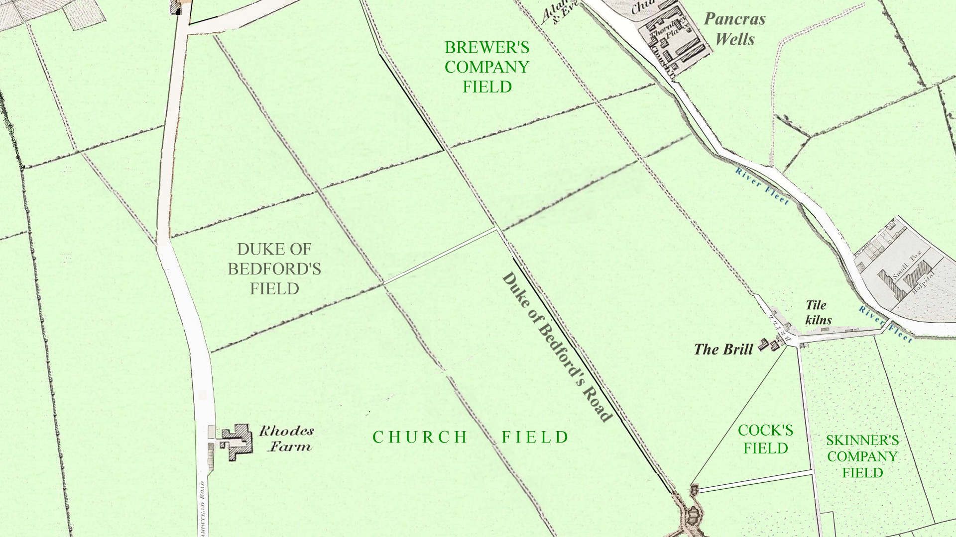
I was to show how Pancras Road was the major road in the area during the 1750s and how the River Fleet next to it ambled down from the long-lost Adam & Eve pub to Battle Bridge (King’s Cross)
I woke up on Friday morning and Matt Brown of the Londonist has featured the same area today. Included in the Londonist article is John Rocque’s 1750s map of Pancras Road and Somers Town with discussions of the River Fleet.
Other stuff happens.
And some stuff happening is an opportunity and not simply just ‘stuff’. Does that make sense?
Somers Town can wait for another day and maps like this will appear on that other day:

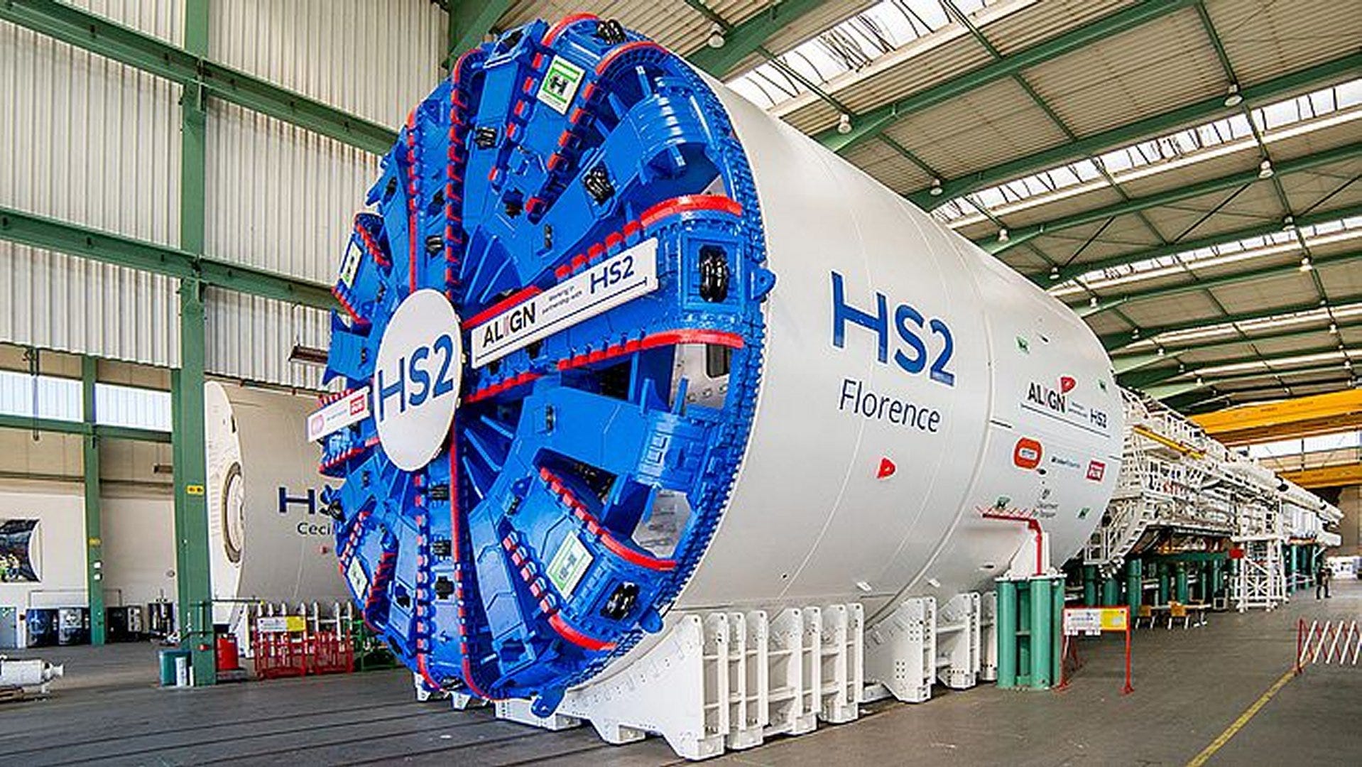
I leave London railway infrastructure and its history to people like Geoff Marshall and Jago Hazzard. It’s not so much my interest. But I’d written up why Euston became the London HS2 terminus, instead of other options, as part of my video of my walk from Euston to St Pancras. It wasn’t to feature today, here in this bit of writing - only on the video.
And so, with the Chancellor finally confirming Euston as the definite HS2 terminus, it maybe a good week to tell the story of why it had to be Euston. To be fair, this is not a tale of old maps but it is a London story nevertheless.
====
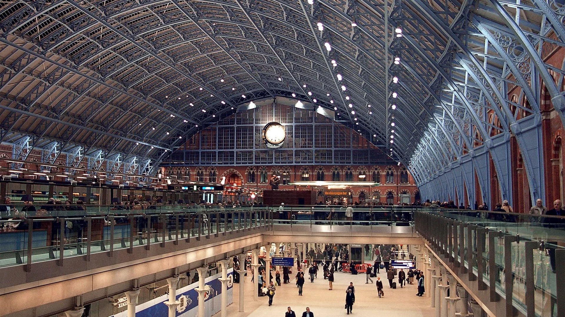
Six minutes walk away from Euston is St Pancras, the existing terminus for HS1 (Eurostar).
I’ll look at why plans to make St Pancras the terminus for HS2, never came about
Also, given that HS2, the Elizabeth line and the Great Western Railway all converge at Old Oak Common, I’ll tell the tale why Paddington could not have been the London HS2 terminus, foregoing the need for an expensive tunnel to Euston.
And indeed why the whole shebang could not have simply been diverted onto the Elizabeth line at Old Oak Common.
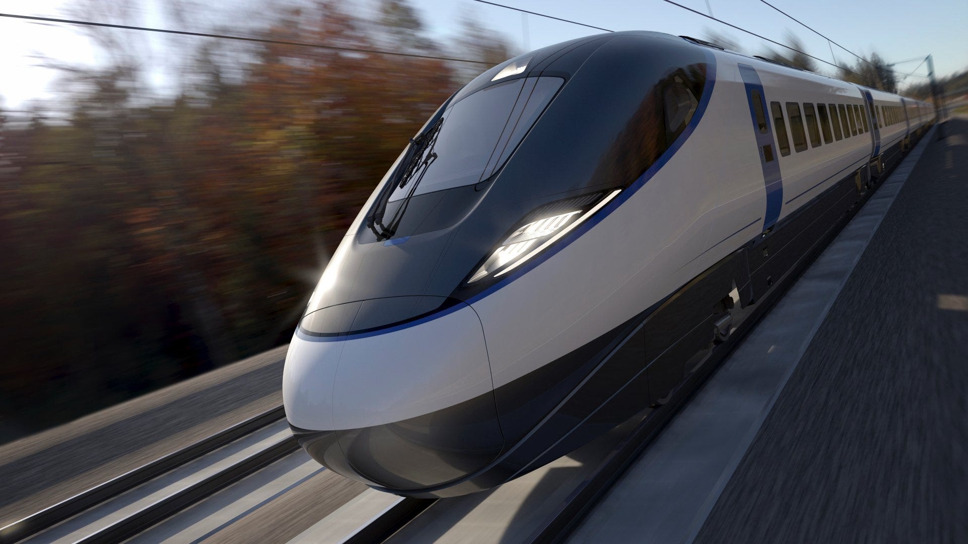
HS2 option 1: Euston as the London terminus
HS2 is going to Euston and the government has confirmed it
The tunnel to Euston will be funded by the government, and works the the Euston area are well under way. The pontifications below are not offering other ideas for HS2 in order to change any minds. There are stated below because other solutions have been endlessly offered on social media. I want to say in each case “This is why not”.
HS2 option 2: St Pancras as the London terminus
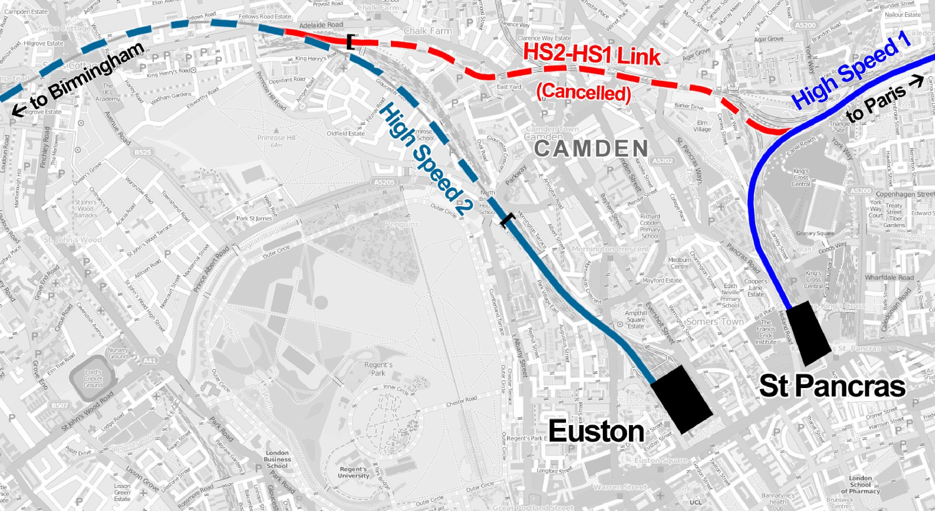
If HS2 is going to Euston, why not tunnel that little bit further into St Pancras?
A short extension to the tunnel being built from Old Oak Common to Euston would, with one kilometre extra tunnel, allow HS2 into St Pancras. This would seem to open up an array of possible connections.
HS1, better known as the Eurostar and HS2 would share the same terminus allowing journeys between Brussels and Birmingham to be a doddle.
Consider the connectivity from Kings Cross St Pancras compared with Euston.
It has Eurostar; domestic HS1 services to Kent; six tube lines; Thameslink services to Surrey, Sussex, South London, Luton and Gatwick; East Coast mainline services, local and long distance; Midland Main Line, local and long distance.
Had there been the vision and political will 20 years before now, Kings Cross St Pancras could have become a ‘mega London terminus’, including HS2. Crossrail 1 might have been routed via Kings Cross as well giving connectivity to Heathrow, with Gatwick already served by Thameslink.
All those years ago there had been a derelict triangle of land between Kings Cross and St Pancras before all the new building. But that ship has sailed. Coal Drops Yard, residential blocks, nightlife have all been built up. There is no longer an option for the area north of Kings Cross to host a railway station.
Next to consider, an expanded St Pancras could have been gone into the area where they built the British Library on the site of old railway sidings.
With the British Library and Francis Crick Institute having been built, St Pancras International is now very much constrained by the space it’s in already. This limits passenger numbers. There is no extra capacity or the option to build more platforms.
St Pancras is a no-no.
HS2 option 3: A connection between Old Oak Common and Paddington, making that the London terminus
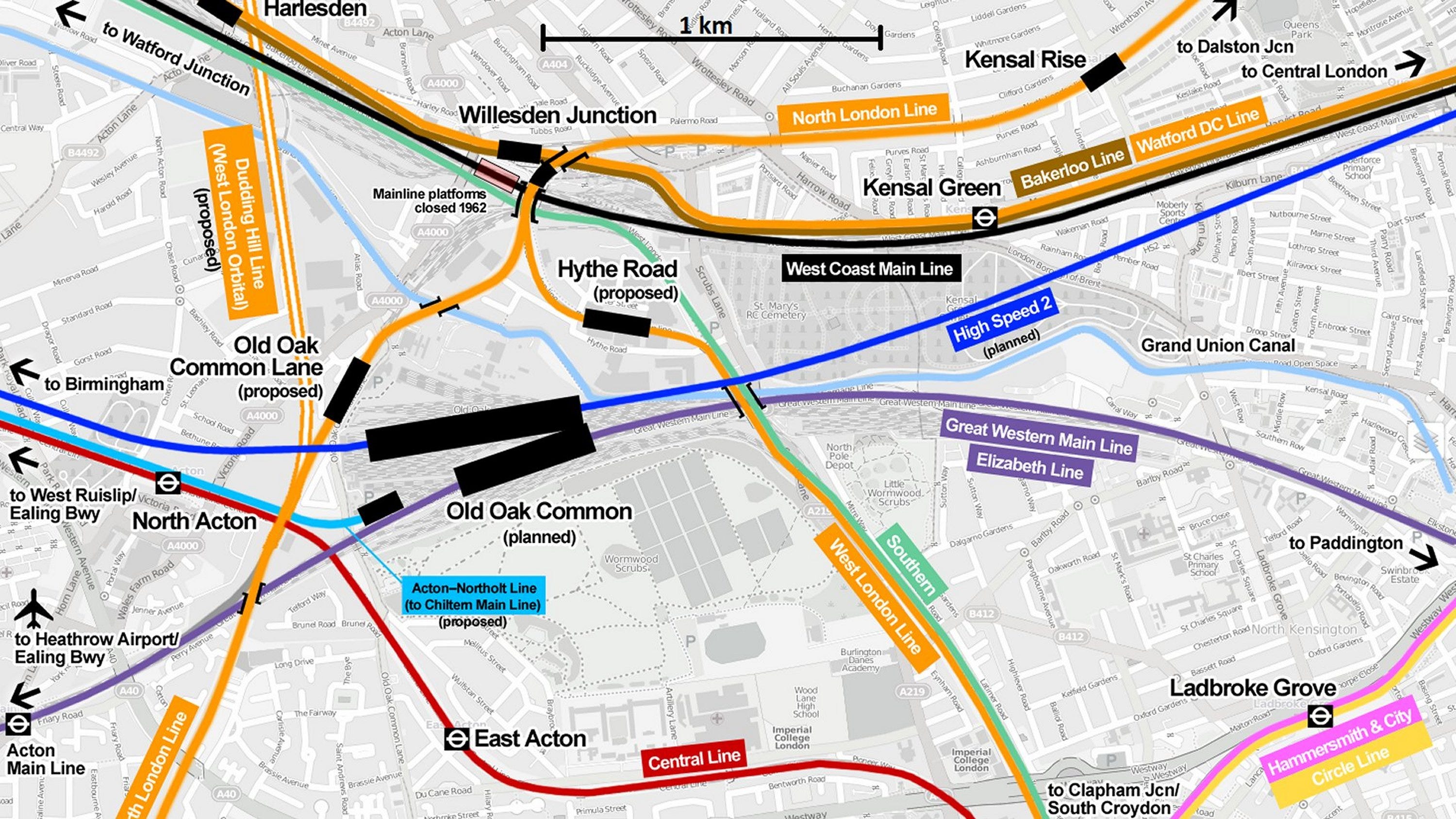
Since HS2 and the Great Western Main Line meet at Old Oak Common - simply build a link
Could we simply have cancelled the expensive London Euston tunnel part of HS2 and diverted it in to London Paddington instead? There had been (before the 2024 Autumn budget) so much talk that the HS2 trains might be terminated at Old Oak Common and that the London Euston section would be cancelled. Could running HS2 into London Paddington instead be a cheaper option? Old Oak Common is already close to London Paddington, so it seems a simple solution.
That is, until we look closely at the way the infrastructure works.
HS2 enters Old Oak Common in a 1 kilometre-long rectangular station box, at a depth of 20 metres.
It would be very difficult to link the low level tunnelled HS2 lines at Old Oak Common to the surface tracks.
A short new 1.2 kilometre tunnel could come out just north of the Great Western Line, meaning a very steep gradient. In the area, to complicate matters, are the Elizabeth line and Bakerloo line tunnels, plus the Grand Union Canal.
Paddington is on quite a sharp bend from Royal Oak, making the 400 metre long HS2 platforms hard - let’s say ‘impossible’ - to fit in.
An underground station solution at Paddington instead – much more expensive - would compromise the whole trainshed structure there. And this defeats the point about saving money on the Euston tunnel.
This is why Paddington wouldn't work out.
HS2 option 4: Build a connection between Old Oak Common and the Elizabeth line. Run HS2 into a variety of London stations
Since HS2 and the Great Western Main Line meet at Old Oak Common, simply build a link
This seems a great idea at first. HS2 and the Elizabeth line tracks are so close at Old Oak Common.
Why not dispense with the idea of a single London terminus altogether? Every purple line station could be a boarding point for Birmingham!
At Old Oak Common, the Elizabeth line is located physically above - indeed 20 metres above - HS2.
Assuming a connection could be built to level-out the height differences of the tracks, other problems occur with this idea.
Elizabeth line station platforms use screens specifically designed for the train door spacing - multiple doors spread along the carriages, rather than at the end of each carriage as for HS2 with the need for lots of luggage racks.
Most HS2 trains will be too long for the Elizabeth line platforms - the existing stations have 240 metre platforms; some peak-hour HS2 trains would need to be 400 metres long.
HS2 trains could theoretically run through the tunnels, but the whole train would not be able to be boarded at most of the stations - just some of it.
Most importantly, HS2 would use up valuable Elizabeth line capacity - and inevitably get stuck behind the Elizabeth line trains. Purple line trains are already packed like sardines in rush hour. Losing capacity there would be a disaster for London.
HS2 option 5: Euston as the London terminus but also an HS1-HS2 link
Early proposals for HS2 outlined the construction of a two-kilometre-long link between HS2 and HS1, which would have allowed high-speed trains to operate directly from the North and Midlands to destinations in continental Europe via the Channel Tunnel. The link, which was to be built through Camden Town, was abandoned in 2014 on grounds of cost and insufficient capacity for trains on the HS2 track. Camden residents were also up in arms about the disruption that would have been wrought upon their lives.
The idea has been abandoned for a decade now. It will remain abandoned.
HS2 option 6: A Euston-St Pancras railway station
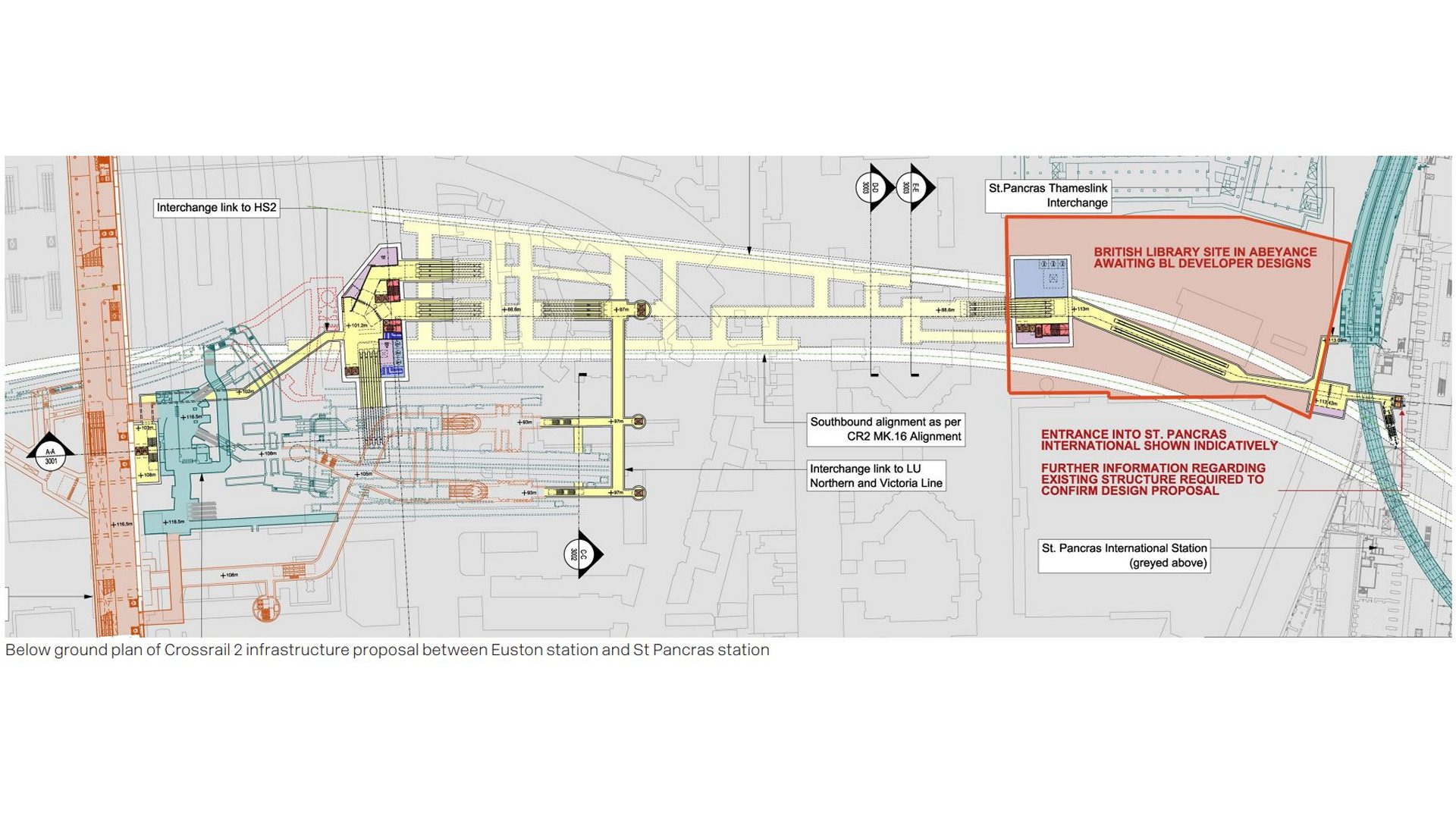
Deus ex machina: If Crossrail 2 gets built, a new station called Euston-St Pancras is in the plan
Euston St Pancras railway station is a proposed station on the future Crossrail 2 line linking Hertfordshire and north-east London to south-west London and Surrey.
The station would be integrated into Euston and St Pancras mainline stations, as well as Euston Underground station. Access to King's Cross station, and King's Cross St Pancras Underground station would be via a short walk through St Pancras station. A link has been proposed to Euston Square station on the Underground too.
The platforms are proposed to be under Somers Town: from just south of the Eversholt Street and Drummond Place junction in the west, to just north of the British Library at Ossulston Street in the east. Entrances to the station are proposed to be the existing entrance to Euston Underground station, and new entrances at the corner of Eversholt Street and Grafton Place, and inside St Pancras station, by the Thameslink platforms.
It this is built, St Pancras and Euston become joint HS1/HS2 termini.
=====
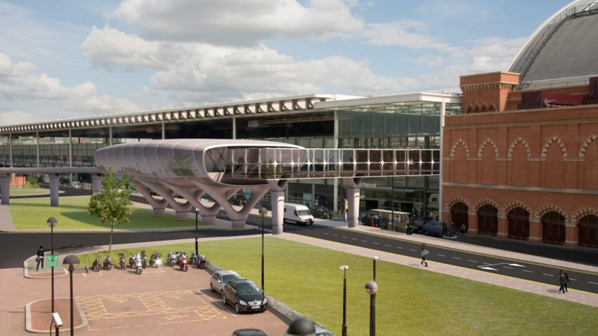
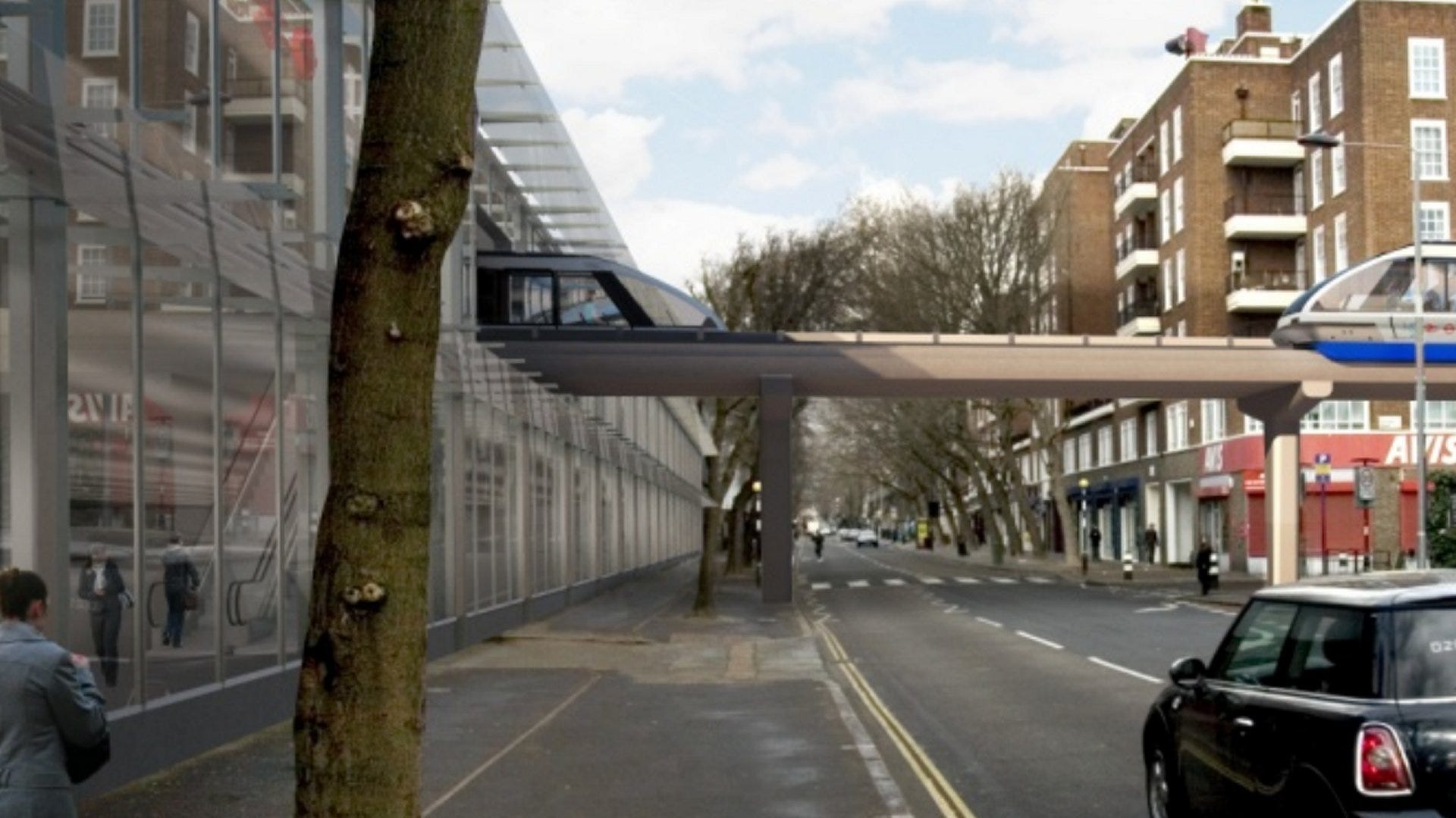
There are fun ideas to link Euston and St Pancras involving an Automated People Mover (APM) either above Phoenix Road in Somers Town, or beneath it.
I won’t go into this here but there are a couple of fab photos of the plans provided by the ARUP report looking into the scheme.
This brings us back to Somers Town which might have been the subject of this post. But that’s now for a another day.
Oo - here’s another map on the same footprint as the others above.

But really. I’ll stop now.
Ah, sorry to steal your thunder, Scott. I find the old railway lands and St Pancras church area deeply fascinating. There is so much to say, and I look forward to your future post. And great stuff with the HS2 “whatabout” analysis.