

What's in a name? (micro edition)
London's very own North Pole

My 12th March - 12th April 2026 stay in London in order to walk the whole of the Bakerloo line in both directions has passed the middle point. I was waylaid somewhat earlier this week by a rather heavy cold, the main project-completing effect of which has been “delays in the Stonebridge Park area”.
But the effort has resumed.
I have chosen to stay in an AirBnb for the month which is not quite London Underground connected. Every station is just a little bit too far away to want to walk to. I’m aware that this is a walking holiday but that’s extra walking.
The 220 bus from Wood Lane gets me up to Willesden Junction when the ‘WJ mood’ overtakes me. The good old number 7 will, Bakerloo line-wise, deposit me in Paddington from the Highlever Road stop.
But, not being able to pop into the tube station next door, means that I have discovered the neighbourhood that I am in, in a little bit more detail than I would have done. The local Tesco Express has been my go to for ‘chicken ding’ (the AirBnb has a microwave). The owner of Mick’s Fish Bar, indifferent to me on my first visit, has started to ask how I am (eating too much fried food is how I am). I got a great - if a bit short - haircut along with a hot towel shave from the Kurdish barber.
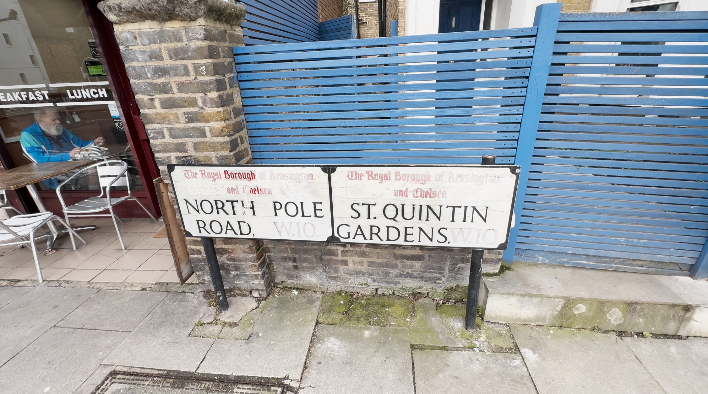
All of these establishments plus a post office, shawarma takeaway, a health food store, flower seller, a nail bar and more are positioned along a rather short stretch of road called exotically North Pole Road.
North Pole Road starts in the Royal Borough of Kensington & Chelsea at the St Quintin Gardens triangle and runs to the southwest under a railway bridge to Wood Lane by which time it has changed both borough (to Hammersmith & Fulham) and postal area (W10 to W12).

North Pole Road has given this area a microname: North Pole.
I’m sure but not certain that there are just two places called North Pole on Earth. One at the top of the world and this one here in London.
During the days of my heavy cold I still made a point of getting out every day and took my iPhone camera along.
If you have a bit of time on your hands - and access to old maps - every picture you take tells a story. London is a huge subject and even when you concentrate on 100 metres of it, it’s still a huge story. What a rewarding city!
This area got its name North Pole quite by accident despite the best efforts of nineteenth century property developers. More of that later. Let’s go back to the lay of the land around the year 1800.
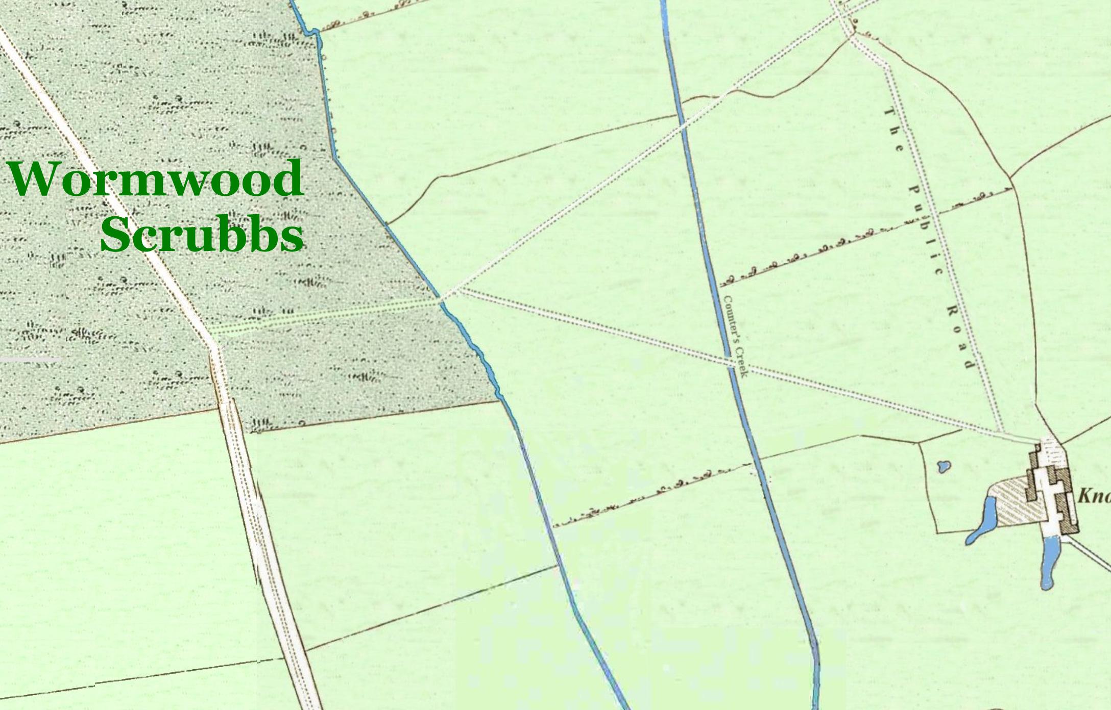
It’s a classic 1800 case of “Nothing to see here. Move on sunshine”. Not quite. The road on the left of the map running into ‘Wormwood Scrubbs’ (sic) is the future Wood Lane. There’s a path from Wood Lane which crosses two branches of a stream called Counter’s Creek before it reaches a large farmhouse called Knolton Barn Farm.
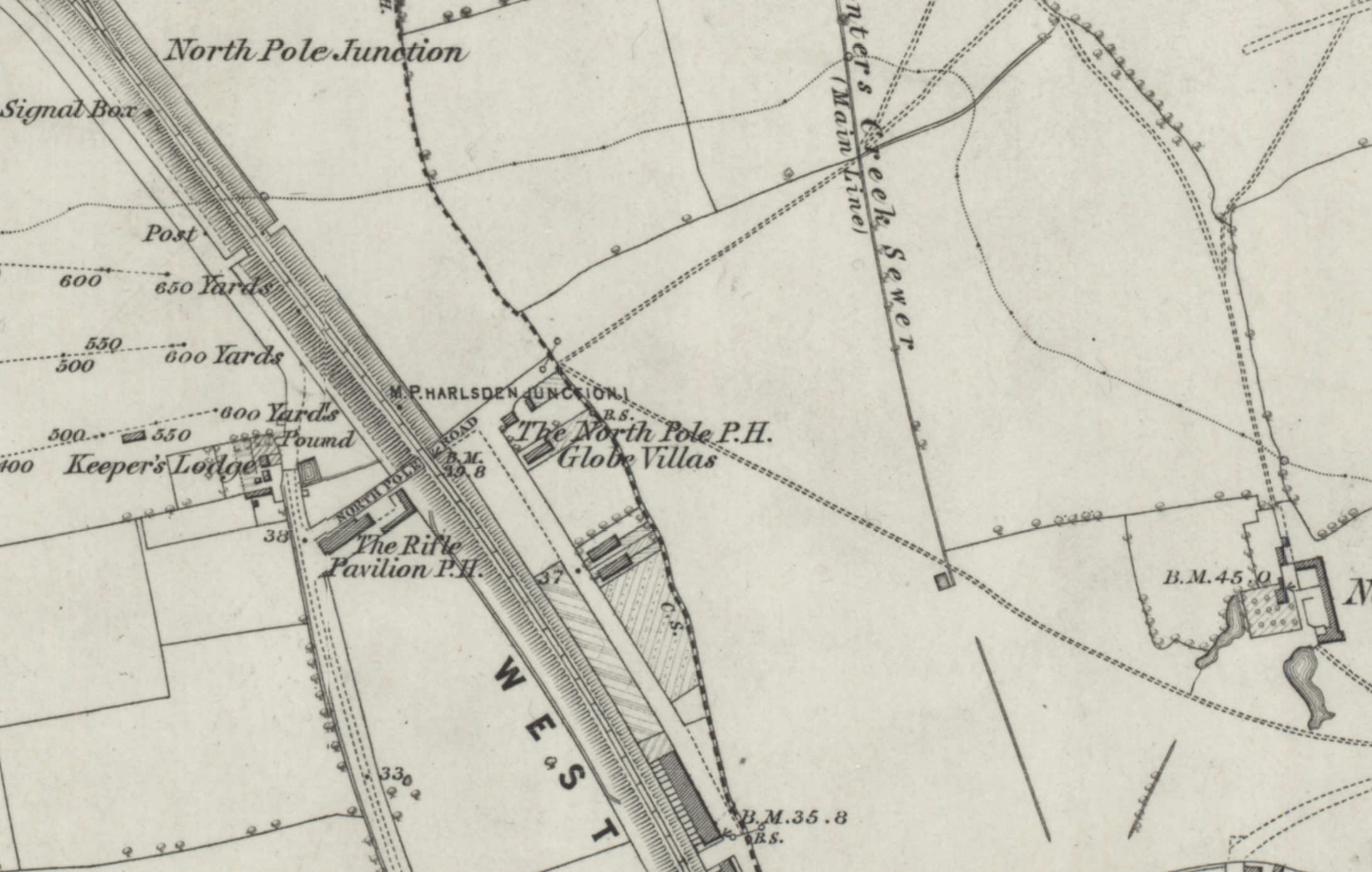
Seventy years later and changes are afoot on the map above. Part of Wormwood Scrubs has been turned into a rifle range. This gun club was situated behind where Burlington Danes School now stands.
To take advantage of the club participants, a pub called the Rifle Pavilion has been established where Wood Lane and the new North Pole Road meet. Scrubs Lane is the name for Wood Lane north of the junction.
A railway line has been built and, beyond it, a second pub called The North Pole stands at the junction of North Pole Road and Latimer Road (the Latimer Road name is not marked on the map). The pub gardens stretch down to one branch of Counter’s Creek and North Pole Road stops dead at the stream.
Next to the North Pole pub along Latimer Road are Globe Villas and this hints at an endearing piece of naming history.
The North Pole was originally called ‘The Globe’ when it was built in 1839 as a single storey inn. Globe Villas was next door along Latimer Road. In the 1920s, a few doors along at 298 Latimer Road the ‘Globe House Laundry’ was established, a clear reference to the original name.
Not a lot of money was spent on the original 1839 pub sign for the Globe. Its depiction of a globe weathered away leaving only the North Pole visible. Locals began calling the pub the North Pole informally and the name stuck. This caused the road outside to be renamed. Now that’s how history works!
Incidentally, the pub was built here in 1839 to serve the attendees at the north western edge of the Hippodrome racecourse which stretched over Notting Hill. The Hippodrome closed in 1842.
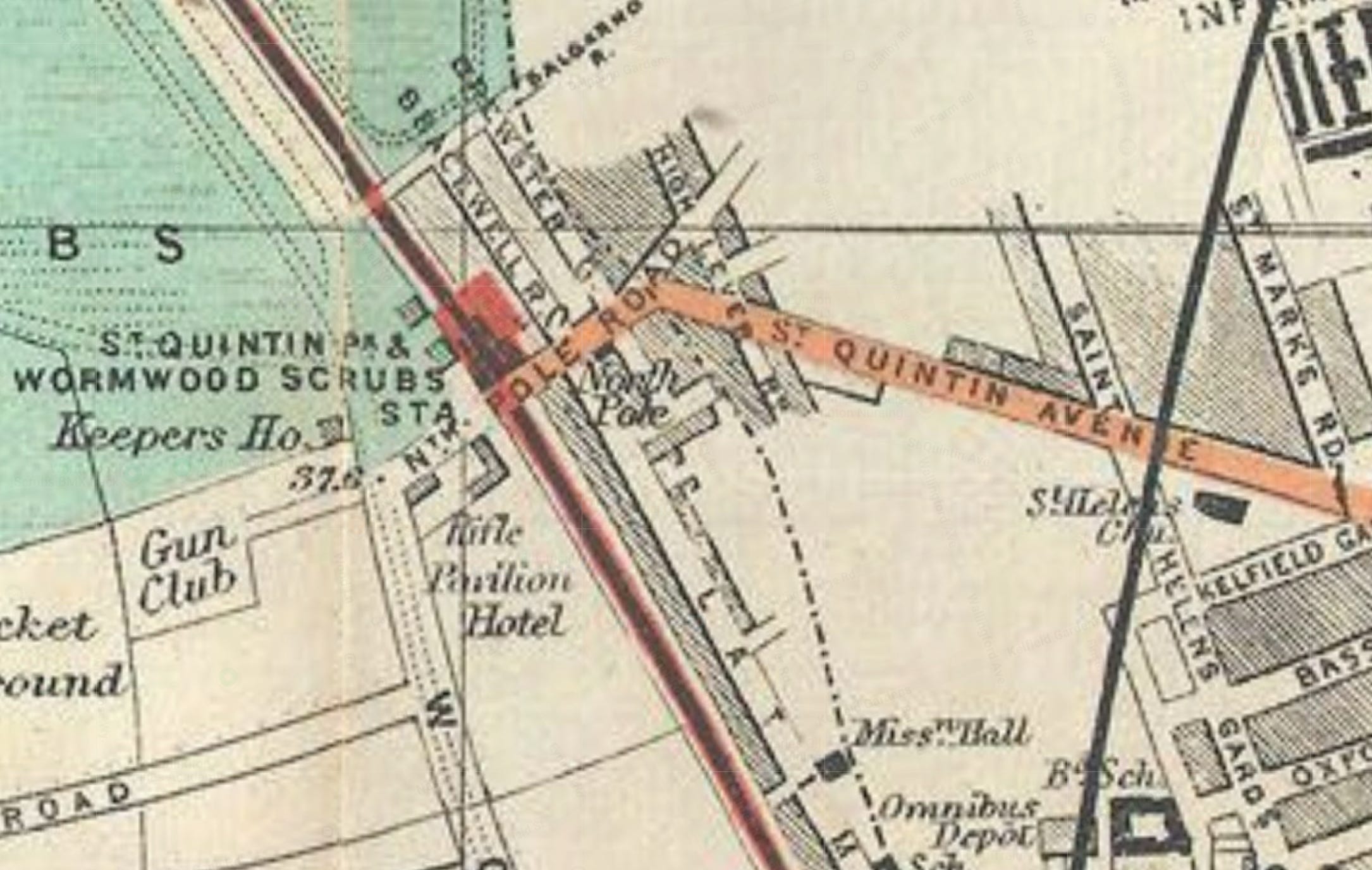
By the 1890s, further development is taking place. Knolton Barn Farm (later Notting Barn Farm and hence the Notting Hill/Notting Dale names) has gone.
The path to the farm has been built up into St Quintin Avenue.
An effort to rename the rather common North Pole suburb name with a new posher-sounding name of St Quintin Park has arrived along with a new railway station on North Pole Road: St Quintin Park and Wormwood Scrubs. This station opened in 1871 but was bombed in 1940 and never reopened. Mildmay Overground trains run over the bridge without stopping at what would be a very useful reopened station.
The North Pole name won out and St Quintin Park is now used by nobody for the area.
Some photographs then.
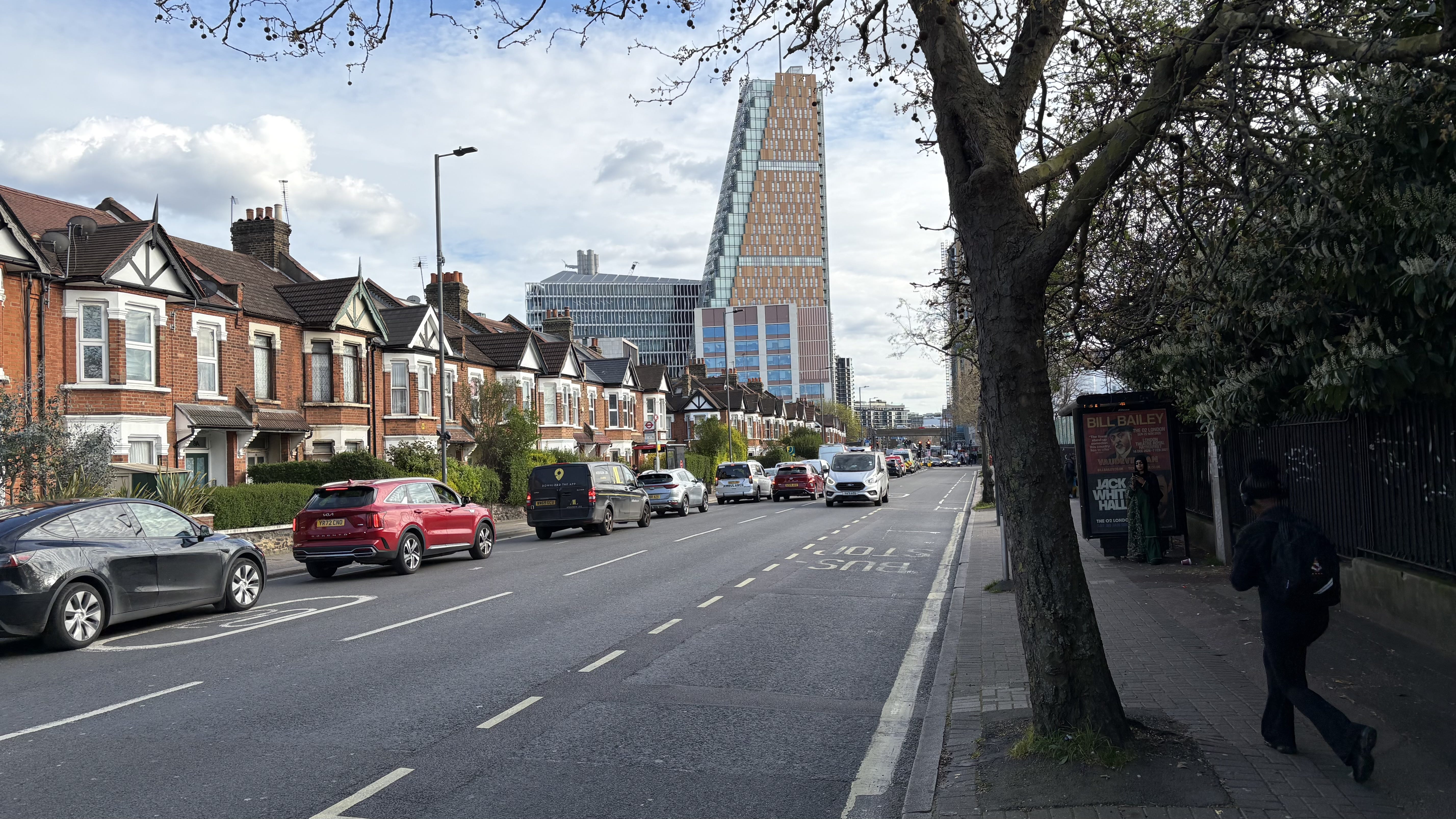
This is Wood Lane, W12 running south from the North Pole Road junction. Charitably it might be described as non-descript. There’s the 220 bus stop on the right towards Willesden Junction. The new builds in the distance have replaced what was the White City stadium area. One interesting thing maybe is that Wood Lane - in the London Borough of Hammersmith & Fulham - is architecturally quite like many other places in London. Once we’re over the border into Kensington & Chelsea in North Pole Road there’s another ‘West London stucco’ style stretching over to Paddington which is unique in London. The border here between boroughs and postcodes is a real border.
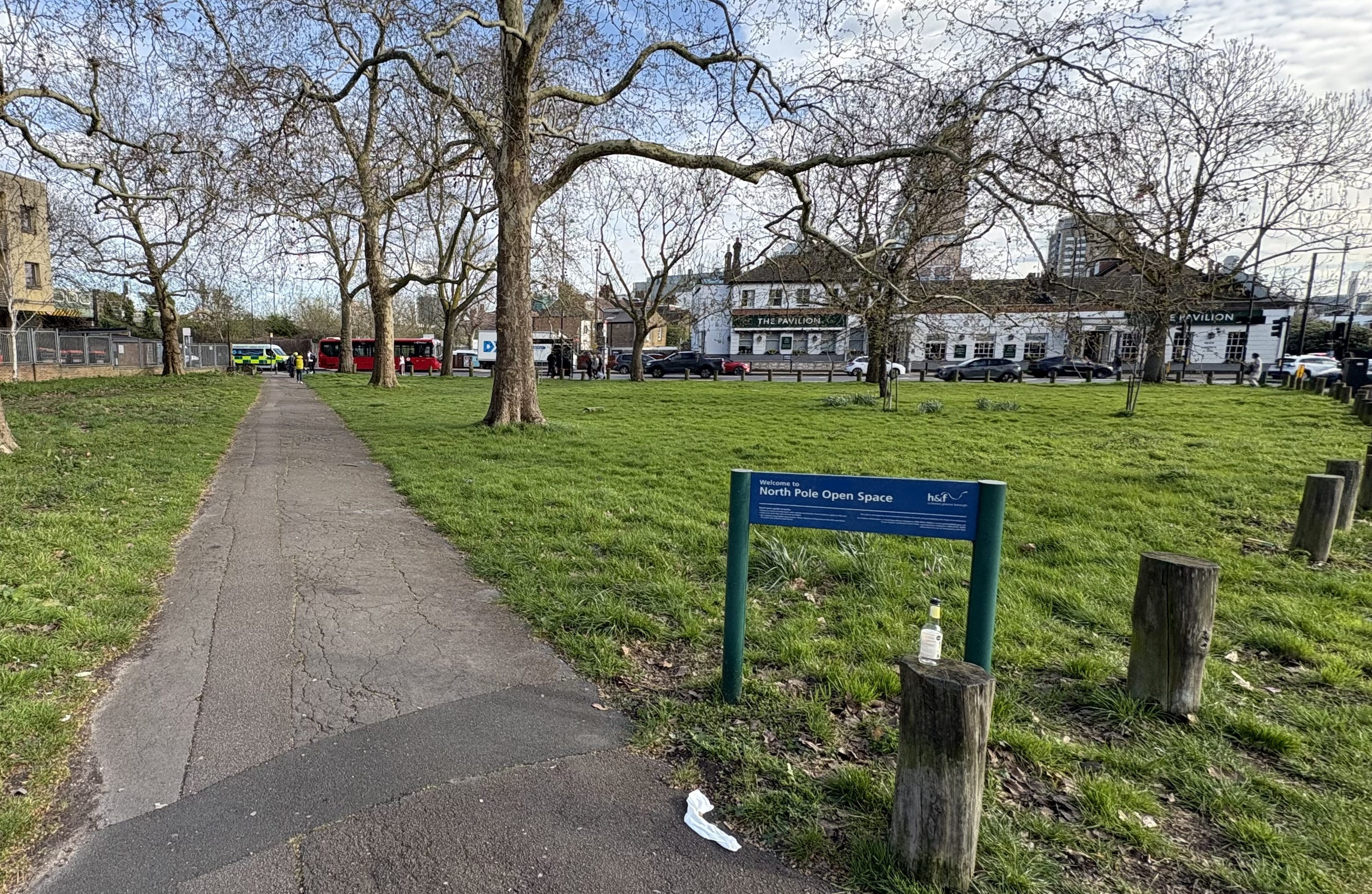
Corner of Scrubs Lane/Wood Lane/North Pole Road. I assume there’s another North Pole Open Space on Earth at 0 degrees north. The white pub in the background is still called the Pavilion after all these years which is comfortingly consistent.
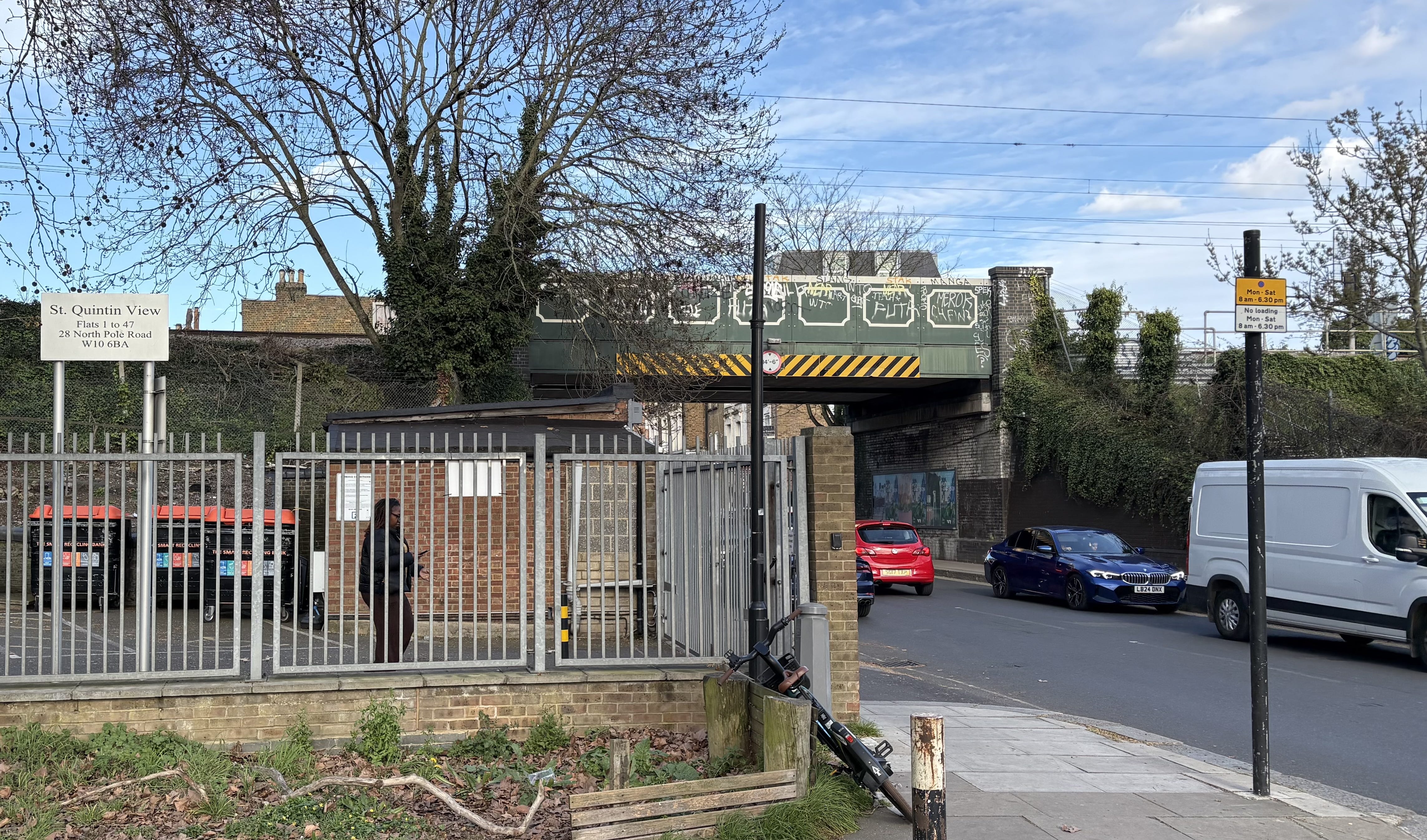
New flats here (off camera, left) are on the site of the old station. An architect with a sense of history has kept the St Quintin name. Under the bridge and we’re in W10 and a new borough.
Under the bridge and Marion the hairdresser was used by my aunt in the early 1950s. It doesn’t appear to be still running sadly.
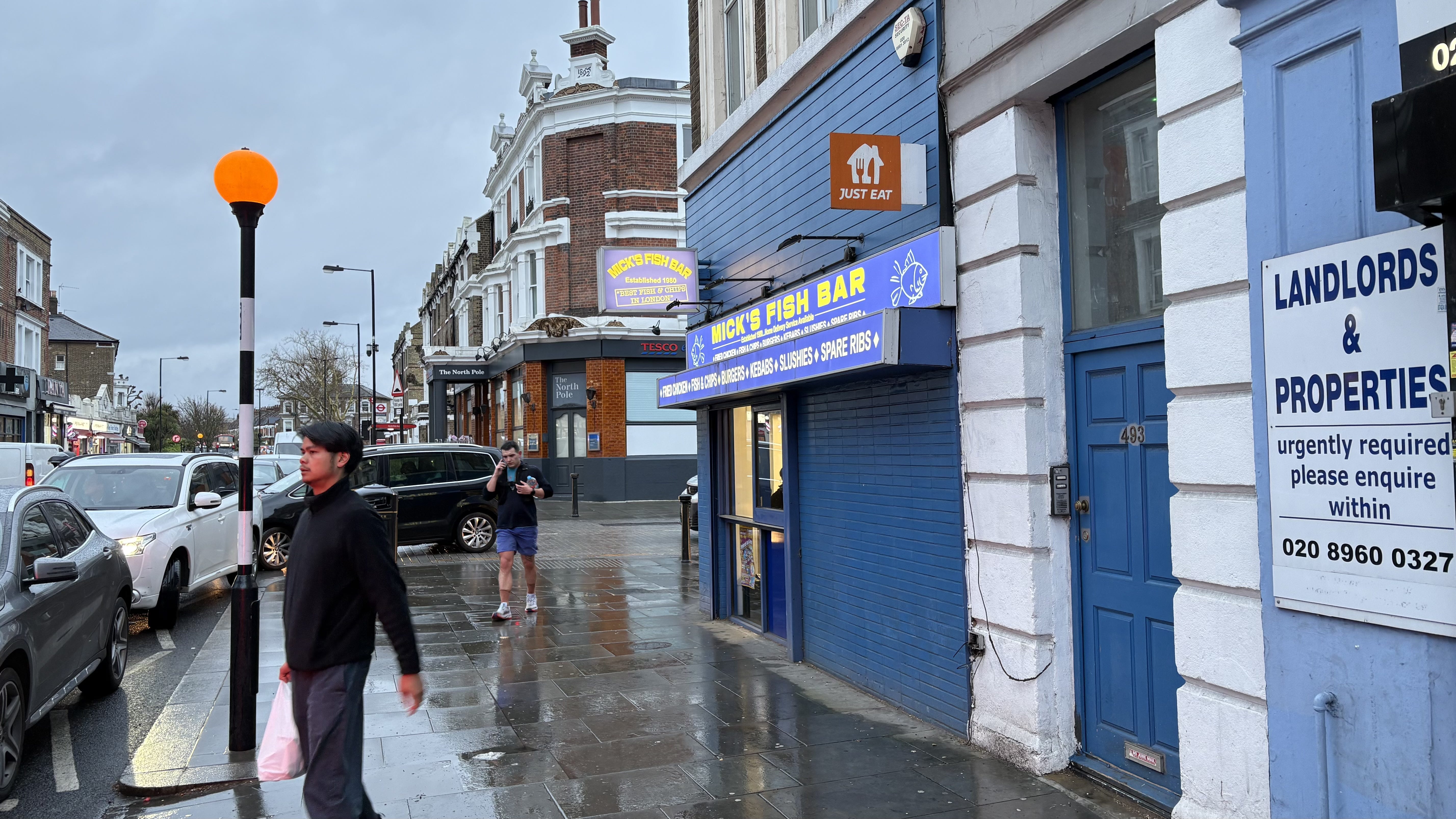
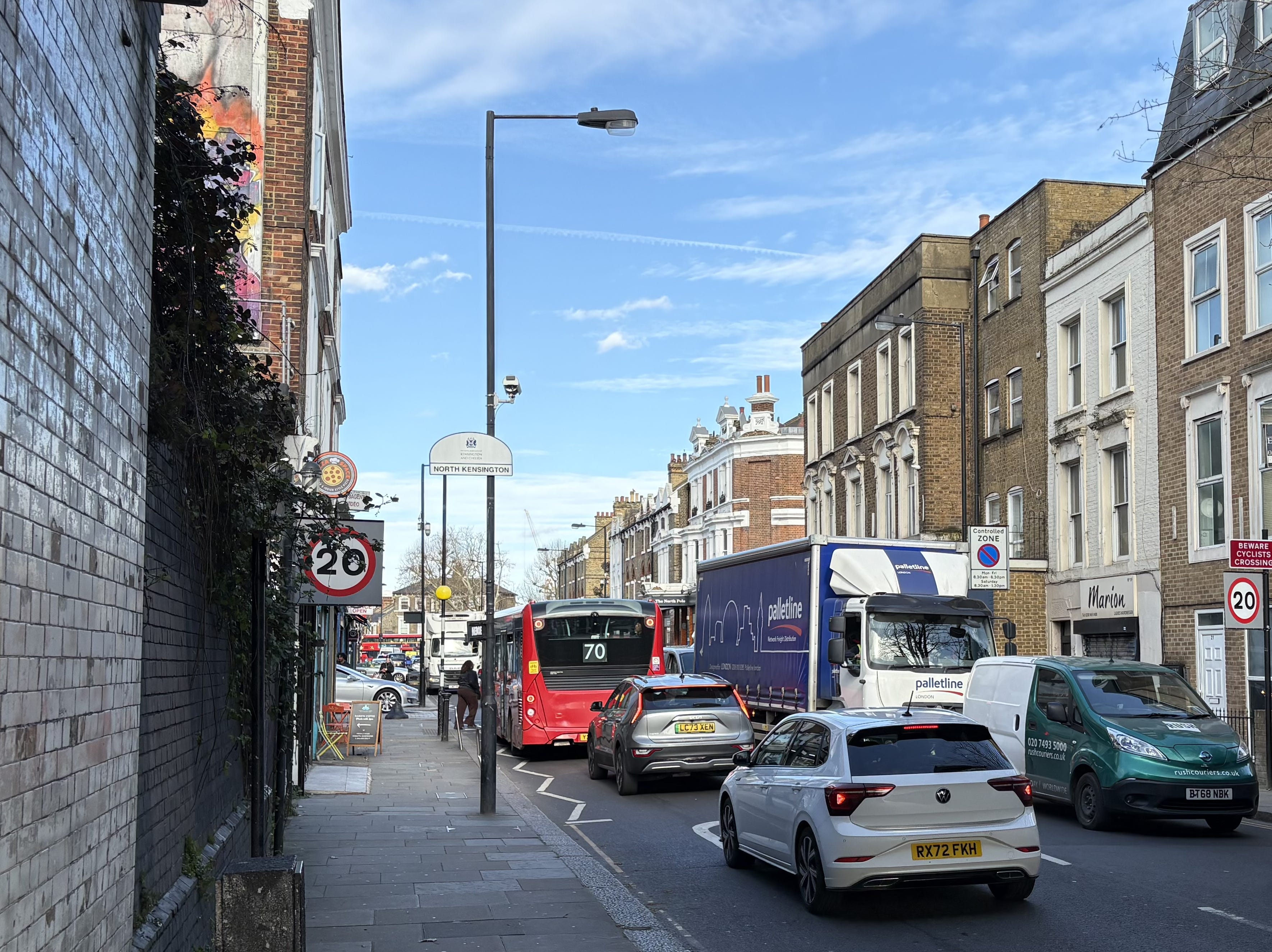
Mick’s Fish Bar and the former North Pole pub. In summer 2012 it was bought by Riding House Properties who quickly closed the pub, leasing the ground floor to Tesco Express and converting the upper floors to residential flats.
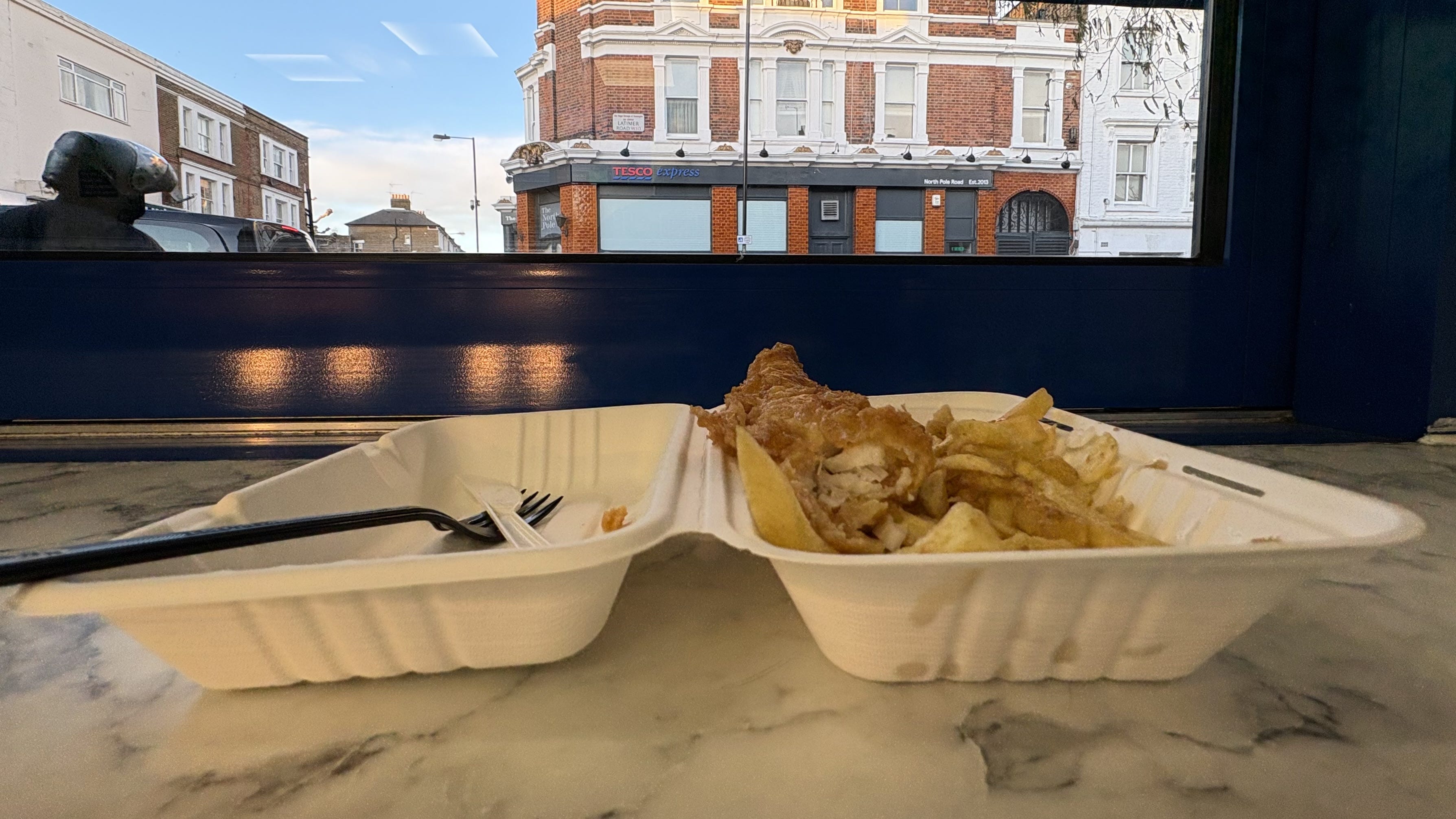
View from Mick’s window across Latimer Road. Now Latimer Road - which gives its name to an underground station but now runs nowhere near that station - is another London story for another time.
Notes
A fantastic read: northkensingtonhistories.wordpress.com/2020/08/02/the-fourteen-pubs-of-latimer-road-and-norland-road/
Thank you for this. I cycle through here on a fairly regular basis (west of wormwood scrubs), but had no idea of the history. I remember being struck by the fact that St Quintin Avenue seemed unusually long and straight. Nice to know why that is the case.
Fascinating! This is roughly my neck of the woods. Ish.
There's a lot of railway infrastructure here. North Pole depot, junction etc.