

The Greenwich Peninsula
From marsh to industry to hedonism

Twenty-first century partygoers to the O2 Millennium Dome sometimes arrive using the IFS Cloud, whisking the visitor south across the River Thames from the former Royal Docks.
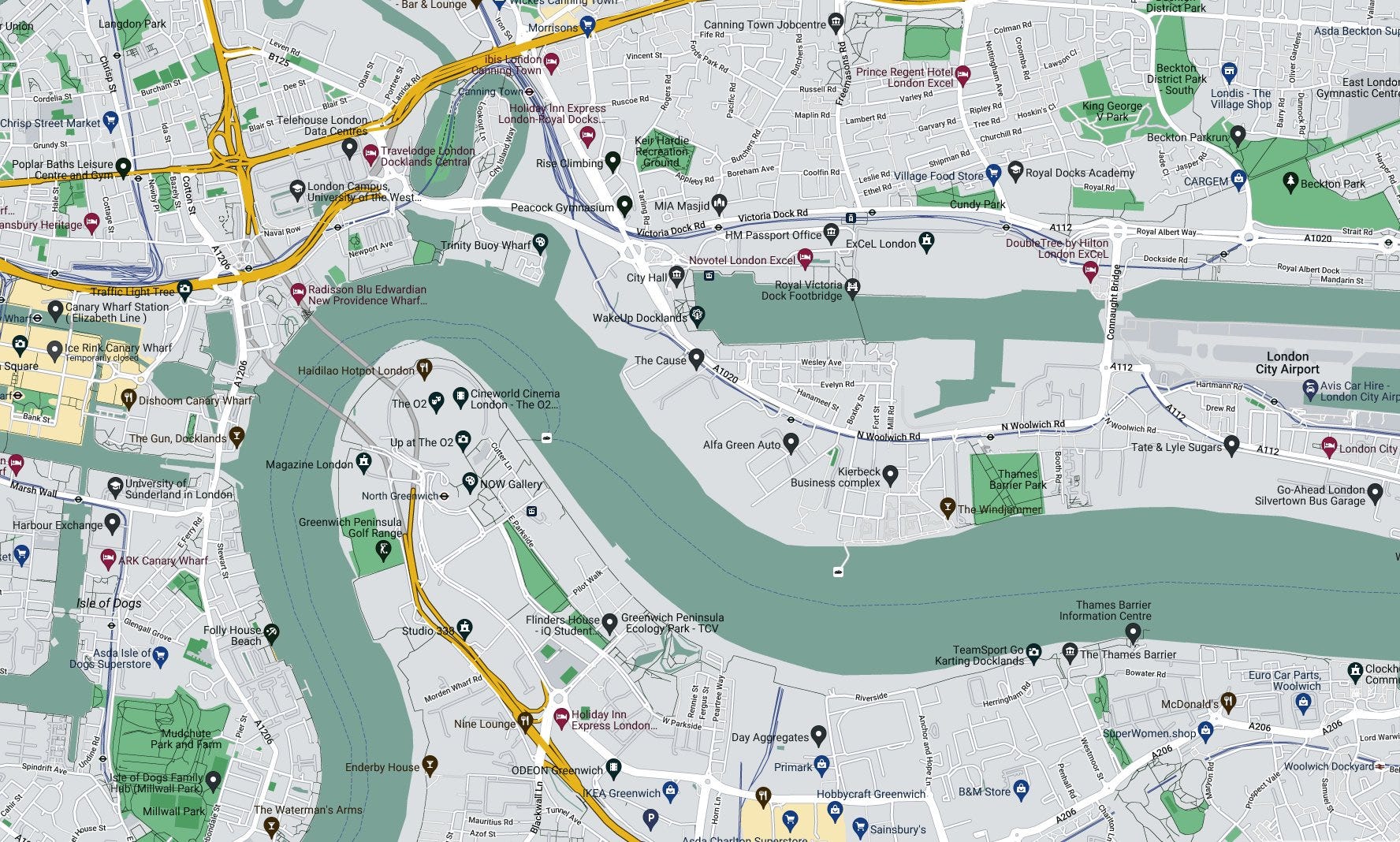
From above, swinging in the wind and with the gentle burr of moving cables they can survey the Isle of Dogs with its gleaming skyscrapers, marvel at the plane landings at London City Airport, see the Thames Barrier at Woolwich, keeping London safe from flooding (for the while).
Wind back 150 years or so to a map with the same footprint and lots of things are different.
Poplar and Blackwall - in the top left of the 1870 map - was as built up then as now. The Thames flows the same course. Everything else is rather different.
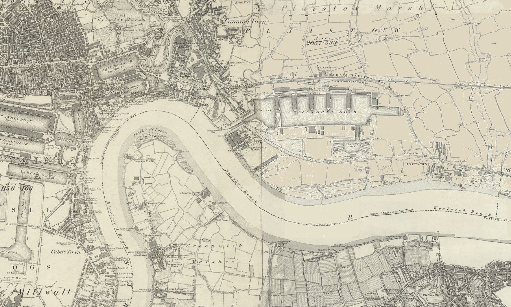
In most recent memory, were the thriving docks on the Isle of Dogs. A rather poor population - men, boys and some women - in Poplar, Cubitt Town and Millwall were employed in the various jobs associated with the trade which made the British Empire rich.
On the south bank of the river, marshes dominate all the way east to the built up area of Woolwich.
The Woolwich Dockyard is an important facility but you’d never know it from this map. It’s a secret - a blank space as far as the Ordnance Survey was concerned. It was well into the 1900s before maps were allowed to show it.
We’ll cross the Thames before we return to the south bank for a closer look.
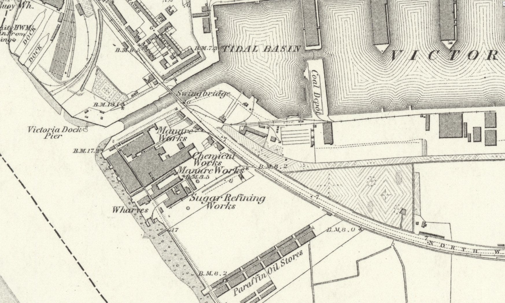
Opposite the Greenwich Peninsula is a sugar refinery. Remarkably, Tate & Lyle are still in the area even after all this time. Behind the factory is the Victoria Dock, the first of the Royal Docks-to-be, and a notable addition to an area after its arrival in 1855, on a previously uninhabited area of the Plaistow Marshes. Custom House to the north of the dock administers the show. It has its own station on the North Woolwich branch line which heads to Silvertown.
Behind the Victoria Dock and Silvertown are a series of undeveloped marshes stretching all the way to Tilbury and beyond.
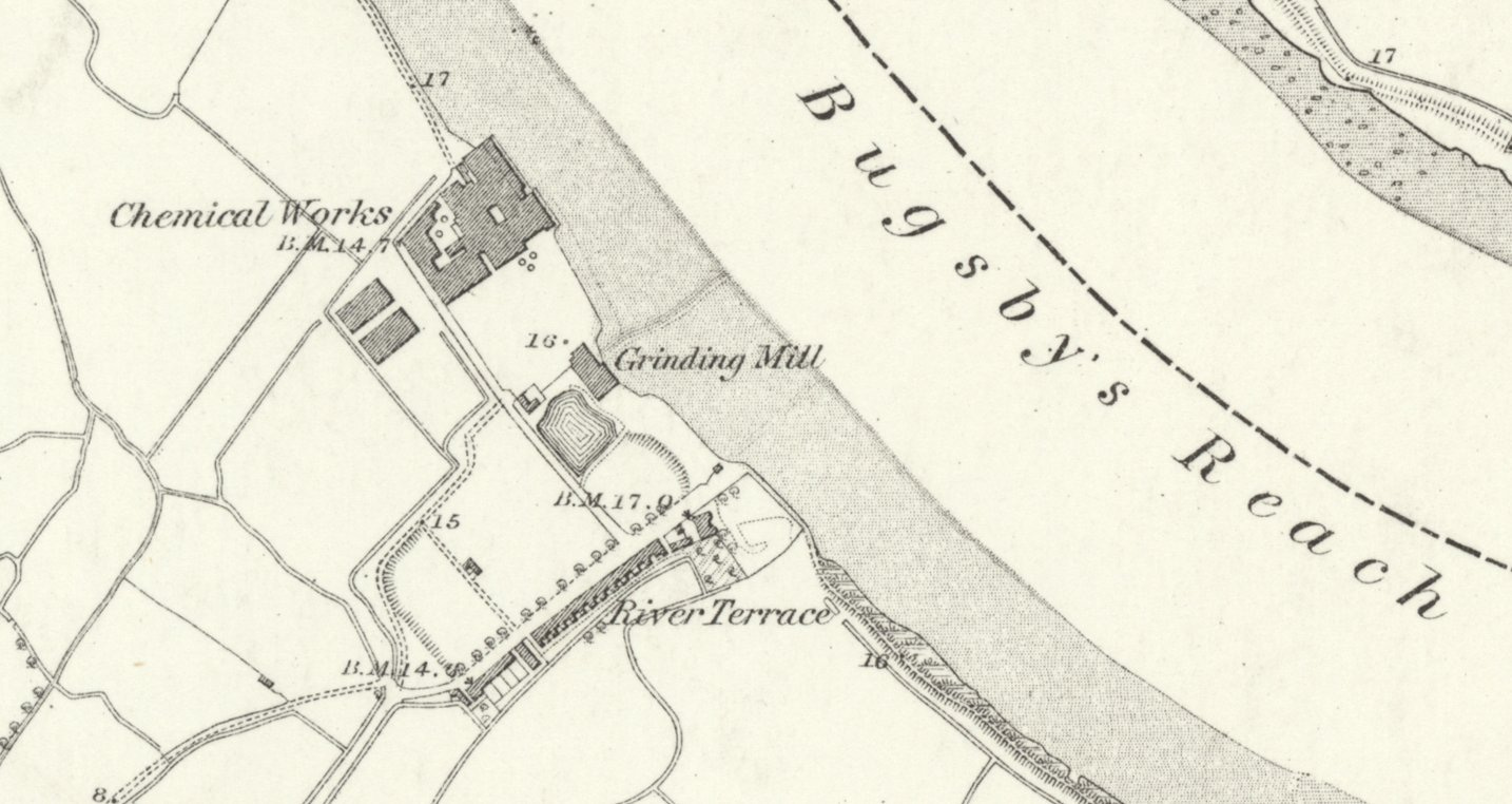
Back southside on the Greenwich Marshes, a chemical works has arrived amidst the meadows. This was one of the forerunners of much toxic industry to arrive here. This polluted the soil so much that heavy metals had to be removed for years before the area was developed to become the inevitable 21st century box-shaped apartment blocks of North Greenwich. Vernacular architecture anyone?
The Greenwich Peninsula had a remarkable history all of its own and it’s to that we’ll now turn for a closer look.
At the bend of the Thames, where we now find the O2, was Bugsby Marsh – with Blackwall opposite.
Bugsby may have been the commander of a prison hulk that was once moored here, but it has also been suggested that the word is a corruption of ‘boggarty’, which meant ‘haunted by sprites or spirits’. The methane gases of the marshes could have conjured up such manifestations.
During the seventeenth and eighteenth centuries, Blackwall Point (the northern tip of Bugsby Marsh) was a location where the pirates’ corpses were hung. This practice was known as gibbeting. Not content with the punishment of hanging, before their demise pirates were measured for a cage. This must have been a wonderful light relief to the victim, knowing that their body would be displayed in cages to deter other would-be pirates, in view of London-bound ships for months after being sent to the afterlife. It seems that simple hanging was too good for them.
Bugsby's Marshes later became known as East Greenwich as it developed in the 19th century. More recently, it has been referred to as North Greenwich, due to the location of the North Greenwich tube station, which should not be confused with North Greenwich on the Isle of Dogs, located on the north side of a former ferry from Greenwich.
In the 16th century, Dutch engineers drained the peninsula, enabling it to be used as pasture land.
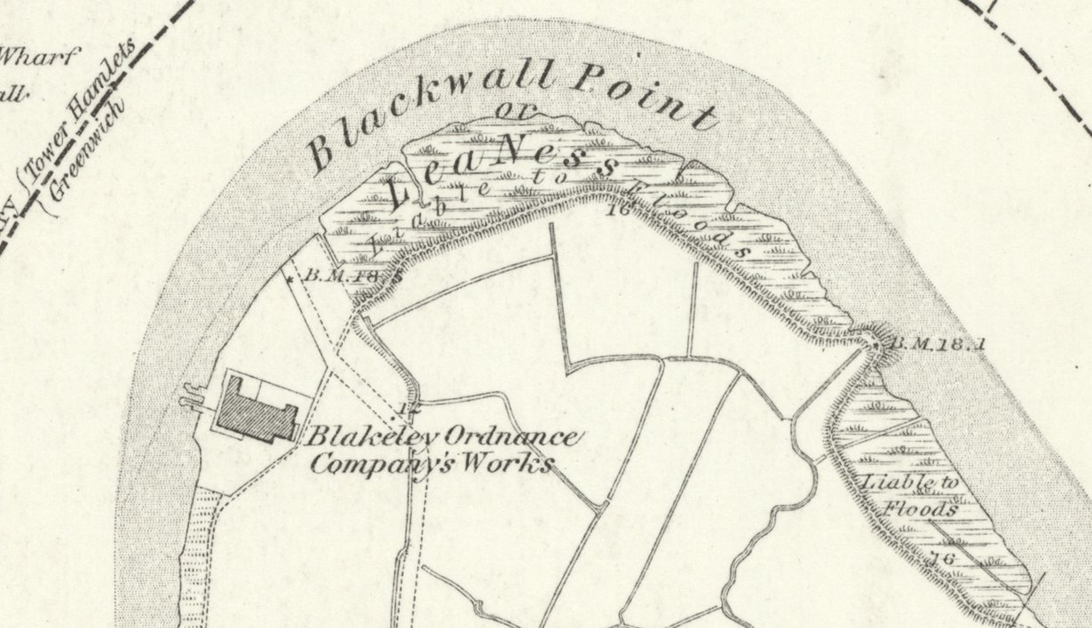
The Board of Ordnance established a gunpowder magazine on the west side of the peninsula in the 1690s, which served as the government's primary magazine until the opening of the Royal Gunpowder Magazines at Purfleet in 1765. The southern entrance to the Blackwall Tunnel now lies under the site. By 1771, gunpowder was no longer stored at Greenwich, although the buildings remained for several decades.
The peninsula underwent steady industrialisation. Various industries, including heavy gun manufacturing, chemicals, submarine cables, iron boats, iron and steel production, flourished in the area. Henry Bessemer built a steel works in the early 1860s, which later closed due to a fall in demand. Other industries such as oil mills, shipbuilding, boiler making, and the manufacture of Portland cement, linoleum, and animal feed also emerged.
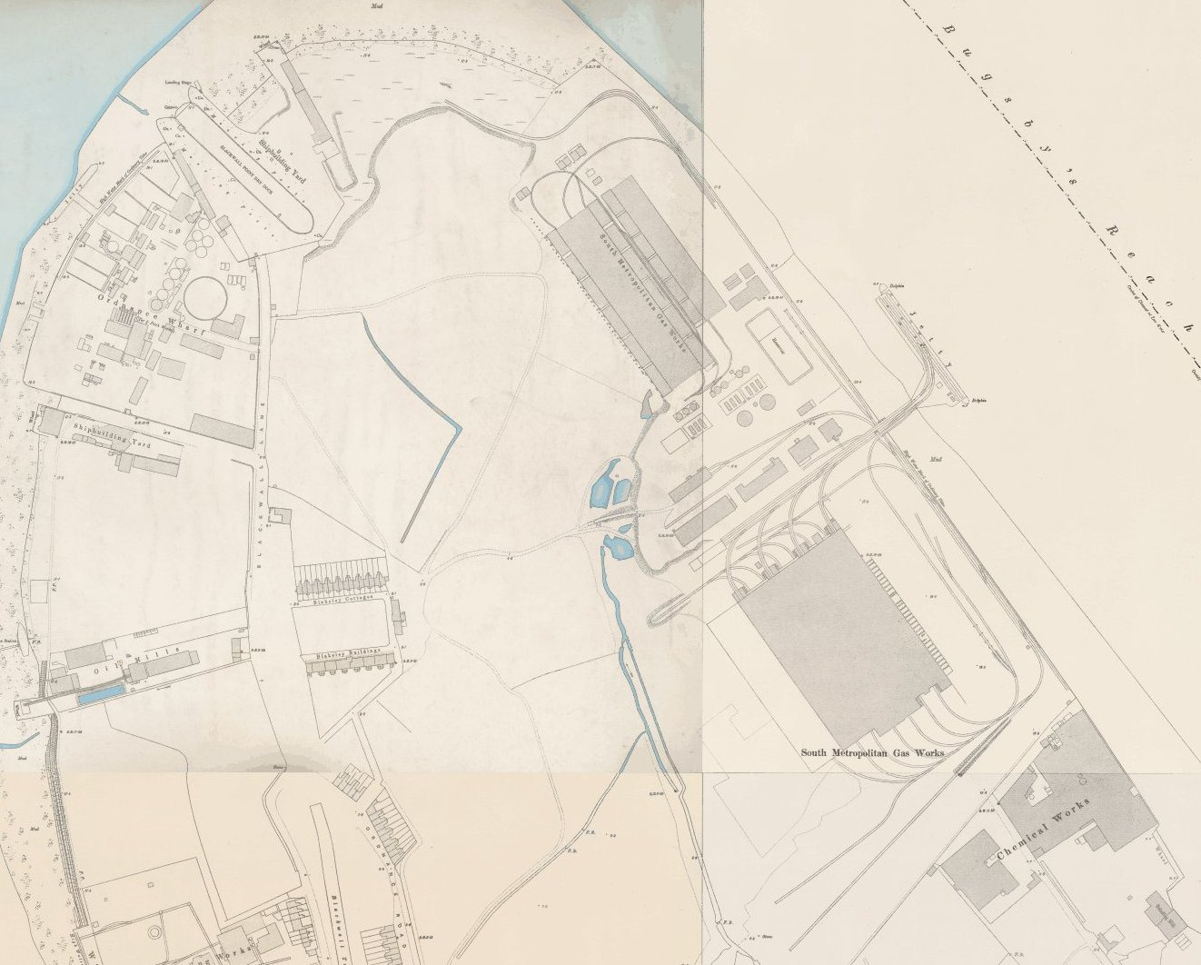
For over a century, the peninsula was dominated by the East Greenwich Gas Works, which grew to become the largest in Europe, covering 240 acres. The gasworks primarily produced town gas, also known as coal gas, along with coke, tar, and chemicals as important secondary products. The site had its own extensive railway system and a large jetty for unloading coal and loading coke. In the 1960s, the plant began manufacturing gas from oil, but the discovery of natural gas reserves in the North Sea soon rendered the complex obsolete.
The eastern shore of the peninsula was home to Blackwall Point Power Station, which was replaced in the 1950s by a new station that ceased operation around 1981. The Victoria Deep Water Terminal, handling container traffic, was established in 1966 on a large area that included the site of the Victoria linoleum works.
At the southern end of the peninsula, Enderby's Wharf was occupied by a succession of submarine cable companies from 1857 onwards. The peninsula remained relatively remote from central London until the opening of the Blackwall Tunnel in 1897 and had no passenger railway or London Underground service until the opening of North Greenwich tube station on the Jubilee line in 1999.
The closure of the gasworks, power station, and other industries in the late 20th century left much of the Greenwich Peninsula a barren and heavily contaminated wasteland. In the early 21st century, surviving industries were mainly concentrated on the western side of the peninsula, between the river and the A102 Blackwall Tunnel southern approach road.
Significant public and private investment since the early 1990s has brought about dramatic changes in the peninsula's topography. English Partnerships purchased 1.21 square kilometres of disused land on the peninsula in 1997, investing over £225m to enhance the transport network, create new homes, commercial spaces, community facilities, and open up access to parkland along the river.
The construction of the Millennium Dome (the O2), new roads, riverside walkways, cycle paths, and public artworks, such as Antony Gormley's Quantum Cloud and Richard Wilson's A Slice of Reality, have transformed the area. The 1999 opening of the tube station and the North Greenwich Pier have improved transportation links. Transport for London also constructed a cable car over the River Thames just before the 2012 Summer Olympics.
Another excellent piece. Thank you, Scott.
Great article giving a remarkable insight into a long lost part of London