


The Camden Town of the year 1800
How a new town came to be

I’ve been extending an 1800 map of London into the surrounding countryside. Recently I’ve been working on Camden Town in particular.
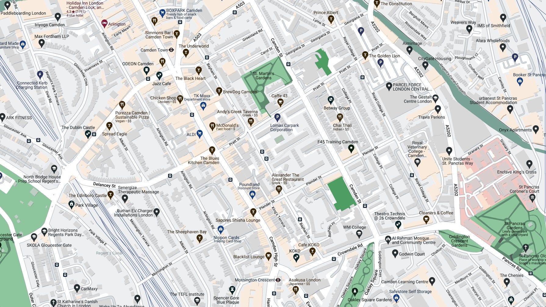
Here is Camden Town now:
And this was the same area in the year 1800:

An 1800 tour of Camden Town
If you are still interested, I’ll get on to how I produced this map later on in the post. But let’s take a tour first of the Camden Town of the year 1800. It’s a very rural affair with much less building.
Charles Pratt, the first Earl of Camden came into the possession, by marriage, of the manor of Cantelowes and its land. From 1791 onwards, Pratt created Camden New Town, named after himself, on five streets east of the High Street.
To get our bearings, by 1800 - the date of my reconstructed map - the following three main east-west streets existed: Pratt Street (a new thoroughfare, vaingloriously named), King Street (also new), Fig Lane (existing before Earl Camden and called Gloucester Place by 1829; Crowndale Road now). North-south, a new street was Royal College Street (named for a new veterinary college) and an existing one - King’s Road - along the line of a route to Kentish Town.
And, along with the existing High Street and a few older streets there, that really was it for Camden Town. King Street is now Plender Street. King’s Road is now St Pancras Way. Very little building had taken place by 1800 - the new streets cross existing brickfields.
No other streets existed in 1800. Some stumps of streets - access cul-de-sacs along Fig Lane (Crowndale Road) would later be extended to become Bayham Street and Camden Street, but not yet.
Only St Pancras Old Church was built by 1800 - no other churches.
We’ll start at the top right, zoom in, and move clockwise around the reconstructed map describing what was here at the turn of the nineteenth century.

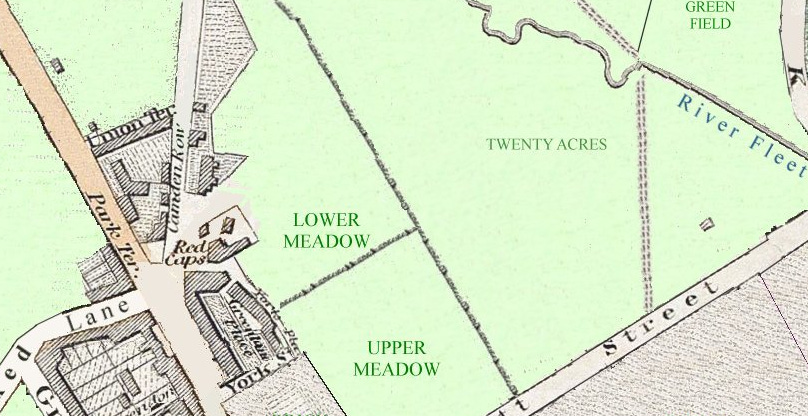
Elm Lodge, and the fields south of it, was the private estate of a Mr William Agar. Elm Lodge and its parkland was situated just where modern St Pancras Way crosses the canal. I wasn’t sure for certain when the parkland surrounding the lodge appeared but all evidence points to 1791 when the lodge itself was built.
During the 1810s, William Agar strongly opposed the construction of the Regent’s Canal through his land, though his primary concern may have been securing maximum compensation. The canal builders won out in 1820 and the canal cut through the farm and estate.
Following William Agar’s death in 1838, his widow began letting portions of the estate for building whilst maintaining ownership of Elm Lodge. The resulting hastily constructed settlement was known as Agar Town. This was a very short-lived name. It earned the nickname ’Ague Town’ due to its poor health conditions and was dubbed a ’suburban Connemara’ owing to its largely Irish residents. The area’s inhabitants were certainly impoverished.
The area was transformed as the Midland Railway’s St Pancras station expanded its tracks and goods yards in the 1860s. Most Agar Town residents relocated to nearby areas, such as Kentish Town. The Agar Town name largely disappeared from usage.
The Veterinary College of London was founded in 1791 by a group led by Granville Penn, a grandson of William Penn, following the foundation of the very first veterinary college in Europe in France during 1762. The promoters wished to select a site close to the metropolis, but far enough away to minimise the temptations open to the students, who were all men. Earl Camden was just then making arrangements to develop his land, and he replied to the college's newspaper advertisement for a suitable site with an offer to sell it some of his holdings.
The Earl donated a paddock on the opposite side of the access road (Royal College Street). The college is still there; the paddock not.
The George and Falcon pub stood at the bottom of what is now St Pancras Way and dated to the 1600s. In the eighteenth century it was renamed the Elephant and Castle.
In 1714, an elephant tusk was supposedly found in the River Fleet, near to this spot and causing the pub’s name change.
The section of St Pancras Way directly outside the pub was known as Elephant Row for a while.

Another pub also beside the then open-air River Fleet was called the Adam & Eve - seen on the above map extract on the extreme right. This hostelry didn’t survive on Pancras Road beyond the nineteenth century. It stood beside a toll gate and closed soon after tolls were removed on roads throughout London. People weren’t stopping as much to pay the charge and the pub lost the customers which had made it viable.
Fig Lane was the original name for modern Crowndale Road and predated Lord Camden’s road plan. There was a 1790s terrace along Fig Lane called Gloucester Place. The road was called ‘Fig Lane’ as the rural estate south of it was called Fig’s Mead. When it urbanised, Fig’s Mead was renamed Somers Town. There were brick fields to its north.
At the Fig Lane junction with Hampstead Road and Southampton Row (Camden High Street) was the site of the later Cobden statue and Mornington Crescent station.

From the Cobden statue junction to the modern Parkway (Crooked Lane) were a number of disappeared terrace names along what is now Camden High Street.
Three older streets exist - Warren Street was later absorbed into Delancey Street. Grove Street became Arlington Road. Clarendon Street disappeared into redevelopment later in the nineteenth century.
The curiously-named Crooked Lane (now Parkway) only then extended as far as the footpath that can be seen running across the bottom left of the above map extract. The footpath extended all the way around the boundary of the royal-owned Marylebone Park Farm, marking its extent. The farm’s footprint exactly matched the modern boundary roads of Regent’s Park, when that was laid out just over a decade later - Prince Albert Road, Park Village East and other roads still mark the border of the royal park.
To complete the circuit around the future Camden Town…
At the main junction of Camden Town was a long-established business, once known as Mother Red Caps or Mother Damnable's, more recently the World's End.
The first reference to a tavern in the Camden area occurs in 1690. At that time the locality was entirely rural and the proprietors relied on trade passing by on the road from London to Hampstead and Highgate.
The name Halfway House was accordingly used. It is not clear whether there was one establishment in the first half of the 18th century or two, but by 1751 the Mother Red Caps and the Mother Black Cap were both in business.
By the 1800, Mother Red Cap was at its final location, and it had acquired a tea garden. Camden Road was later (in the late 1820s) built across the grounds. The present building dates from 1875.
Opposite the pub on the modern site of Camden Town station was the original site for the St Pancras Workhouse before the needs of the parish became too much and it was resited (see the 1829 map below).
How I made the map
How did I produce this particular map and also how accurate is it?
Luckily for me, notable mapmakers of London were active at the turn of the nineteenth century.
The latest of the maps I used dates from 1829 and from two mapmaking brothers - Christopher & John Greenwood. They made their ‘Map of London : made from an actual survey in the years 1824, 1825, & 1826’. They did sterling work in early nineteenth century cartography. They were responsible for this beauty from the same published year of 1829:

But their London map is a work of great merit. And we can focus on 1829 Camden Town in particular:

This is the map I based my 1800 map on. I had already georeferenced the Greenwood map making the streets and locations on it match the modern versions.
Instead of adding items to the 1829 map to make the 1800 version, it’s a matter of taking things away! Of note on the Greenwood map, in no particular order, are the St Pancras Workhouse, the Regent’s Canal, St Pancras Churchyard with other churches. And many streets built in Camden Town.
I first turned to the excellent “Streets of Camden Town” booklet produced by the Camden History Society. There are history societies all over London producing amazing publications and Camden is particularly blessed.
The Camden Town book gives build dates of all Camden streets, street name changes, when churches came along and more.
Confidently we can remove lots of detail from the Greenwood map - many connecting streets, the workhouse, the canal. I’m simplifying this process - there was a lot of research into each instance of an 1829 street and each 1829 building. But we are left with the five streets of Camden New Town east of the High Street, three existing streets east of Camden High Street (York Street, York Place and Greenland Place) and three existing streets west of the High Street - Clarendon Street, Grove Street and Warren Street - the latter two both later absorbed into longer streets.
Connecting out of Camden New Town before the arrival of the Earl’s building schemes we had Crooked Lane (now Parkway) to the west, Camden High Street and Kentish Town Road to the north and Pancras Road to the southeast.
Of note, Camden Road wasn’t shown on the 1829 map - it was a ‘newer’ new road.
Also of note, is the fact that Camden Town wasn’t a name at first. The area was classed only as the southern part of Kentish Town. It first appears as a name on maps in 1802.
Map number two helping me out was Thomson’s 1801 map of the parish of St Pancras:

This is the area immediately north of my own map and shows how Thomson lists most field names. The River Fleet runs across Thomson’s map and so, in turn, my map.
Next we have a great amateur map - William Hyett’s hand-drawn map of 1807:

Part of the British Library’s Crace collection, this map helps confirm the extent of urbanisation, field boundaries and footpaths. Somers Town is edging much nearer to Camden Town in 1807 than it was in 1800.
Lastly we have Milne land use map of London, surveyed between 1800 and 1802:

This confirms field boundaries and the agricultural use of each field - all meadows on his map are marked with m - no arable land at all in Camden Town. Urban detail on this map is minimal, but, like on all of these maps, the now-buried River Fleet can be seen, as it runs above ground. There are a few other new streets added to Milne’s Camden Town, surveyed in 1802, showing that immediately after 1800, Earl Camden was certainly busy!
To conclude, here’s the whole 1800 map again.

NOTES
If you wish to look at this map in more detail and with accompanying information, go to www.theundergroundmap.com/article.html?id=9&annum=1800
I’m working on a number of maps of the countryside which used to surround London. At random, here is part of 1900 Colindale showing local meadows, arable land and parkland. I’ll show further snippets of this work in other future posts.
The good old days.. makes me think of the area I live in, which used to have a lot of farmland but all the farmers are selling their land to contractors left and right and building boring black and white houses ( not kidding that's the color scheme they have with little to no characteristics ) they are going up just about everywhere there used to be farmland. I am not a fan of this, if you must build housing, make them a tad bit attractive at least.
Thank you for this! I live in the area and I ‘ve always suspected it must have previously been very green as many backstreets are very leafy and there tiny gardens and squares and this is probably why - it used to be mostly fields! Also love learning about the back history of the streets and where their names come from.