

Spitalfields revisited
Following C.A. Mathew's footsteps

Last weekend I was invited to dinner by fellow Substacker Astro CW and his wife in Spitalfields, London.
It was a balmy evening, and the three of us walked from Tower Hill through hordes of people kitted out in Arsenal shirts. The football folk were decanting into various pubs to watch their team play PSG in local pubs. We meanwhile were headed for Ottolenghi in Artillery Lane.
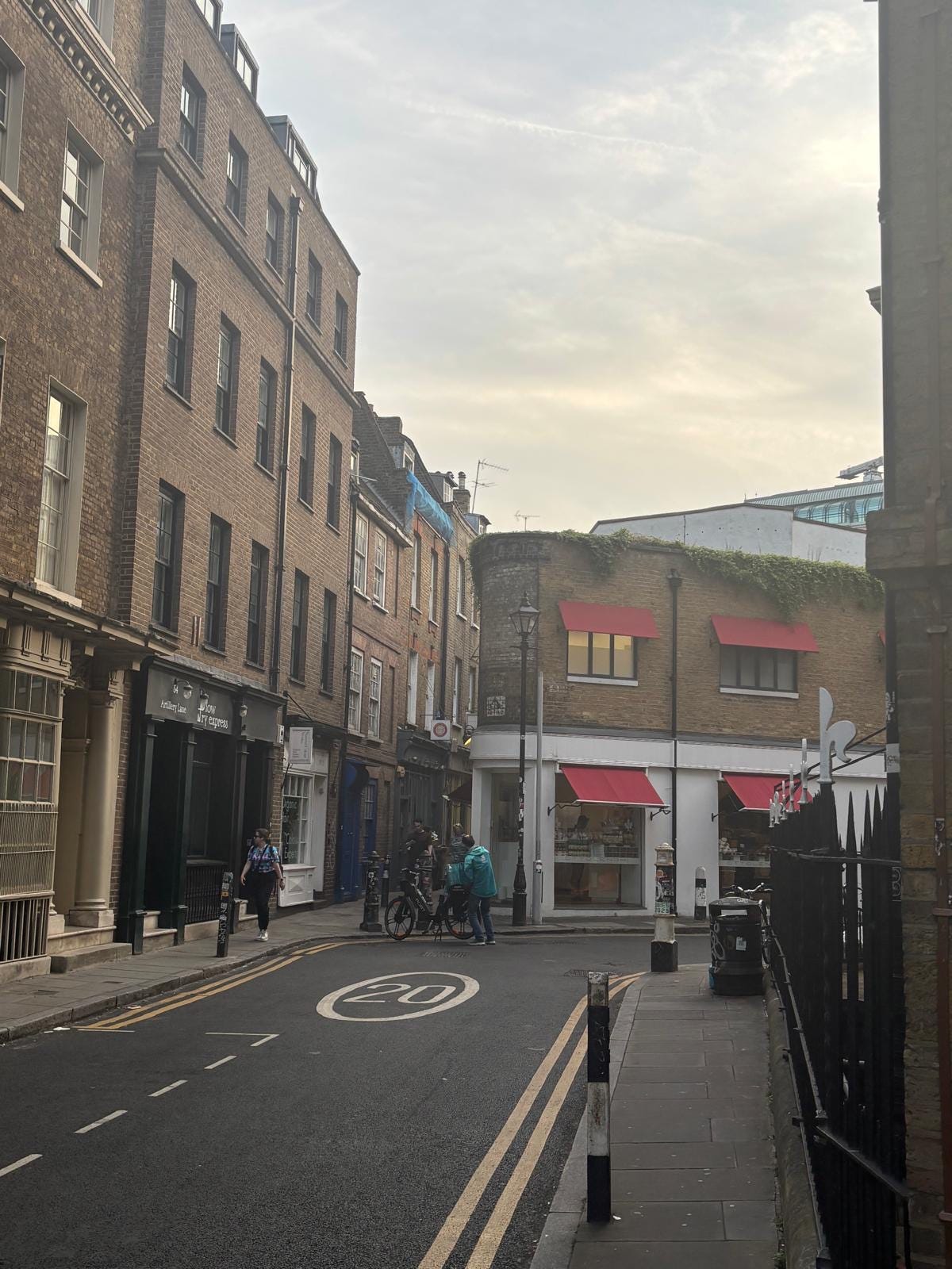
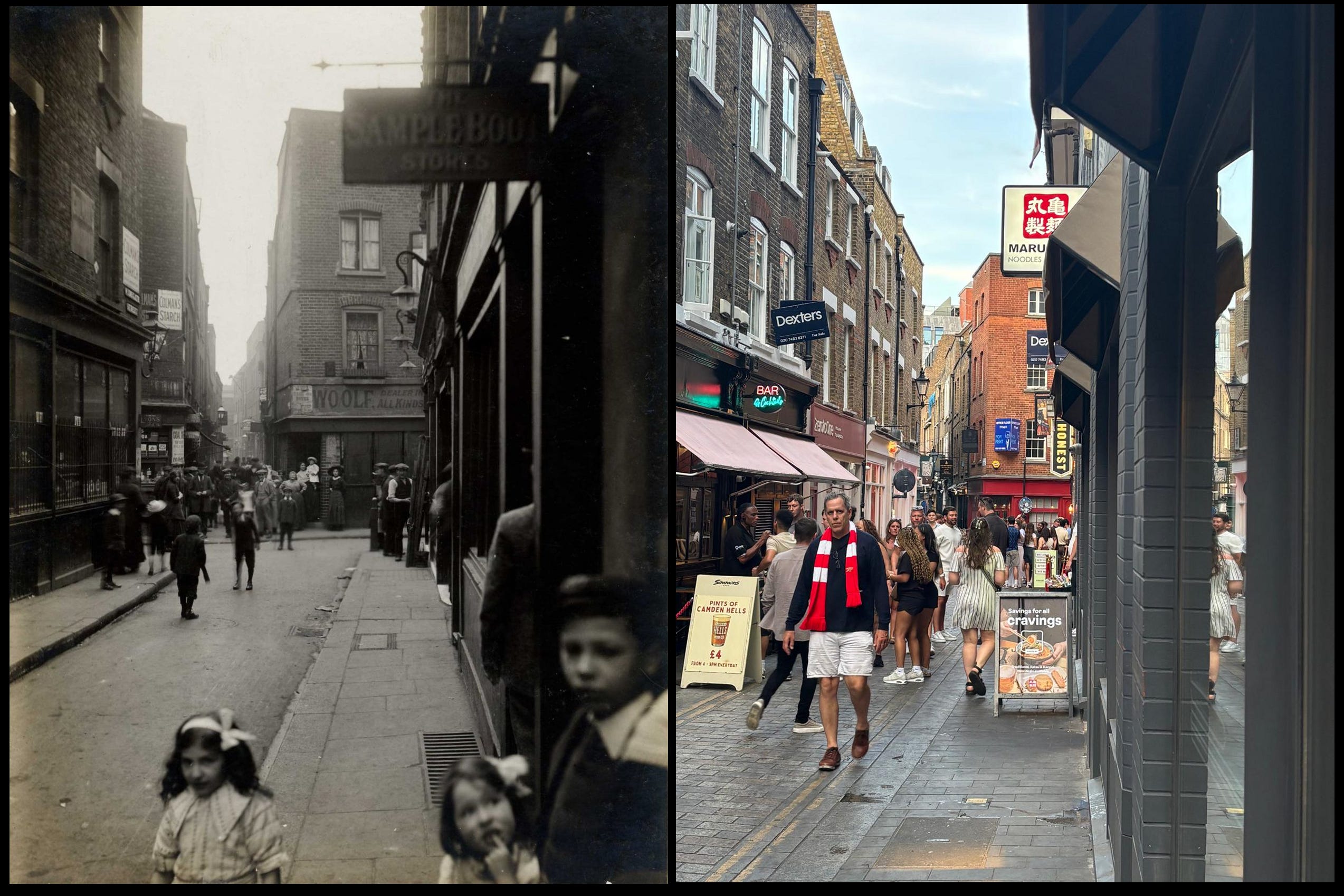
As we turned a corner with the restaurant in view I realised that I recognised the building up ahead. Ottolenghi Spitalfields, it turned out, is the same building as the ‘Titanic newsagent’.
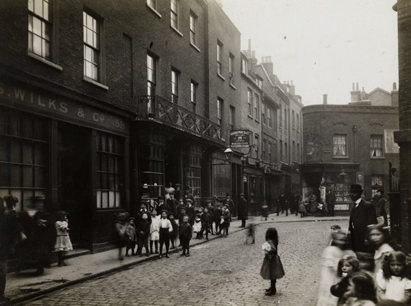
As I wrote here on Substack a couple of years ago, a mysterious figure called C.A. Mathew came out of Liverpool Street station carrying his camera. He walked around the streets of then-Jewish Spitalfields on Saturday 20 April 1912 - some days after the Titanic disaster - took some photos, had them bequeathed to the Bishopsgate Institute and disappeared out of the historical narrative again.
As Mathew’s 1912 Spitalfields tour continued, the local children increasingly gathered in front of his camera.
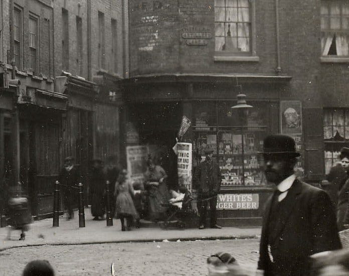
Enlarging a detail from the original photo shows why I’m calling the shop on the corner the ‘Titanic newsagent’. A headline is enticing passers-by to buy a newspaper describing the tragedy which had occurred just days before.
In 2026, this shop is the Ottolenghi delicatessen with the main restaurant situated to the right. It looks in 1912 that this was a house to the right and not yet a retail establishment.
We had our meal in the two hours it took for PSG to beat Arsenal on penalties and decided to spend some time lining up some shots from 1912 in 2026. I’m mentioning football as the 2026 shots have some people dressed in red and white.
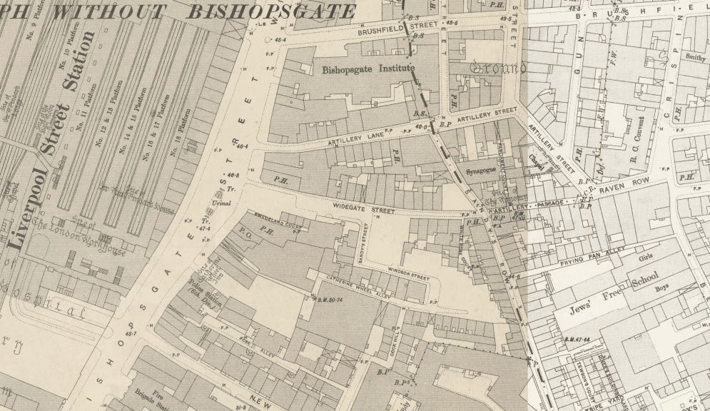
It’s remarkable in 2026, how little has changed from 1912. The buildings are mostly the same although the owners are different. Street lighting has moved on. Artillery Lane before 1895 only started at the newsagent/deli - hence the legacy roadname sign on the corner. Until 1895, the street where the photos were taken from was called Raven Row, after that absorbed into Artillery Lane.
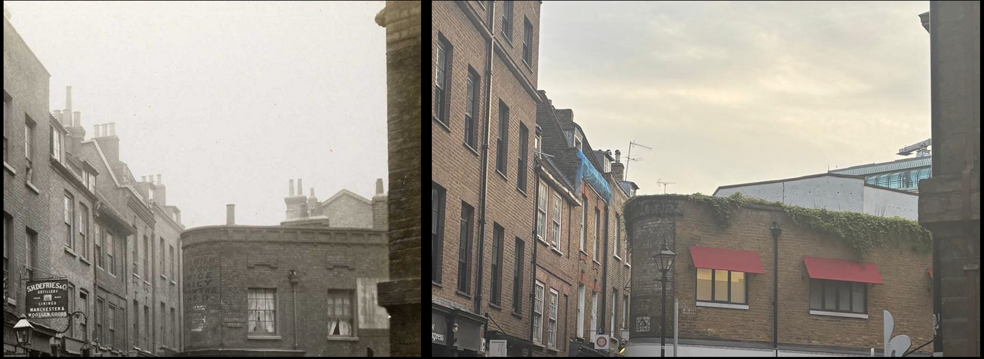
We found that the guttering could still be used to line up the modern shot (top right of old and new photos).
We set off to see what else had survived the years on other C.A. Mathew shots.
At the other end of Artillery Passage - the alleyway leading straight ahead from the newsagent/deli - we reach Widegate Street. Turn about face and we see the view the other way, back towards the passage.
Again it’s a case of the same buildings but modern people - certainly no children out on their own during the Jewish sabbath as it had been in 1912. Modern signage, a lick of paint, many more places to eat, pedestrianised streets.
The next location is particularly satisfying.
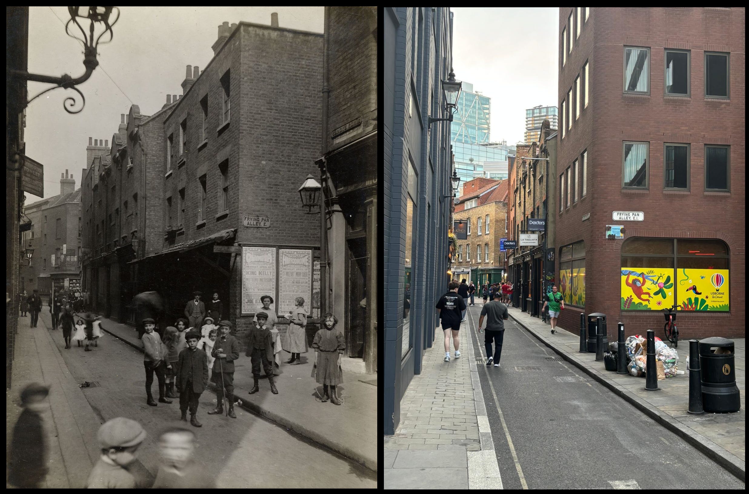
We are now at the corner of Sandy’s Row and Frying Pan Alley, one block south. Artillery Passage is the alleyway on the right in the distance as Sandy’s Row bends. I’m almost sure that only the buildings immediately before Artillery Passage survive but the road pattern is the same. The new buildings of Bishopsgate are in the modern shot.
Sir Rowland Hill devised the London postal area in 1856 on a system of compass points. So it’s Frying Pan Alley, E on the sign in 1912. During the First World War, the postal areas were further subdivided into compass points plus numbers so it’s Frying Pan Alley, E1 in 2026.
In the modern world Middlesex Street (a.k.a. Petticoat Lane) has been driven through the area and you can now walk it to Bishopsgate, cross the main road and look back down the street you walked along.
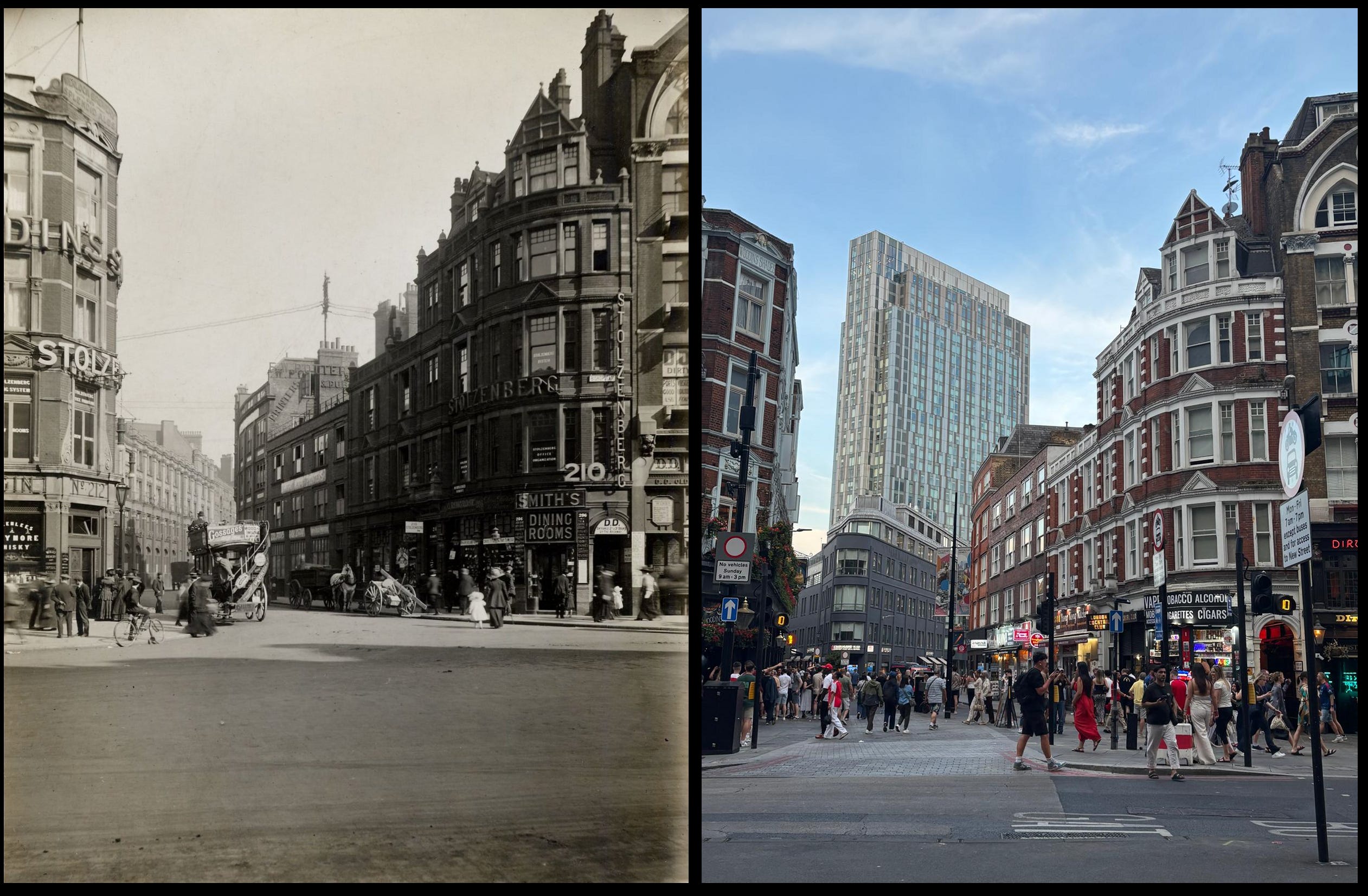
The flanking buildings of Middlesex Street (2026) and the former Widegate Street (1912) are the same, surviving all the changes and The Blitz. Further along Middlesex Street/Widegate Street, the new building marks the new Middlesex Street junction but the angle is the same as in 1912. The tower block is very different. I love the bus leaving the older shot.
The final view, in a way, brings us full circle. This is the other end of Artillery Lane featured in the first shot reaching Bishopsgate.
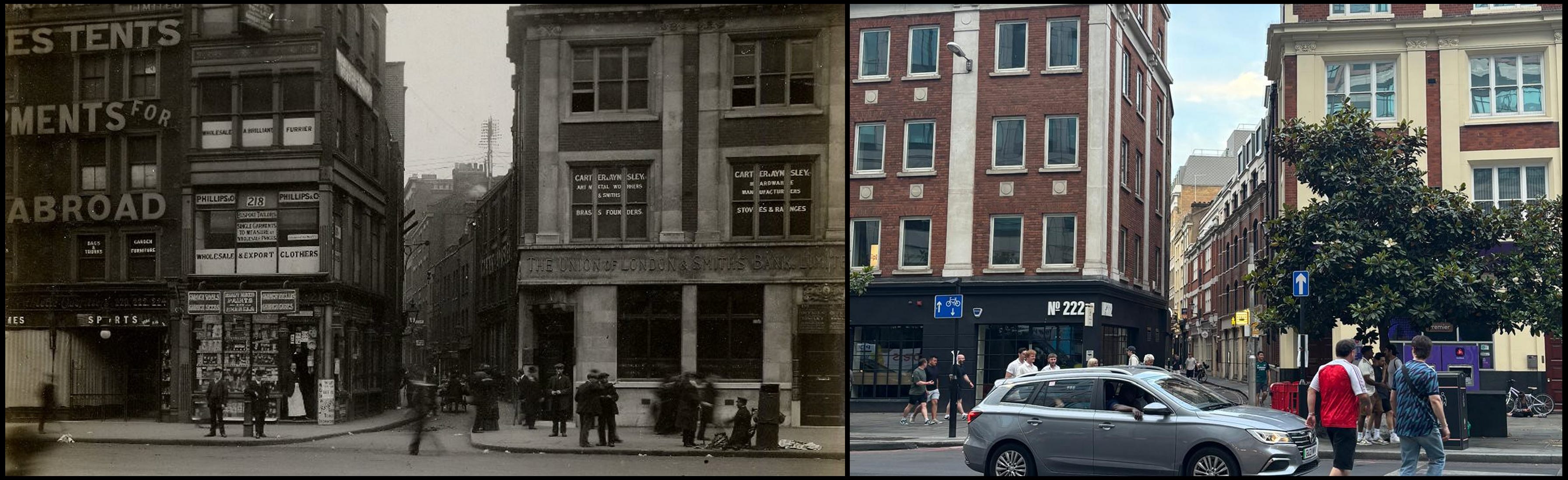
Looking down the lane from Bishopsgate, the building on the right is the same. That on the left corner is different but on the same footprint. The lane leading away from us I think are changed buildings but can’t be sure.
This was the end of our tour but we decided to perhaps do some more matching up in the future in different parts of London.
NOTES
NASA, NASA, NASA! The USA so dominated the space industry in the west from the 1950s onwards that when many Brits (and other Europeans) think about rockets and spacecraft, NASA involvement is often assumed. But there’s a rich European tradition of astronomical discovery and astronautics - ESA (the European Space Agency) for instance has been going since 1975. Astro CW is responsible for the excellent European Space History Substack, doing its best to showcase space endeavour from this side of the Atlantic .
Back on the topic of Spitalfields, I decided to do a little experiment below. No current plans to proceed down this AI route
Really enjoy hearing about things like this. There are so many historical layers in a place like London. It's amazing such things survive amid so much change.
Thanks for the shout out!