

Resurrecting the 1862 Stanford map of London
It's been away nine years. I'm bringing it back

When a company called Motco went out of business in March 2017, their copy of the highly-valued Stanford 1862 Map became unavailable. I’ll cut to the chase here - I’ve brought it back online and georeferenced it.
It is available here: www.theundergroundmap.com/article.html?id=5496
(In due course I’ll create a friendlier URL but this one will remain working even when I do)
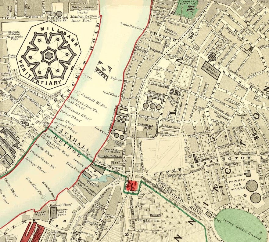
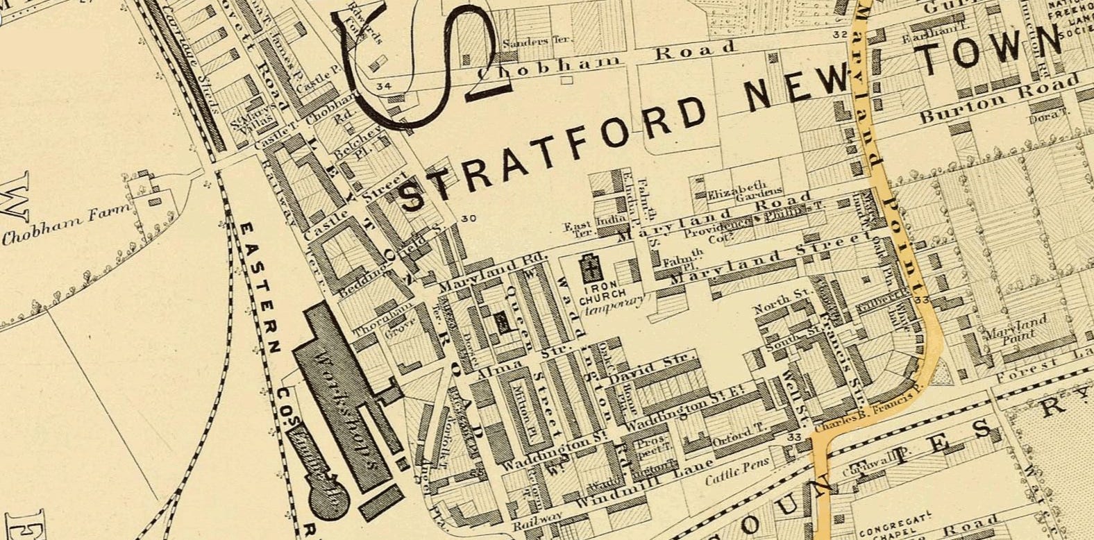
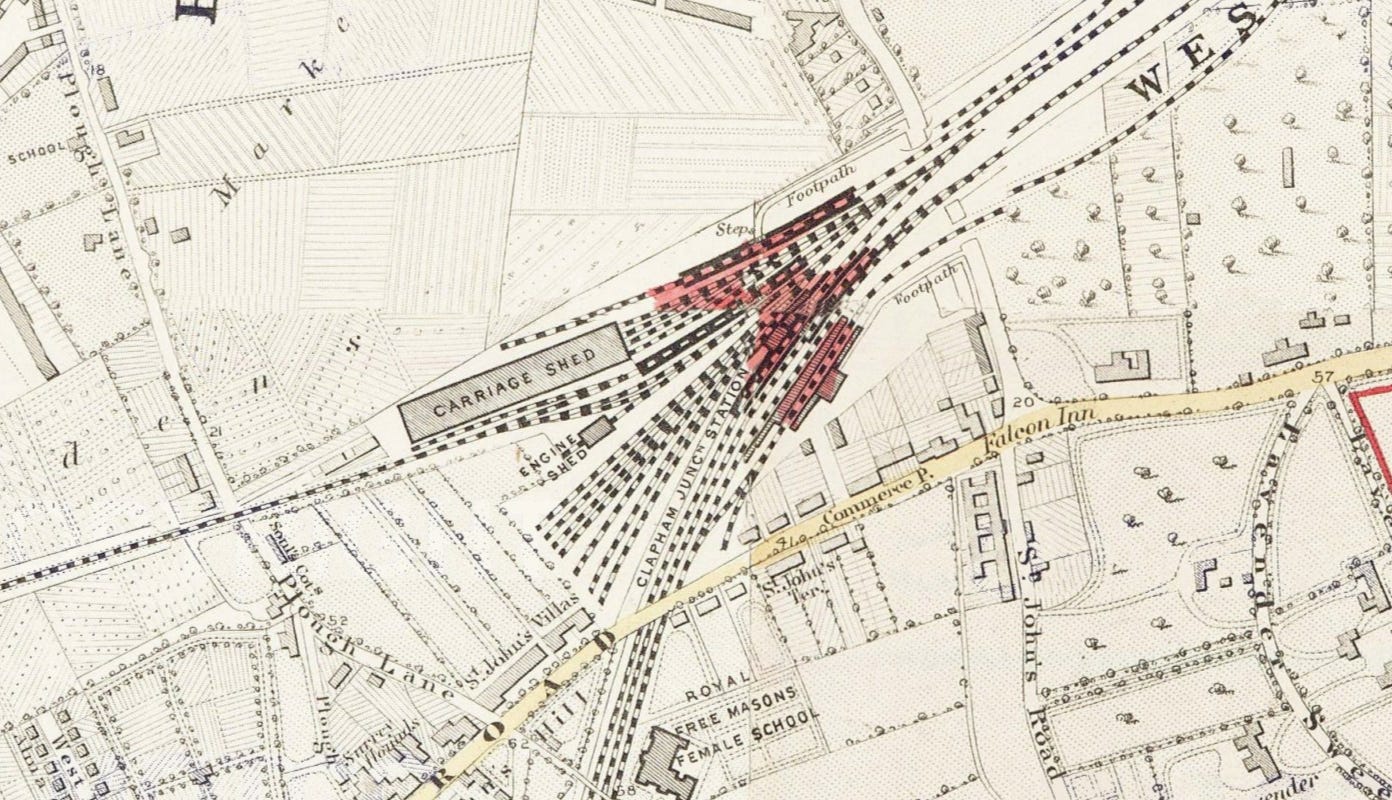
The geographic extent of the full map runs from Highgate and Hampstead in the north to Streatham and Balham in the south, and from Hammersmith in the west to Greenwich in the east.
To view the map, go to the URL above and you can use your mouse to drag the map to where you want to be in London. It’s best on a PC or Mac until I improve the mobile phone interface.
The plus and minus symbols at the top left of the map itself allow you to zoom in and out.
If you are bored with the 1860 map, the control at the top right of the map allows you to change historical decade.
I have been busy reviving the map, but fans of SW London below Clapham will have to wait a tad longer - I only have so many hours in a typical day! There are also just a few glitches and colour changes which I’ll iron out as the weeks go by.
Stanford’s Library Map of London and its Suburbs (1862)
Edward Stanford was born in 1827 and educated at the City of London School, developing his interest in maps after working for the map and stationery dealer Trelawney Saunders. He became Saunders’s partner in 1852, then set up independently the following year. By 1862 he had an ambitious project in hand: nothing less than the most accurate map of London ever made.
Stanford’s Library Map is one of the great maps of London. It shows the city at a key time in the development of the metropolis and the impact of the railway. The method of production was methodical and expensive. Stanford took the Ordnance Survey’s twelve-inch-to-the-mile Skeleton Survey sheets - prepared for the Metropolitan Commissioners of Sewers and showing only outline and elevation - and despatched his own surveyors into the streets to gather the immense quantity of additional detail for which the map became notable. The result was not simply a reprint of government data but a genuinely new work of urban cartography, combining the geometric rigour of the Ordnance Survey with street-level observation across the entire built-up area.
The finished map was published in 24 sheets at a scale of six inches to the statute mile. Each sheet measures around 14 by 16 inches, and together they cover central London and its rapidly expanding suburbs with exceptional granularity - naming individual streets, marking public buildings, recording the railway network, and plotting omnibus routes. Parks, commons, enclosures, and cemeteries accessible to the public are picked out in green; railway stations in red; omnibus routes in a sort of yellowy-brown; and spot heights in feet above Ordnance datum are noted in small figures across the sheet.
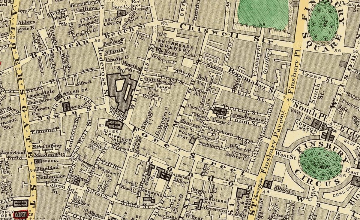
Designed for libraries, institutions and professionals, the geographic extent runs from Highgate and Hampstead in the north to Streatham and Balham in the south, and from Hammersmith in the west to Greenwich in the east: the full spread of mid-Victorian London caught at a moment of extraordinary change, just as Joseph Bazalgette was beginning the great sewer works which created the embankments, the Metropolitan Railway was being driven under the streets, and entire new neighbourhoods were rising on land that had been fields a decade earlier.
Chief cartographer John Bolton worked with Stanford to produce the map, and the verdict from the Royal Geographical Society was unambiguous: it was “the most perfect map of London that has ever been issued.” The map was issued in several revised editions through to at least 1878,.
The name Stanfords became prominent in 1862 precisely because of this map, and the Library Map of London remained in print for well over a century. The famous map shop in Long Acre grew out of the project.
As a snapshot of Victorian London at the height of its transformation, the Stanford map has no equal.
Now fixed, but the version which went out on email was a bit of a typo-fest. I think I was very keen to publish!