

Chalk Farm
Chalk Farm has nothing to do with chalk at all - though there once really was a farm

These days Chalk Farm is associated with the spread northwards of bustling Camden Town and it’s known for its lively pubs, live music venues and restaurants.
Chalk Farm's name derives from the manor originally on its site and has its own rich history, predating that of its better-known immediate neighbour Camden Town. It is rooted in the ancient Manor of Rugmere, which dates to the Domesday Book of 1086. The geography of Chalk Farm is not precisely defined, but the former Manor was part of the ancient Parish and Borough of St Pancras. The core area lies beside Chalk Farm Road and extends to Ainger Road, encompassing part of the Primrose Hill open space.
During the reign of Henry VIII, a portion of the manor was acquired to form the northeastern part of what would later become Regent's Park. The remaining part, continued to be part of the parish of St Pancras. In 1786, the estate was sold to Charles FitzRoy, 1st Baron Southampton, and it became more widely known as Chalk Farm. By the nineteenth century, the estate was owned by Eton College.
Despite the area being built on London Clay, the name does not derive from the soil. It originates from Middle English Caldecote, meaning "cold cottage," first recorded in 1256. Over time, this evolved into Chalcotts by the 16th century and Chalk by 1746. The full form - Chalk Farm - emerged in the 19th century.
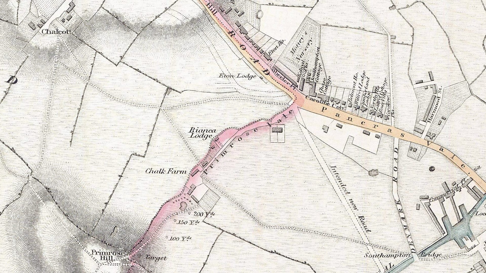
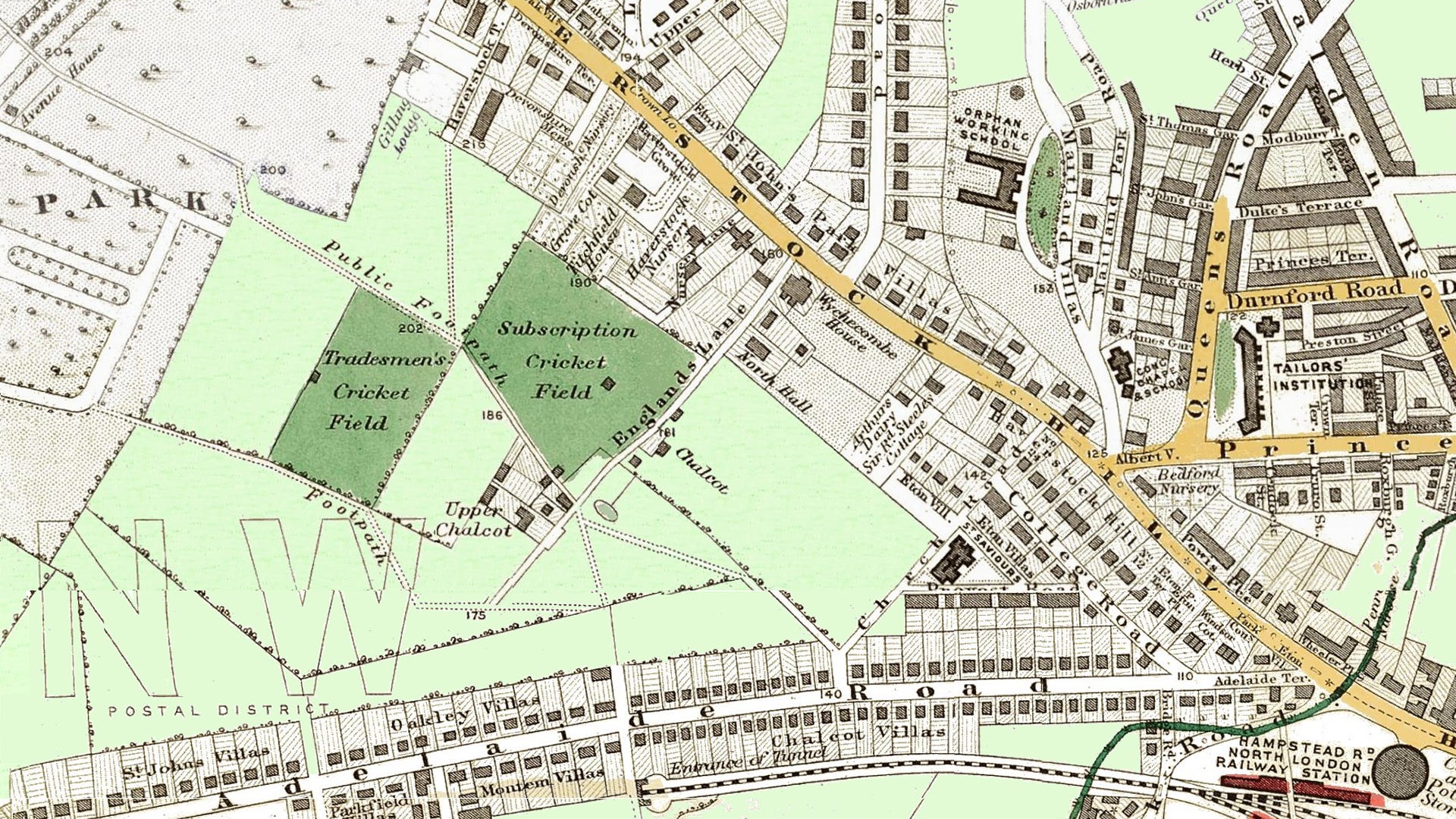
Above is a part of a map of the area from 1829. Modern Chalk Farm station would be positioned at the junction of Primrose Vale and Pancras Vale. Haverstock Hill departs from this point on its way up to Hampstead. Pancras Vale is the modern Chalk Farm Road leading towards Camden Town.
Chalcott
This manor is shown in the top left on the above map at the end of what would be renamed Englands Lane. It is three fields away from its farmhouse, Chalk Farm.
Primrose Vale
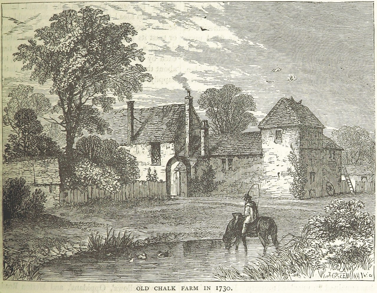
This is delightful-sounding lane led to the summit of Primrose Hill. Halfway along, past Bianca Lodge, was the original Chalk Farm farmhouse where the paved road ended and a pathway continued the journey up to Primrose Hill.
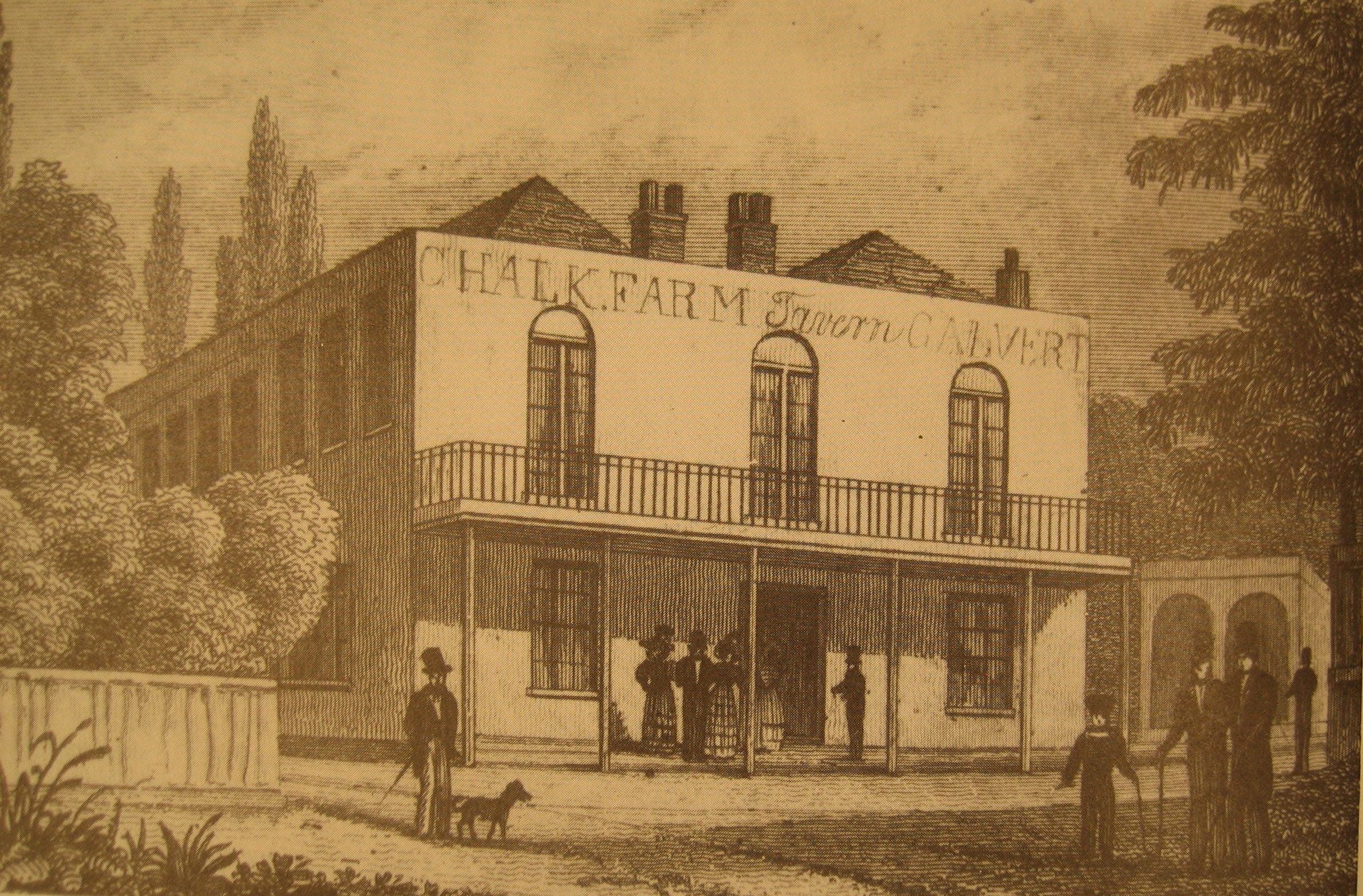
Beside the start of the path was the Chalk Farm Tavern and it is shown on the 1829 map (but untitled). The original inn served as a popular stop for Londoners returning from outings at Hampstead Wells on weekends and holidays, offering spacious rooms for entertainment and a pleasure garden. In 1837, it attracted a crowd of eight thousand for a wrestling match.
The field next to it (marked on the map as an archery target and ground) gained notoriety for duelling. Much like Putney Heath, it was situated well beyond the outskirts of the city. In 1806, the poets Thomas Moore and Francis Jeffrey met there for a duel, but the local policing authorities arrived and arrested both men. Another duel occurred on 16 February 1821, resulting in the fatal injury of John Scott, the editor of The London Magazine. He was shot by literary critic Jonathan Christie. John Scott was brought back to the Chalk Farm Tavern, where he died nine days later. Christie was tried for murder at the Old Bailey but acquitted.
The coming of the railway just a few years after the map was produced, cut Primrose Vale in two and it soon disappeared as a right of way.
The Chalk Farm Tavern remained where it was and a road called Regent's Park Road was cut through the area. The pub ended up on this new road, was rebuilt in 1854, and sold its gardens to develop Chalcot Square - so preserving the historic name for the area. The pub is now a Greek restaurant.
Denmark Road
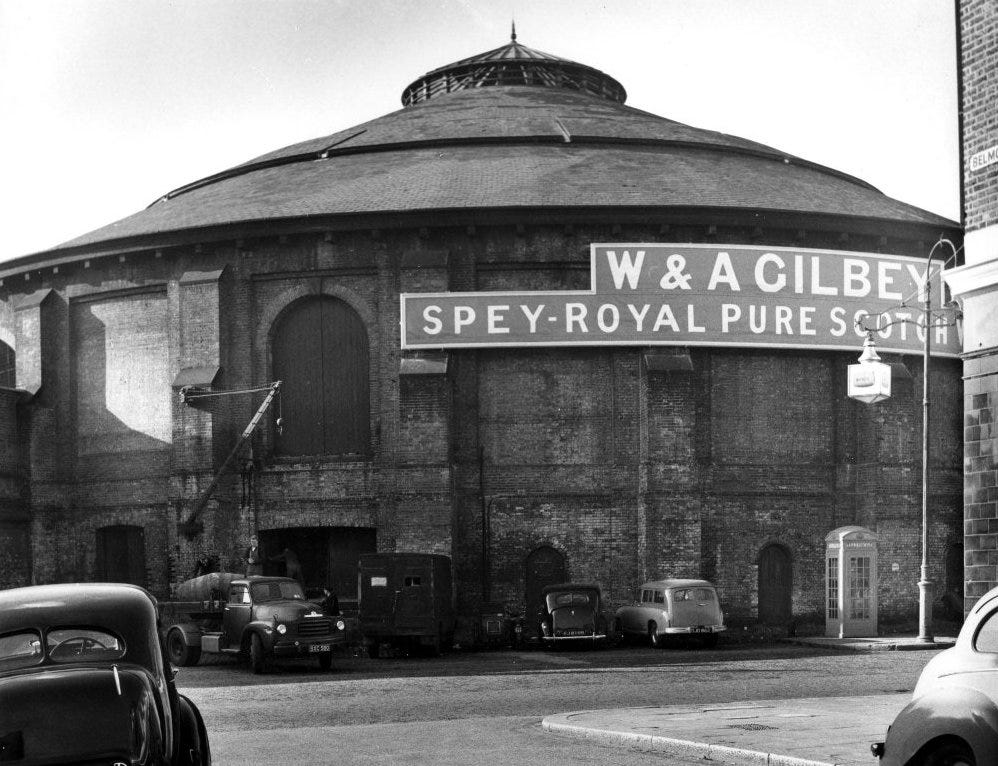
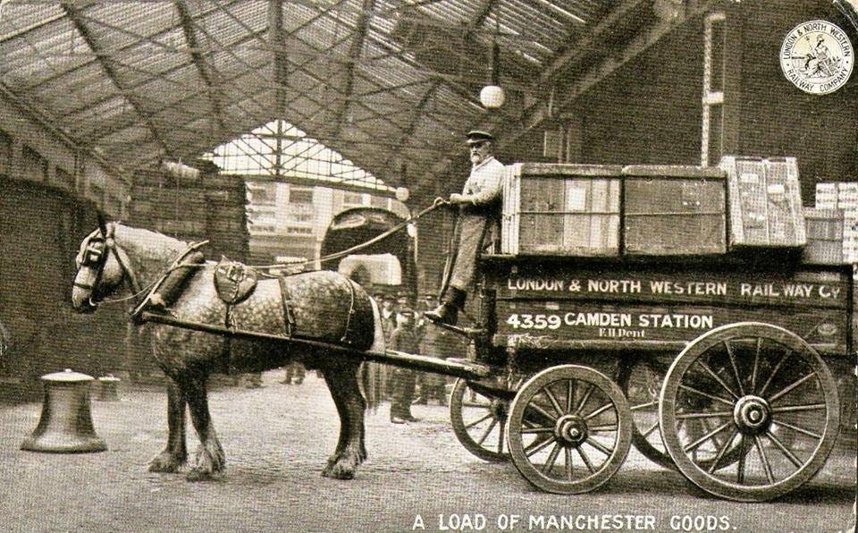
To wrap up some observations on the 1829 map, two roads were planned. Denmark Road was built but “Intended New Road” was not. Denmark Road led to Southampton Bridge over the canal. Camden Goods Station arrived a little after the coming of the railway, burying Denmark Road. Instead, Oval Road was built up from the south to Southampton Bridge to serve the Goods Station. A railway engine shed was built on Chalk Farm Road next to the depot and this became, in time and after a major changes of use, the Roundhouse music venue.
Before the nineteenth century, the Chalcots estate had minimal development but as the century unfolded, things began to change.
This 1865 map is focused slightly to the north of the earlier one. Much building has taken place in the 35 years between the maps, but some fields still remain. At the northwest of this map is the Belsize Park estate before, built upon, it lent its name to a suburb.
Bottom right is the future Roundhouse. Next to this is Primrose Hill station.
Steele’s Cottage is shown on this 1865 map beside the K of Haverstock Hill. Steele’s Cottage was the only building of Chalcott’s on the west side of Haverstock Hill for a long while. Steele’s Cottage was where Sir Richard Steele, the essayist, stayed in 1712 to evade his creditors. The house, depicted by artists like Constable, stood on a mound on the west side of Haverstock Hill and was later known as the White House. By 1755, it was described as a cottage. Twenty-first-century rebranding has recently been undertaken in the area and the new name of Steele’s Village is an attempt to put a unique stamp on this part of London.
The initial proposals for development emerged in the early 1820s, not by Eton itself but in response to the building boom in the vicinity, especially around Regent’s Park to the south. John Shaw, the developer of St John’s Wood, was appointed as the surveyor by Eton College in 1826, and an Act was obtained to grant 99-year building leases. Shaw developed schemes in 1827 and 1829 for the 15 acres fronting Haverstock Hill, involving half-acre plots for detached or semi-detached villas.
The London & Birmingham Railway, projected in 1831 and opened in 1838, contributed to the area's decreased attractiveness. Throughout the 1830s, Eton considered ambitious plans for the southern part of the estate at Primrose Hill, including a giant mausoleum, a cemetery with classical buildings and a botanical garden. These plans culminated in 1842 with the acquisition of Primrose Hill for public recreation.
Adelaide Road
In 1830, the college constructed about 100 yards of a road named Adelaide Road, but no speculators were attracted to build further. These first 100 yards were laid along the line of an existing footpath which can be seen on the 1829 map leaving the junction of Primrose Vale and Haverstock Hill. While the footpath bent towards Chalcott manor house, eventually Adelaide Road was continued west towards Swiss Cottage in a straight line.
John Shaw the younger succeeded his father as the surveyor in 1832. Subsequent development was piecemeal, relying on small-scale opportunistic schemes. While Shaw drafted a general plan in 1840, the layout of the streets was determined by the builders.
Shaw insisted on connecting the Eton Estate with St John’s Wood, and early building efforts, once the Haverstock Hill frontage was completed, focused on Adelaide Road, which was completed to Avenue Road and Finchley Road by 1848.
Samuel Cuming, a Devonshire carpenter, obtained his first building agreement from the college in 1843 for plots along Adelaide Road. Between 1845 and 1852, Cuming constructed 104 houses, mostly stuccoed pairs, three stories above a basement, in a late Georgian style in Adelaide Road. This included a few Gothic-style houses on the north side. In Provost Road and Eton Villas, he built gabled pairs with two stories and an attic above a basement, featuring Tuscan eaves to create a villa effect. Cuming's business thrived, and by 1851, he employed around 80 men. He passed away in 1870 as a wealthy man.
Bridge Road, Chalcott Villas, Provost Road and Eton Villas
In 1851, Samuel Cuming lived in one of his own houses in Bridge Road (later Bridge Approach). This was situated opposite the end of (Eton) College Road, south of Adelaide Road. Among the 117 householders living in his houses on various roads , 35 percent were employed in manufacturing and trade, 19 percent were in the professions, 15 percent were of independent means, 14 percent were clerical workers, and another 14 percent were in artistic or literary occupations. Notable residents included a portrait painter at 4 Provost Road, marine painter Alfred Clint at no. 7, portrait engraver John Jackson at 3 Eton Villas, architect Ewan Christian at 6 Eton Villas, artist William Dobson at 5 Chalcot Villas, and Egyptologist Samuel Birch at 17 Chalcot Villas.
Steele’s Road
Under the direction of George Pownall, John Shaw's successor, Steele’s Cottage was demolished in 1867 and replaced by 1870 with a row of shops in Haverstock Hill and the new Steele’s Road. In Steele’s Road, 22 houses, nine studios, and seven stables were built between 1871 and 1879. At the east end of Steele's Road were the mews, followed by ordinary stock-brick terraces. Opposite these on the north side were five detached houses (nos. 35-39) built by Thomas Batterbury & W. F. Huxley for individual artists. Notable residents included Frederick Barnard, a Punch illustrator, Edwin Hayes, the marine painter, and J. D. (later Sir James) Linton, the landscape painter.
These houses illustrated a significant moment of change in English taste, featuring styles ranging from Gothic to 'Queen Anne.'
The Eton Estate
An omnibus service was established on Adelaide Road in 1856 serving a neighbourhood without extreme wealth or poverty. Most houses were semi-detached Italianate villas, but there were also a terrace of shops and a public house in King’s College Road. By 1862, Adelaide Road formed a band of building through the centre of the estate with side roads and groups of houses at either end. Primrose Hill Road was planned by Cuming in 1858 as a link between England’s Lane, the northern boundary of the estate, and Regent’s Park Road to the south.
Most of the roads applied for after 1868 were in the north part of the estate, but even by 1878, houses existed only in Adamson Road, at the western end; Bursars Road (later Eton Avenue), the largest, had not been completed. In Crossfield Road, 17 houses were built in 1880-1, and in Chalcot Gardens, off England’s Lane, six in ‘Queen Anne’ style.
In 1881, William Willett the elder made a building agreement with Eton for the north-western 15 acres of the estate, where he undertook to erect 200 houses by 1900.
Willett’s red-brick houses were popular at the time, although later seen as ‘airless excrescences’.
Besides the artists in Steele’s Road, King Henry’s Road and Adelaide Road had many more. The Winchester public house in Winchester Road was a meeting place of artists and writers from 1867, and in 1885 seven houses in Eton Road were occupied by artists.
Twentieth-century Chalk Farm
Chalk Farm station was opened on 22 June 1907 by the Charing Cross, Euston & Hampstead Railway.
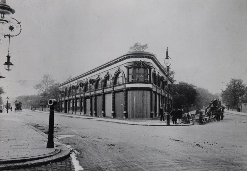
In this 1907 photo of Chalk Farm station, verdant Adelaide Road stretches to the left - much of the greenery and elegance disappeared as Chalk Farm began to urbanise.
The social changes associated with the First World War reinforced a tendency to convert large houses to flats or for institutions. By 1905, Adelaide Road housed the Huguenot Home for French Governesses, the Adelaide Home for Charity Organisation Society Pensioners, the Christian Social Union and the Jewish Domestic Training Home. In 1927, Eton Avenue housed the London Academy of Music, Hampstead Ethical Institute and the London Society for Teaching and Training the Blind.
In 1930, the whole area was still classified as middle-class and wealthy, except for patches in Bridge Road and King’s College Road at either end of Adelaide Road where mews and small houses were occupied by ‘unskilled labourers above the poverty line’.
Large blocks of flats were erected during the 1930s, despite protests by Hampstead council and the Ratepayers’ Association that there were already far too many flats in the borough.
Major bus routes operated from the now-vanished Chalk Farm bus garage for over 70 years.
The area escaped lightly in the Second World War bombing and post-war the area consolidated until youth culture arrived nearby in the 1970s and 1980s.
Twenty-first-century Chalk Farm
The southern end of Chalk Farm Road hosts Camden Market, which is now a major centre for the retailing of street fashions targeted at the young. In the Instagram age, tourists too have arrived and Camden is now among the top five places to visit on trips to London. Few of those venture as far as Chalk Farm itself which now finds itself on the border between ‘posh’ Belsize Park and ‘edgy’ Camden Town - not being part of either.
The southern part of Chalk Farm is home to figures such as Jude Law, Sadie Frost and Sienna Miller, who were part of the 'Camden set' of writers, artists, and actors in the early 21st century.