


A forgotten landscape under the City of London
The lost streets beneath the Barbican

I took a walk in February between Barbican station and Moorgate station and videoed the result. While editing the video, I discovered a network of streets which have vanished from the modern map and here I want to tell some of their stories.
The video can be seen at the bottom of this article but - first of all - here’s the walking route I took on a modern map.

I ascended the stairs next to Barbican station all the way up onto the ‘highwalk’ system of walkways. This took me across Aldersgate Street. I rounded the corner beside John Trundle Court, briefly along the line of Beech Street (which is buried in a tunnel beneath) and then alongside Defoe House.
Following the same line which took me past Thomas More Garden, next it was down on Lakeside Terrace, into the Barbican Centre and out of that onto Gilbert Bridge.
Then Andrewes Highwalk followed by St Alphage Highwalk, down the street level at London Wall and all too soon we’re at Moorgate. All well and good.
If we superimpose exactly the same walk onto the 1950 Ordnance Survey, it’s nearly impossible to comprehend the changes.

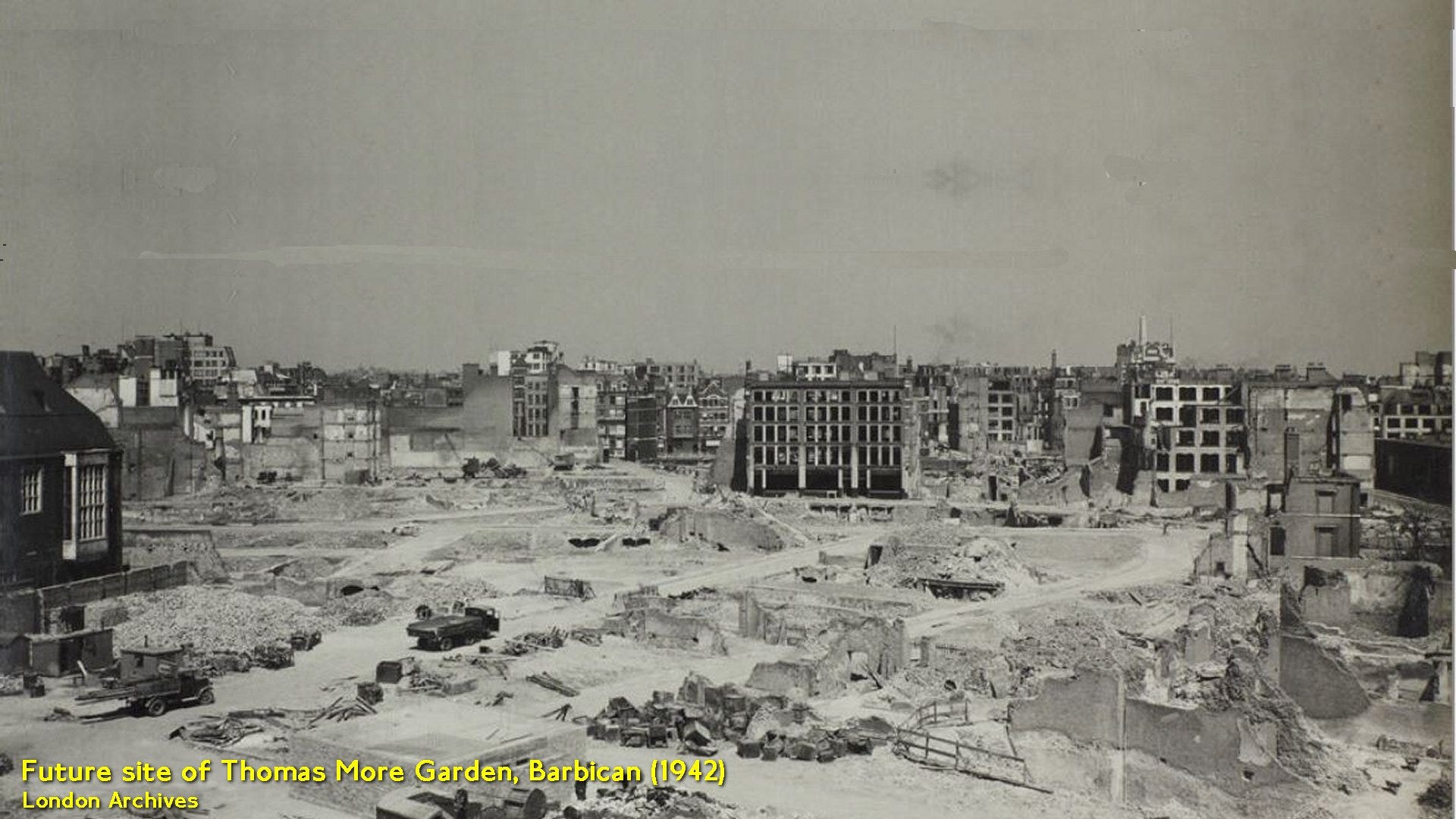
The purple squares of my walk take us through an empty landscape of Blitz-destroyed streets. The empty spaces between the roads on the map are simply rubble. A few items are marked ‘Ruin’ (semi-standing buildings). Only the grey buildings remain in anything near an intact state.
It’s a myth that ‘1960s planners’ caused rampant destruction to build the Barbican. In fact there was nothing here but the memory of former streets.
I’ll just add here a 1942 photo from the future site of Thomas More Garden to demonstrate the post-war challenge before the Corporation of London.
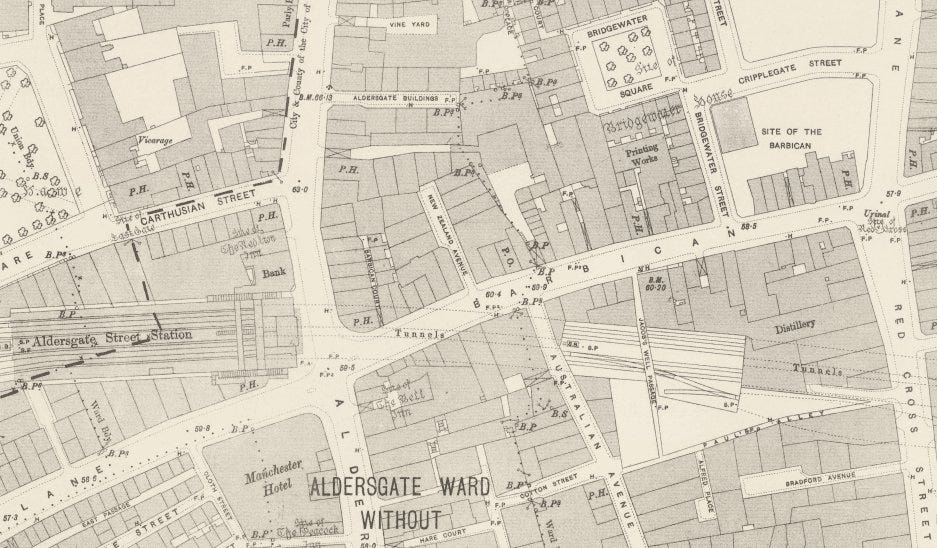
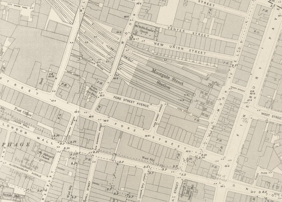
Before I get on with the lost streets of the area, here’s the intact cityscape dating from the late 1890s, courtesy of the Ordnance Survey. It has the same footprint as the other maps above. I’ll be taking sections of this map - you’ll able to refer to the overview here to see where we are.

Aldersgate Street
This is the first street encountered on the walk.
It’s quite a long way up from Barbican station onto the system of ‘highwalks’ but there are stairs up just beside the tube station entrance. At the top of the stairs, a bridge takes us across the road.
The Barbican Estate was designed to be walkable from end to end and, to do this, streets like Aldersgate Street needed pedestrian bridges above them which were high enough to clear a London double decker bus underneath. Hence the elevation of the estate highwalks.
In the previous Substack post to this, I wrote about the A roads of Britain. Aldersgate Street is a brief segment of the A1 route to Edinburgh and situated west of the Barbican Estate. The road has been in existence since medieval times and so falls outwith the remit of ‘lost streets’. It’s crossed on a bridge.
Beech Street/Barbican
Roman London's main fort was built between 90 and 120 AD at the meeting point of London Wall and Aldersgate Street. Around 200 AD, the city's walls were erected, encompassing the existing fort.
'Barbican' comes from the Low Latin 'Barbecana', denoting a fortified gateway or outpost for defence. A Roman watchtower, or 'specula', once stood north of the fort and its site - Barbican - was still being marked on the 1890s Ordnance Survey. The street which ran beside it was also called Barbican.
A 35-acre estate was constructed between 1965 and 1976. It needed a name and ‘Barbican’ was chosen. To stop confusion the former road called Barbican was renamed as Beech Street. As we walk into the estate, Beech Street has been placed in a tunnel and we can walk over the top of it into the post-1960s Beech Garden. It’s the last street shown on the 1890s map (even those renamed) that we’ll encounter until much later in the walk. The other soon-to-be-traversed old streets all disappeared at the same time in the early 1960s.
Australian Avenue
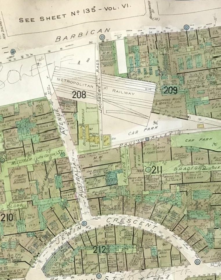
As we reach Defoe House on the modern walk, we encounter the location of Australian Avenue. This road dated only from the 1890s, replacing older courtyards. There was a matching New Zealand Avenue nearby. The insurance map shows it as a road of manufacture. It leads to Jewin Crescent. We don’t directly pass over the site of Jewin Crescent but it has an interesting history.
Jewin Crescent (formerly The Crescent)
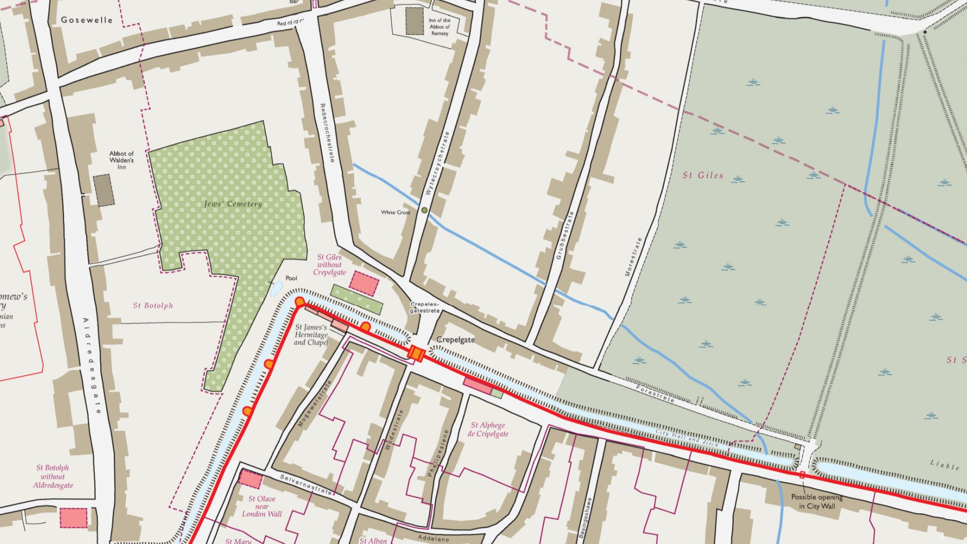
Jewin Crescent and adjacent Jewin Street were the site of the first London Jewish cemetery. “There is a green hill far away, without a City wall.” This location, directly outside (without) the Christian city, meant that a non-Christian cemetery could be placed here. Jewin Crescent marks the site of what was the only permitted Jewish cemetery in England up until 1177.
Following the expulsion of Jews from England in 1290, King Edward I granted the cemetery site to William de Montford, then Dean of St Paul’s.
The cemetery was long built over by the time The Crescent was built. The Crescent replaced Bull Head Court and Nixon’s Square in 1799. The Crescent was renamed Jewin Crescent in 1878 and like all nearby ex-streets, survived until 1963 or so.
Bradford Avenue
As we pass from Defoe House down onto Lakeside Terrace on the modern walk, we pass over where Bradford Avenue would have been. This was a street of warehouses, built in the 1890s and opposite the Midland Railway Goods Depot in Red Cross Street.
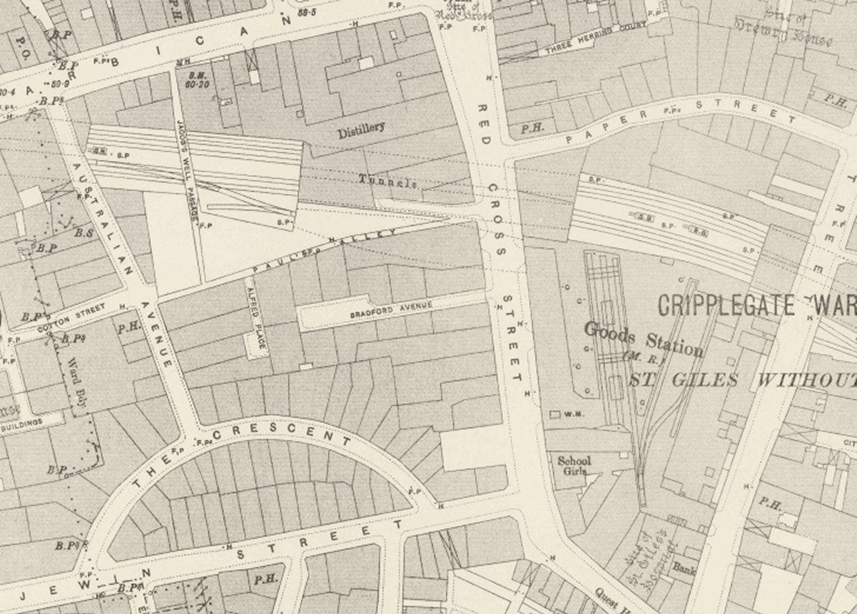
Red Cross Street
Red Cross Street once ran to the junction of Beech Street and Golden Lane. It was one of the major thoroughfares of the area. There was a red cross here located at St Giles Cripplegate in Fore Street.
According to the 1918 book, ‘A Dictionary of London’, the first mention of the street is as Redecrochestrete in 1274. It was thus a street of great antiquity.
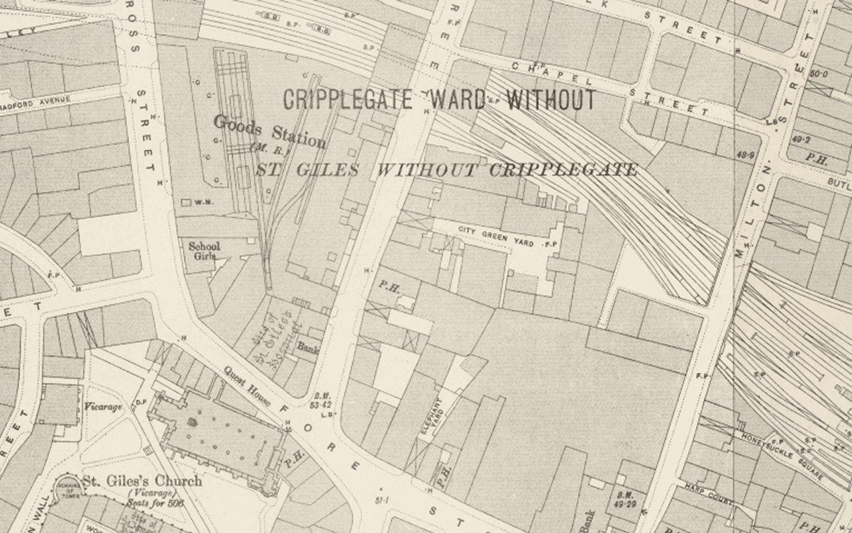
Midland Railway Cripplegate Depot
This stood on the far side of Red Cross Street.
When the Metropolitan Railway expanded from Farringdon to Moorgate in December 1865, the tracks had to avoid the Whitecross Street debtors’ prison which was here at the time, and in the way. The new tracks had to skirt the prison’s northern wall and this caused a kink in the route which slowed down the trains.
The Debtors Act of 1869 finally ended debtors prisons and the Metropolitan Railway, finding themselves owning the prison site, built the Cripplegate Depot between Aldersgate and Moorgate stations.
It was taken over by the Midland Railway and lasted until after the Second World War as just about the only building to survive the Blitz hereabouts.
The 1950s Ordnance Survey map shows the Cripplegate depot (‘Goods station’) as one of the few standing buildings.
The first act of the creation of the Barbican Estate was the realignment of 500 metres of the Metropolitan line - the section which had needed to skirt around the prison wall - between Barbican and Moorgate stations between 1963 and 1965.
Defoe House and Lakeside Terrace and both built directly above the realigned railway tracks, hence their particular placement and reason-for-existence on the Estate.
The Barbican Centre was built over the former site of the Cripplegate Depot. Since this post is not about modern times, we’ll move on without discussing this outstanding venue. If you’re expecting more art and culture, sorry about that.
Whitecross Street
It’s possible to exit the Barbican Centre onto Gilbert Bridge. This walkway follows the original line of Whitecross Street.
Whitecross Street still exists in Islington but not here. It formerly continued further south from its current southern end, to just outside St Giles-without-Cripplegate church.
From modern Gilbert Bridge, St Giles-without-Cripplegate church can still be spotted. It survived the Blitz and stands incongruously amidst the modernity.
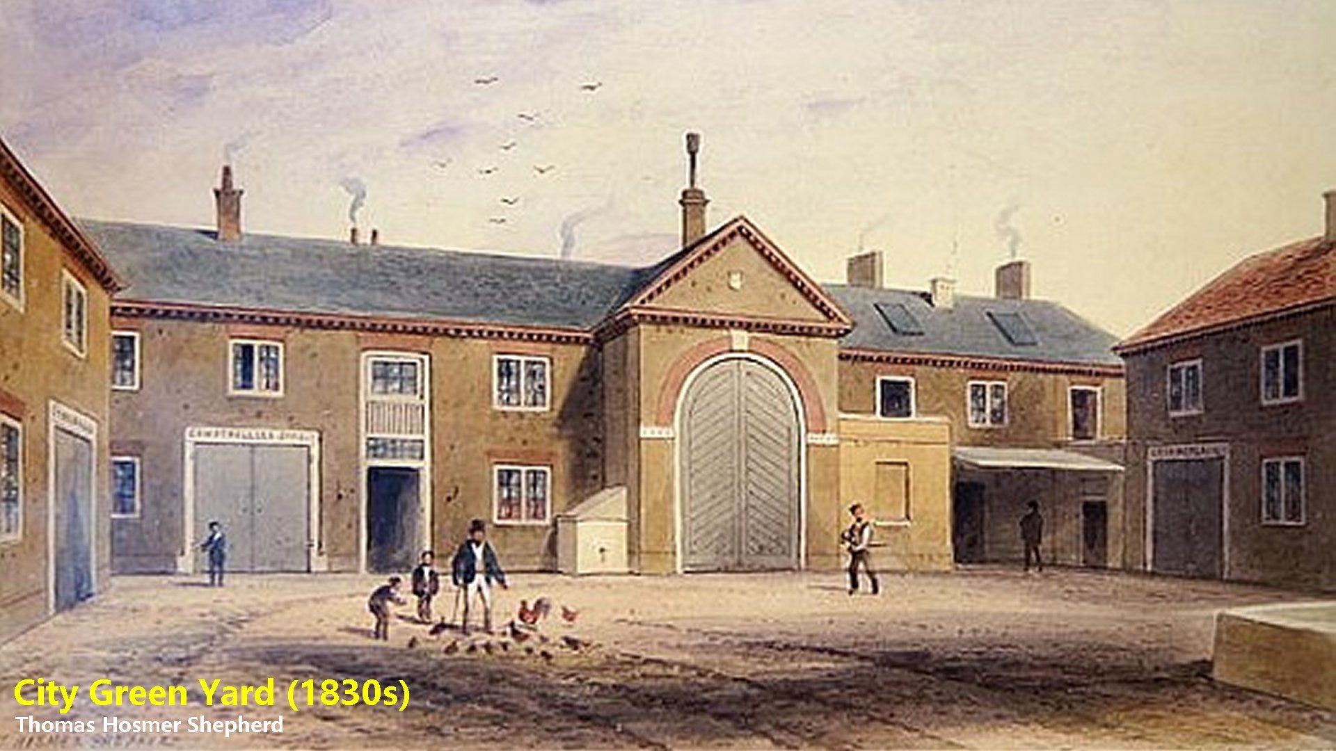
City Green Yard
City Green Yard here was notable for providing married quarters for the City of London Police. Until 1883 it had been the Lord Mayor’s stables.
Elephant Yard
As we turn left at the end of Gilbert Bridge and onto the modern Andrewes Highwalk, here we’d be crossing Elephant Yard. Elephant Yard was the coaching yard which used to belong to the Elephant Inn, demolished in the 1840s.
At the end of Andrewes Highwalk (named for Lancelot Andrewes, a rector of St Giles-without-Cripplegate Church), we’d reach Milton Street in olden days.
Milton Street
Milton Street was a major road - completely gone in the modern world. Before a renaming, it was called Grub Street - famous for its concentration of impoverished writers, low-end publishers and booksellers.
Mr Milton was a carpenter and builder who in 1830, at the time of the name change, owned the building lease of the street.
On the modern walk, we finally encounter an existing street - Fore Street.
Fore Street
We cross Fore Street only on a highwalk and we don’t descend to it. Fore Street derived its name from its position outside the London city walls. The street flourished as a shopping destination until the mid-19th century.
After the Fore Street bridge we turn left onto St Alphage Highwalk – it’s signposted to Moorgate station and runs parallel to, but at a level above, Fore Street.
St Alphage Highwalk passes the site of the church of St Alphage by the old London wall. This saint, who died in 1012, was Archbishop of Canterbury. Greenwich was the scene of his martyrdom. When he refused to impoverish his tenants to ransom himself from the Danes, he was brought into the Danish assembly and pelted to death with animal bones.
At the end of St Alphage Highwalk, we descend the steps down to London Wall and out of the Barbican Estate.
London Wall
It would be impossible to do justice to the story of why this street is called London Wall. It’s a whole story in itself and I might tell the story one of these days. Oh, the anticipation!
But the alignment we’re walking along was not the original course of the street – it was again a post-wat repurposing.
Moorfields
Next left is Moorfields which gets its name from an open space located adjacent to the northern wall of the City. It is the only street since Aldersgate Street which hasn’t had any name change, route change or length shortening. And it’s the site of Moorgate station, the end of the walk.
Notes
There’s an accompanying video. Find it at the bottom of the post.
For 15 years until quite recently, I was an annual visitor to the International Astronautical Congress. Despite the sci-fi name, that is actually not a conference for space enthusiasts but for industry, agency and academia to meet up and share knowledge. Held every year in a different city, the 2016 edition was held in Guadalajara, Mexico. The SpaceX company had been exhibiting for years but its enigmatic owner had never put in an appearance. Guadalajara being relatively nearby California, this time he decided to appear and give a speech. Nearly everyone at the conference attended. I’d never seen a packed hall like this one; it was like the second coming - a multiplanetary messiah. He talked only about building rockets to begin settling Mars. Some questions were highly technical, which he impressively answered. Other questions were definitely not - “Can I have your baby?” was one memorable audience contribution. It was the beginning of the Elon Musk fanboy and fangirl phenomenon. It was then based on perceptions of his sharp Edison-like vision - somebody who might truly save humanity. They still follow him blindly in 2024 even as his social media posts get more and more ridiculous. It’s a cult. In the eight years since that IAC speech, his fall from perceived genius to confirmed numpty has been something to watch. And this is a long way around of telling you that, like many Brits, I have left X/Twitter and I’m now on Threads. Which isn’t as good as Twitter was. Nowhere near. But I can’t be on the same social media platform as that man. What a complete waste of Twitter - something which was so good and society-benefiting.
This LT Museum picture shows the Barbican being built. I find it particularly fascinating as you can see the ongoing straightening of the railway as discussed above.
https://www.ltmuseum.co.uk/collections/the-collection?query=1998-31991&date%5Bmin%5D=&date%5Bmax%5D=&sort_bef_combine=search_api_relevance_DESC