

A Bayswater stroll
A flâneur with an old map

For the third article in a row, I’m in west London but at last I got to leave the Royal Borough of Kensington and Chelsea.
The Wikipedia informs me that a 'flâneur' is a French term popularised in the 19th century for a 'stroller', 'lounger', 'saunterer' or 'loafer'. Traditionally depicted as male, a flâneur is an ambivalent figure of urban affluence and modernity, representing the ability to wander detached from society, for an entertainment from the observation of the urban life. Flânerie is the act of strolling, with all of its accompanying associations.
Not sure about that urban affluence, and the ability to wander detached from society would get an inattentive boy run over in London.
But I took a Central line walk a while ago from Lancaster Gate station to Queensway station and, while I knew where I wanted to end up (the famous Leinster Gardens houses with the fake frontages), I was happy to see where the stroll took me. I calculated the direction I needed from Lancaster Gate station and, on a sunny day, kept my shadow in roughly the same place. I would pass interesting things and dwell on them. That was the theory.
For the non-flâneur, this would have been a simple walk along the Bayswater Road. I was having none of that.
I printed out an old map from 1800 when hereabouts was rural and headed for a modern street called Elms Mews in the knowledge that this wee road appeared on maps both old and new. And from there I’d improvise my route.
Here is my tale, albeit with many, many facts gleaned after the perambulation.
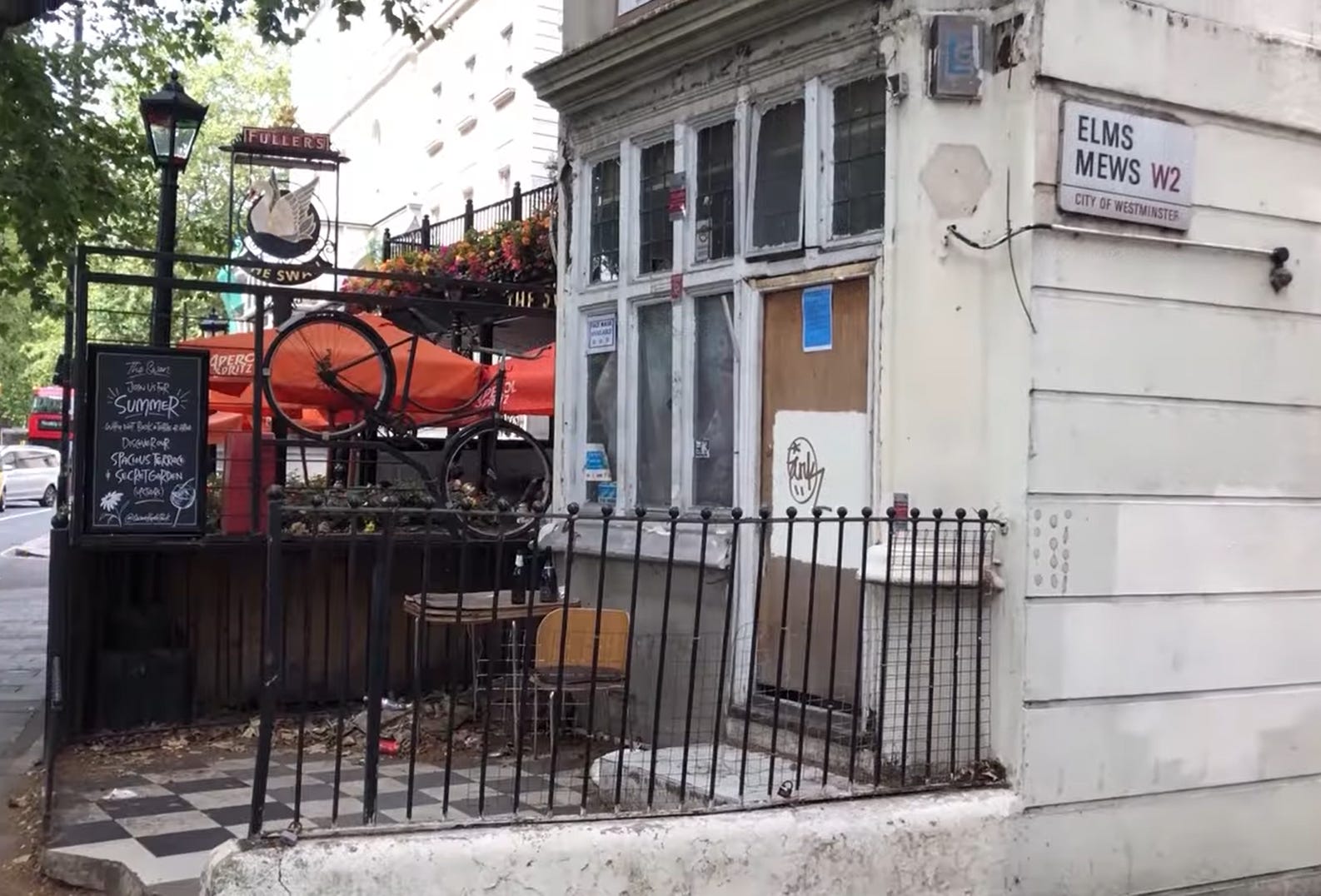
Having reached Elms Mews, I noticed that the 1800 map placed this thoroughfare on top of the course of the former River Westbourne.
In 1380, this spot was documented as Bayard’s Watering Place, characterised by its numerous gravel pits, streams and springs.
Fresh water sources included those in a field marked on my 1800 map as ‘South Conduit Field’ and beside which a stream called the Kilbourne had originated in Hampstead and flowed beneath the Uxbridge (Bayswater) Road at the future site of an entrance to Hyde Park/Kensington Gardens. At this location, it became known as the Bayswater rivulet, and was subsequently, and more commonly in these 21st century days, called the Westbourne.
The Bayard’s Watering Place name likely indicated a location for refreshing horses, either from the stream itself or from a spring such as the one in South Conduit Field.
By the eighteenth century, the district was commonly referred to as Bayswater.
Seventeenth-century Bayswater existed as a very modest hamlet right here, 200 metres west of Lancaster Gate station. It wasn’t near what we’d now call Bayswater - the area on Queensway around the station called Bayswater.
The hamlet had few residents. By 1646, a certain Robert Hilliard maintained a dwelling at Bayard's Watering. A Robert Pollard owned two houses called ‘Bayard's Watering Place’ by 1710, complete with outbuildings and one previously occupied by a Mr Alexander Bond, all according to British History Online.
Westminster Abbey granted permission in 1439 for constructing a conduit to provide drinking water to the City of London. Although a Hyde Park plaque states the water originated ‘from this spot’ south-east of the Serpentine, most other accounts locate the spring’s head “in a meadow opposite the north side of Kensington Gardens, close to Bay’s Water Tea Garden” This meadow was South Conduit Field and is shown on the map coming up.
The plentiful water of Bayswater often rendered the main road nearly impassable due to mud and flowing water, particularly at the hollow north of the future Serpentine where the Westbourne crossed the thoroughfare. A brick bridge was constructed over this stream in 1675, subsequently replaced by a stone bridge by 1769.
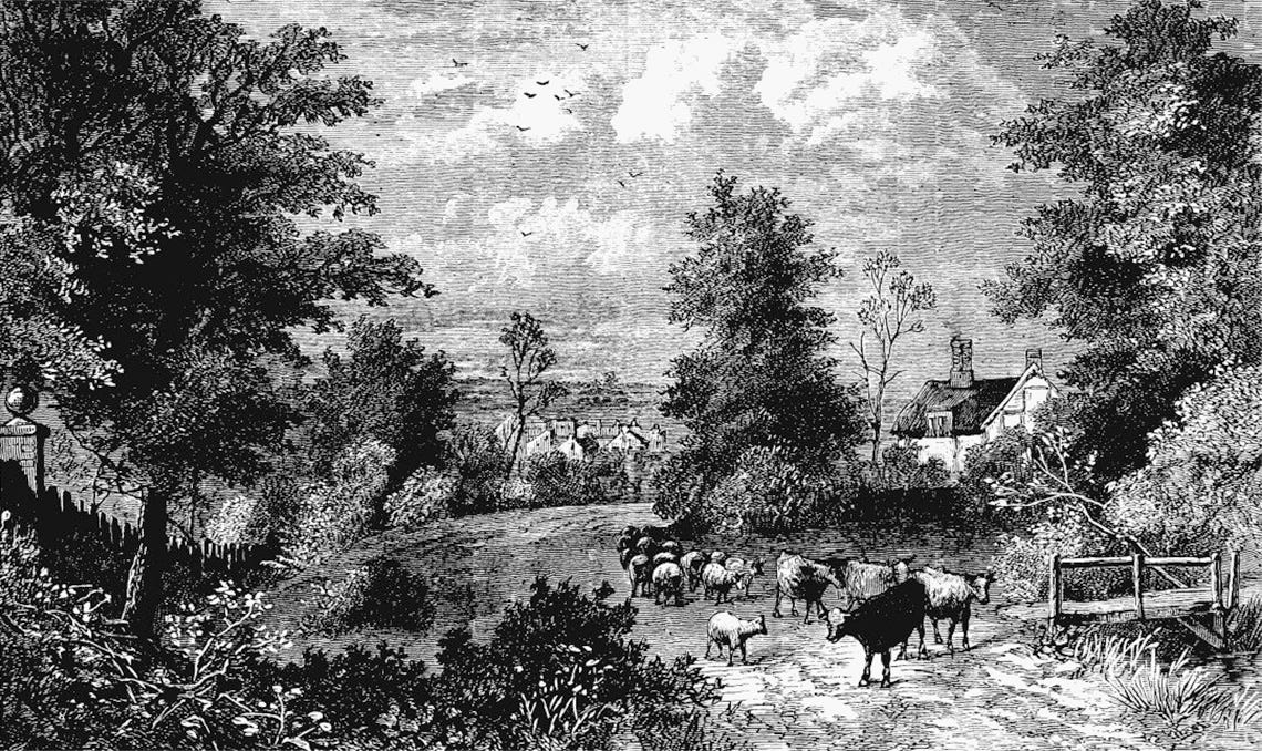
Scattered farms existed along the road, some cultivating watercress, alongside inns and small clusters of settlements west of present-day Lancaster Gate. Gravel extraction had occurred in these areas since at least the thirteenth century, giving the entire stretch between today’s Queensway and Notting Hill Gate station the name Kensington Gravel Pits. Despite gravel quarrying, the area retained its scenic character, its surrounding fields interspersed with nursery grounds and market gardens.
Bayswater still remained a “small hamlet” in 1807, notable for its tea gardens, water supply and the lying-in hospital (later known as Queen Charlotte's) situated further east.
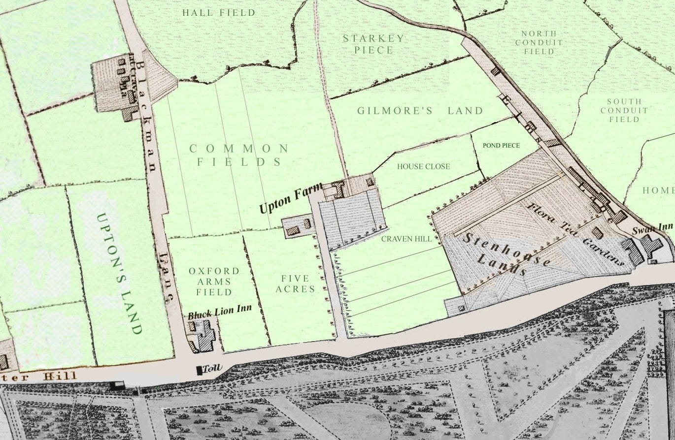
Let’s take a look at part of that old 1800 map here:
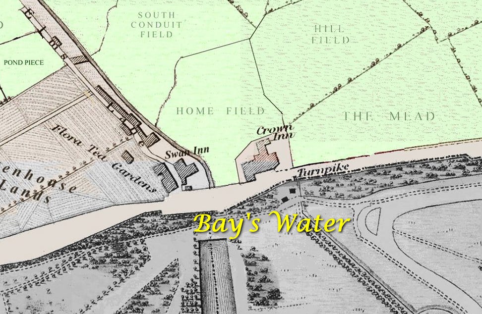
As hinted at above, the settlement of Bay’s Water was sited where the River Westbourne crossed under the Bayswater Road, into Hyde Park and then onwards to form the Serpentine.
The Swan Inn lies on the main road but also on the banks of the river. It must have been a lovely bucolic spot. This pub dates from the 1600s and is still here. The inn may have at first been called the Saracen’s Head. It was in former times a resting point for stagecoaches proceeding toward London.
The highwayman Claude Duval is reputed to have stopped here for his last drink on the way to his 1670 hanging at Tyburn. Born in 1643, he was a French highwayman in Restoration England. Little else is known of his history but he was robbing the passing stagecoaches on the roads to London. According to popular legend, he abhorred violence, showing courtesy to his victims and chivalry to their womenfolk, thus spawning the myth of the romantic highwayman, as taken up by many novelists and playwrights.
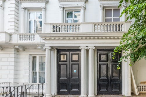
Integrated with the Swan were the Flora Tea Gardens - seemingly the same ownership but two names.
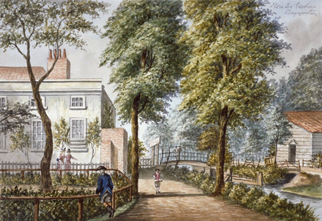
In the image above, we seem to be looking up what became Elms Mews when it ran beside the Westbourne. That seems to be the Swan Inn on the left. The Flora Tea Gardens and the Swan Inn were, as said, one and the same - the latter serving less tea and more gin. Had I stepped back dangerously into Bayswater Road to take the first photo, I’d have been able to catch the same scene.
Of further note on the 1800 map is the Crown Inn, sited where Lancaster Gate station is now, beside a toll booth. Pubs beside the toll booths collecting money for proceeding along a turnpike road did cracking business, especially when the tolls created delays.
I eschewed the delights of going along Elms Mews. Little did I know at the time of the walk that there was a pathway to Craven Terrace which would have been a fine choice. Such is the downside of flâneurism. Instead I continued west along Bayswater Road, determined to find interesting stuff.
I ignored a road called Lancaster Gate - didn’t look worthy of my attention at the time but found out that the second right was also called Lancaster Gate and this had a median between two carriageways and two statues.
The statue nearest the Bayswater Road was inscribed One King, One Empire, Empire Day at the base. It turns out that the statue honoured Reginald Brabazon, 12th Earl of Meath (1841–1929).
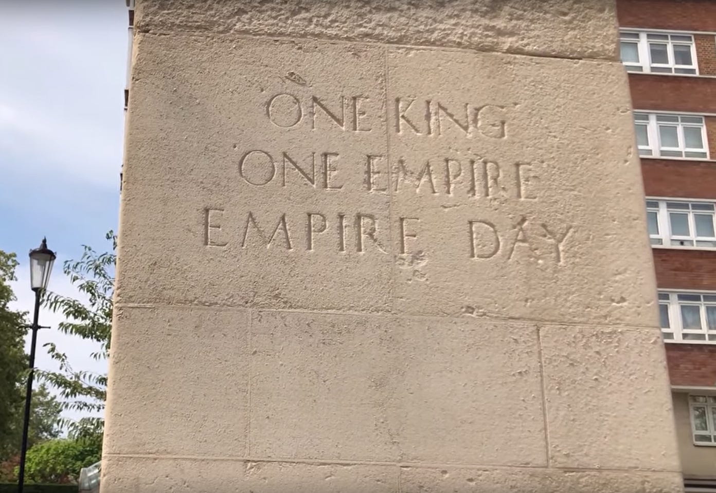
On further reading I found that Reginald Brabazon had created Empire Day in 1903, cleverly designed to coincide with Queen Victoria's birthday on May 24. In 1958 it was renamed Commonwealth Day.
By the time of his death, his Irish earldom was located in a country outside the British Empire which must have stung a bit.
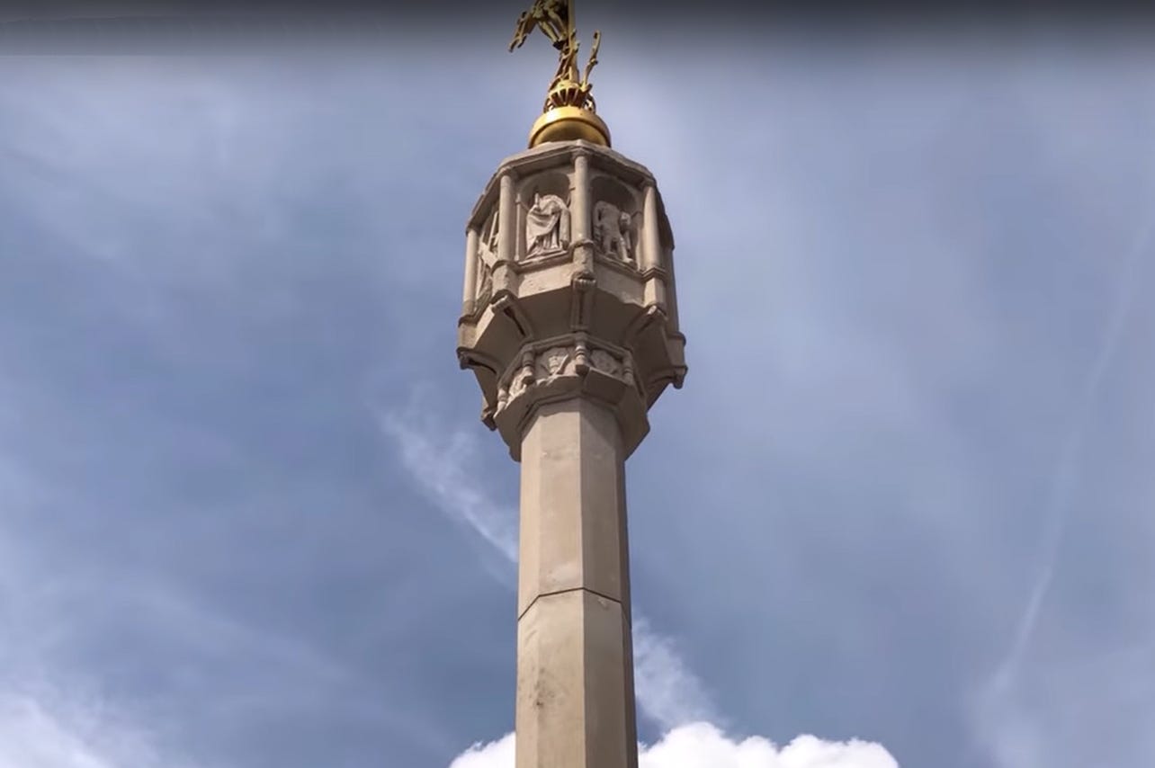
The other statue is the Lancaster Gate Memorial Cross, commemorating those from the Borough of Paddington who died in the First World War.
Straight ahead north stands the former Christ Church, built in 1855 by F & H Francis, now converted into the flats of Spire House.
Landowner Joseph Neeld leased land which soon formed part of the site for an ambitious scheme surrounding the new Christ Church. These terraces were known as Upper Hyde Park Gardens until 1865 and thereafter as Lancaster Gate, a name previously reserved for the square around the church. By 1868, these terraced houses were considered the most handsome in London.
Wealthy residents arrived in the area. They ranged from East India merchants to people who had relocated from formerly more fashionable districts. Nearby Westbourne Terrace's first occupants included Richard Cobden who lived at no. 103 from 1848 to 1856 - he was my Substack subject in my previous article.
At the Lancaster Gate Memorial Cross, I went left along yet another road with the name Lancaster Gate and after a few hundred metres right into Leinster Terrace.
This is a small neighbourhood shopping street. The Lancaster Gate Medical Centre located here told me that some people still considered this part of the Lancaster Gate area. The naming is all rather confusing.
The Leinster Arms, beside Leinster Mews on the right was originally established in 1856 as The Scotch Stores. By 1881 this grade II listed pub became known as The Leinster Arms.
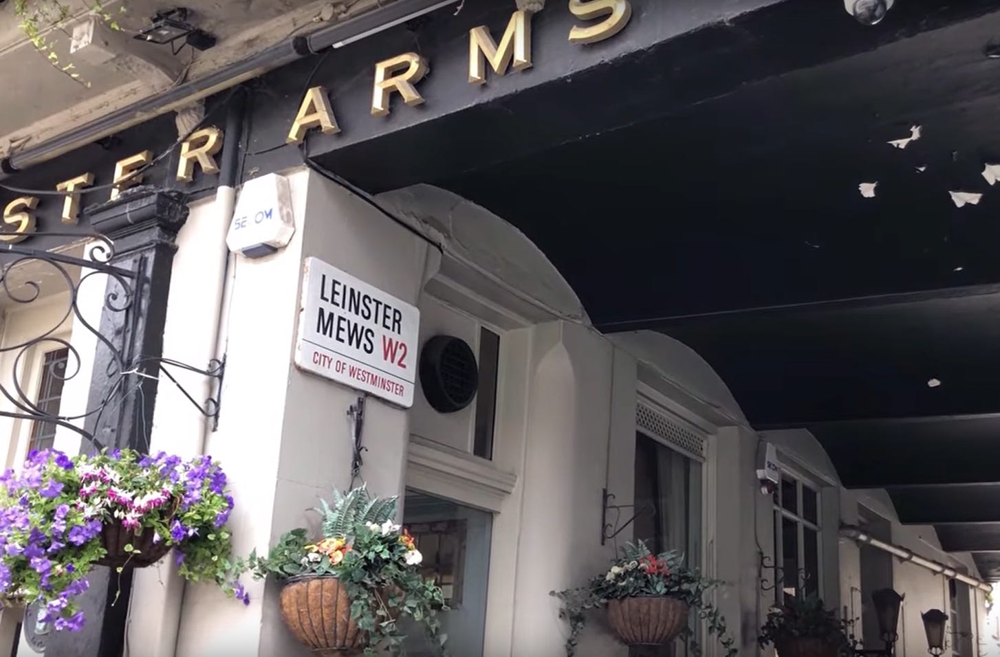
I should have stopped for a drink but I decided to head off in the same direction, this road being called ‘Leinster’ and all that. I was homing in on those houses.
Leinster Terrace morphed into Leinster Gardens as I walked.
Numbers 23 and 24 Leinster Gardens are mere façades, their buildings removed during the Metropolitan District Railway’s construction. Internet lore has made them rather famous. Instagrammers put themselves in the shot with the houses behind and thousands of them tell exactly the same story to camera. So I too here will tell the tale.
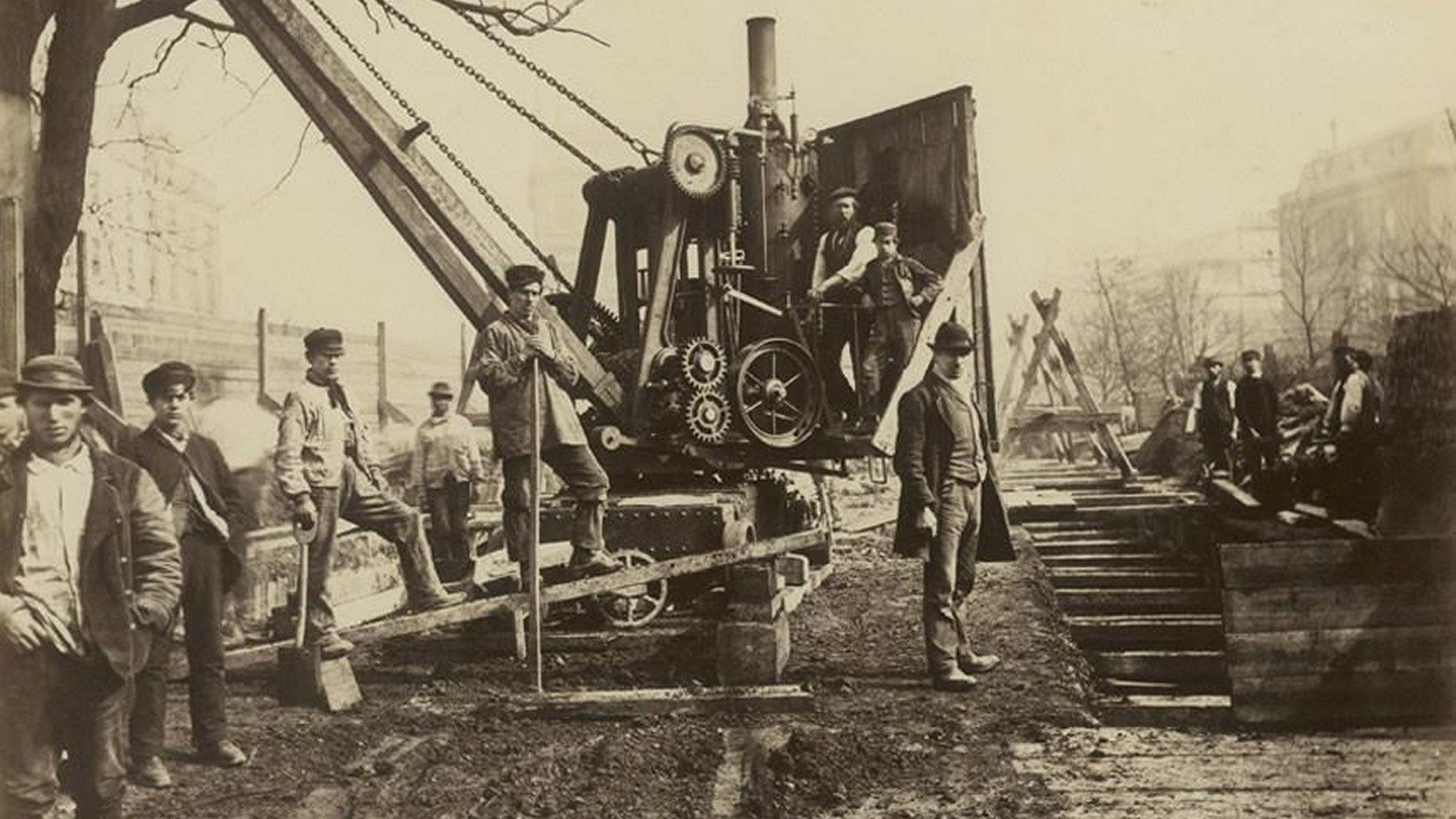
Railway engineers of the 1860s employed the ‘cut and cover’ method, excavating channels – mostly under the line of existing roads – before covering them to form an underground passageway for the railway and the reconstructed road on top. Most properties demolished in the way of the railway tunnel building were rebuilt, though not all.
One notable exception produced one of London’s most distinctive curiosities: a pair of false-fronted houses. When the Metropolitan District was constructed under Leinster Gardens, connecting Paddington and Bayswater stations, numbers 23 and 24 were demolished to accommodate the construction.
Steam locomotives powering the underground railway burned coal to generate steam. Although fitted with condensers to capture most smoke and steam condensation, the locomotives required open-air track sections to safely release accumulated steam and smoke, preventing contamination of underground tunnels and maintaining breathable air.
The area west of Leinster Gardens provided one such open-air venting section. To shield residents from this unsightly operation, the railway company constructed house façades at 23 and 24. These appeared identical to their five-storey neighbours but measured only two metres thick. Trees and painted upper-storey windows were added to create the impression of genuine houses.
Indications revealing the false frontages are the absence of letterboxes on the front doors and the painted windows lacking curtains, unlike their neighbours.
I decided to walk around for a rear view of the houses – following a route via Craven Hill Gardens and turning right into Porchester Terrace.
The walk along Craven Hill Gardens would have in former times taken us through the farmyard of Upton Farm. This farm managed the fields hereabouts and, apparently, had a delightful tree-lined lane connecting it to Bayswater Road. Blackman Lane on the map above is the future Queensway.
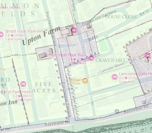
This merged map above – 1800 and now - shows that the former farmhouse of Upton Farm would now be placed directly on the site of the fake houses. The farm’s lane was turned into Porchester Terrace.
Upton Farm was purchased in 1733 by Lord Craven - hence the local ‘Craven’ street names. In 1742, this area was noted as “intended to be called Craven Hill”.
Plans for Porchester Terrace to run northward to Westbourne Green existed by 1823. The Paddington Estate began leasing single and semi-detached villas along this new road.
Even in 1840, open land persisted south of Craven Hill. Literary and artistic figures were drawn to this still semi-rural district. Poet Sarah Flower Adams moved with her husband to 5 Craven Hill, soon followed by author and politician William Johnson Fox, the composer Eliza Flower (Sarah's sister). In her “snug, out-of-the-world corner”, Eliza hosted Thomas Carlyle and others in a literary circle familiar to the young Robert Browning.
Enough of all the history and back to the modern walk.
The video linked below shows a train running underneath my feet at the rear of the famous fake houses.
Fulton Mews on the opposite side of Porchester Terrace from the ‘venting railway area’ was also constructed above the line of the District Railway.
It was time to conclude matters and finish my walk to Queensway station
I walked north, turned left into the short cut called Queensborough Passage which got me to Queensborough Terrace. Since there isn’t a handy road heading towards Queensway – which there should be if I was designing the area from scratch - I had to turn south down Queensborough Terrace back to rejoin Bayswater Road.
Inverness Terrace is an interesting road north. Way along it is a bust of George Kastrioti, an Albanian hero. But this was not the time to visit it and so from this walk I don’t have a photo.
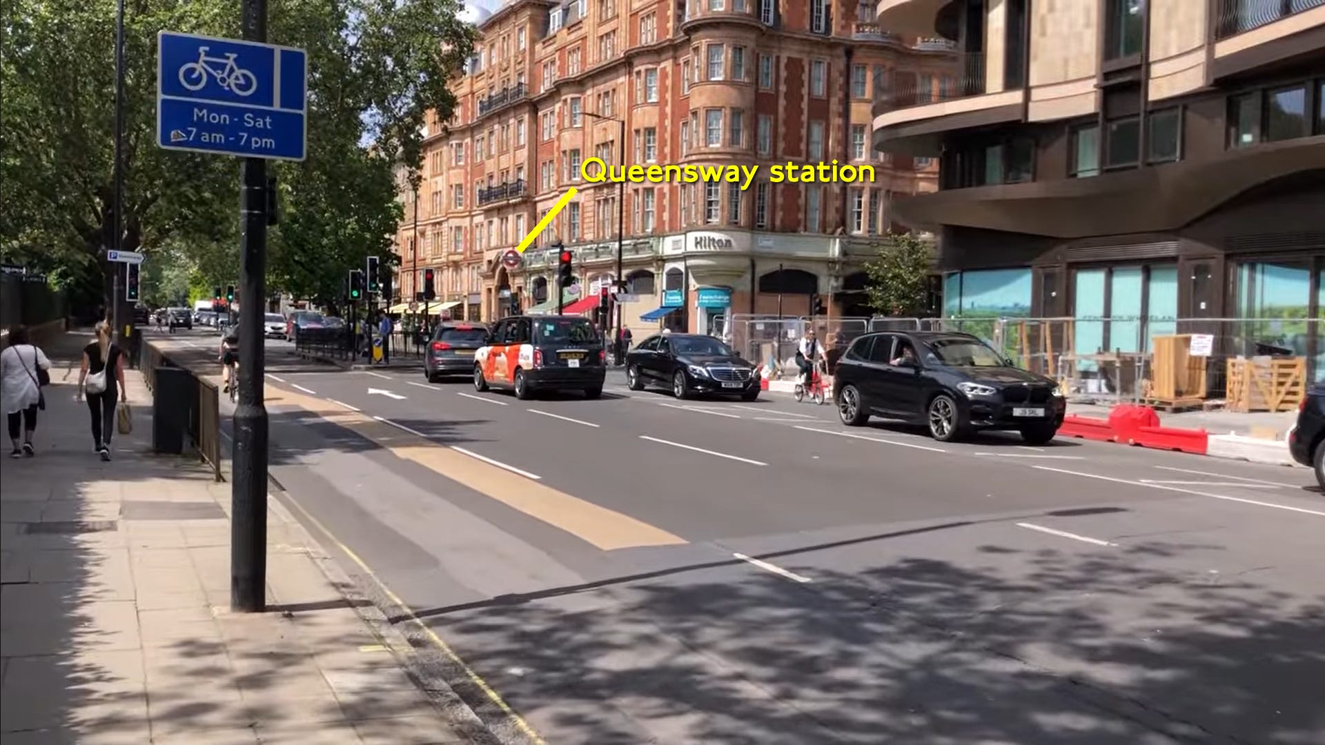
One block west of Inverness Terrace and the route ends at Queensway tube station, on the corner of the road of the same name.
If you wish to follow along with the video I made (excuses for the T shirt), here it is:
Footnote: The map I used, and other old maps, are available to download (and print) for paid Substack subscribers. Go to www.the undergroundmap.com, navigate to an area of London, change the year of the map on the pile of paper control (top right) and click Request this map.
All will then become clear…
Much enjoyed reading this as it took me back over fifty years to my first days in London having left my native northeast England. I lived at 46 Leinster Gardens for some 9 months and have sunk many a pint in the Leinster Arms. The accomodation wasn't what I suspect it is today. Number 46 was a 'hostel'. Four of us to a room and three rooms sharing a bathroom and toilet. Being teenagers we didn't care and I eventually moved to the more 'salubrious' Edmonton and rented a house with three others.
I lived in Hereford Road, just off Westbourne Grove for the first ten years of my life. I used to go to an infants and then junior school on Edge St. off Kensington Church St. The junior school, then called St. George's, had etched in stone on its walls, built in 1837 (if I remember exactly) on the site of the Kensington Gravel Pits. Now it's a fancy prep school. My mother worked in a chemist shop on Queensway and I used to go to the ice rink on Saturdays and take a class from Miss Hogg. We used to go to Whiteley's when it was a department store.